Today marks an incredible day in UrbanFootprint’s journey: we’ve raised $11.5 million in Series A funding. Since day one, we’ve been supported by an amazing group of funders as we pursue our mission to make cities more livable for everyone. We couldn’t have gotten this far without the early Angel investors who believed in us and venture firm Social Capital, which has been foundational to our success. They are now joined by Valo Ventures, who led this round of financing, and new partner Radicle Impact.
First, a big thank you to our customers and the UrbanFootprint team
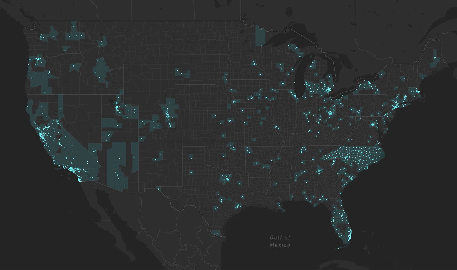
Since launching UrbanFootprint in April 2018, we’ve helped over 500 customers map, measure, and analyze more than 4,000 planning projects in over 700 cities across the U.S. Over 20 top universities are using UrbanFootprint to teach the next generation of planners and urban practitioners. Even this early success would not be possible without our customers — the planners, designers, cities, universities, and businesses using it every day. Thank you for joining us on this journey and supporting our shared mission to build more sustainable, equitable, and resilient communities. Your invaluable support and feedback has played a pivotal role in our success, and we’re excited to venture into the next chapter of our company and mission together.
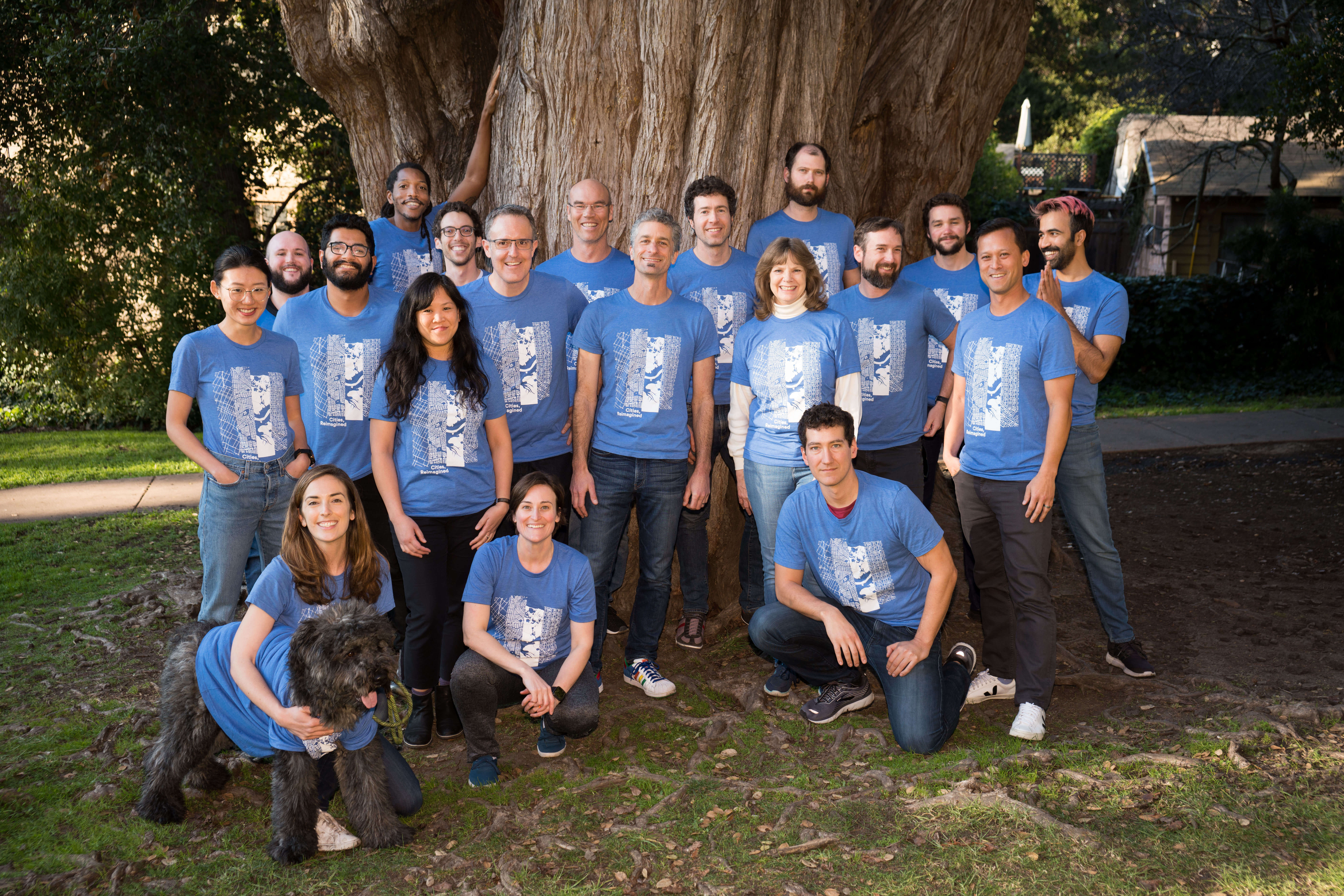
And of course, we cannot forget to thank our team at UrbanFootprint.
We are privileged to work with some of the most talented, dedicated, and driven people in the industry — men and women who took a chance to work with us, who work with a purpose and passion that powers us forward. It is a true honor to be a part of this team.
Celebrating two years of UrbanFootprint
Looking back, we’ve come a long way since the idea for UrbanFootprint was just that — an idea. More than twenty years ago, we sought to close what we saw as a critical gap in how decisions are made about cities, development projects, and infrastructure investments. We saw a need to inform these decisions with real data about the impacts of plans and policies, to rise above local and partisan politics to a higher ground where facts drive better, more sustainable outcomes and the lasting coalitions required to foster real change.
From this pursuit emerged our approach to data and community-driven scenario planning, built on the foundation that testing and understanding multiple choices leads to better outcomes. Methods and models were built and refined over countless projects across the U.S. and abroad — with each application leading to more informed decisions, as well as a better and faster toolset. In UrbanFootprint lives our mission to make these tools and methods accessible and available to every city and urban practitioner, and critically, to every business challenged with understanding and competing within urban markets. As the world urbanizes, impacting how such businesses operate is paramount in the mission to improve the lives of citizens across the globe.
Today, planners are faced with addressing some of society’s toughest challenges, including climate change, acute housing shortages, unprecedented traffic, pollution, hazard risk, and more. Planners are real-life urban superheroes — the women and men on the frontlines working to improve the quality of life for a projected 7 billion urban citizens by 2050. It’s our hope UrbanFootprint can help planners, communities, and businesses transform these obstacles into opportunities with the data and tools to drive better plans, policies, and action.
Planners are real-life urban superheroes — the women and men on the frontlines working to improve the quality of life for a projected 7 billion urban citizens by 2050.
To really take on such challenges, we need to dramatically increase who can harness the power of great data, great maps, and sophisticated modeling of consequences. UrbanFootprint is designed, from the ground up, to be more collaborative and more accessible than traditional tools because we want to arm every player in the urban environment with the tools needed to take on some of society’s most critical questions:
How can we plan for more resilient cities in the age of climate change?
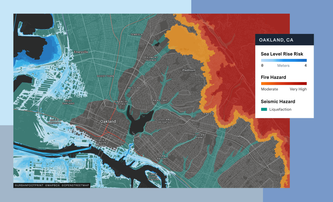
How might city zoning policies impact key issues like the housing shortage?
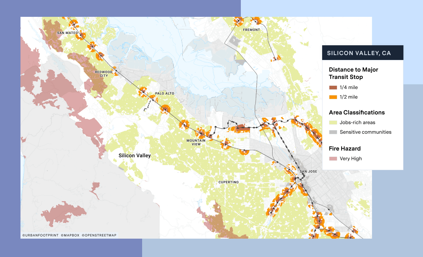
How can we improve access to transit and identify new opportunities for micromobility?
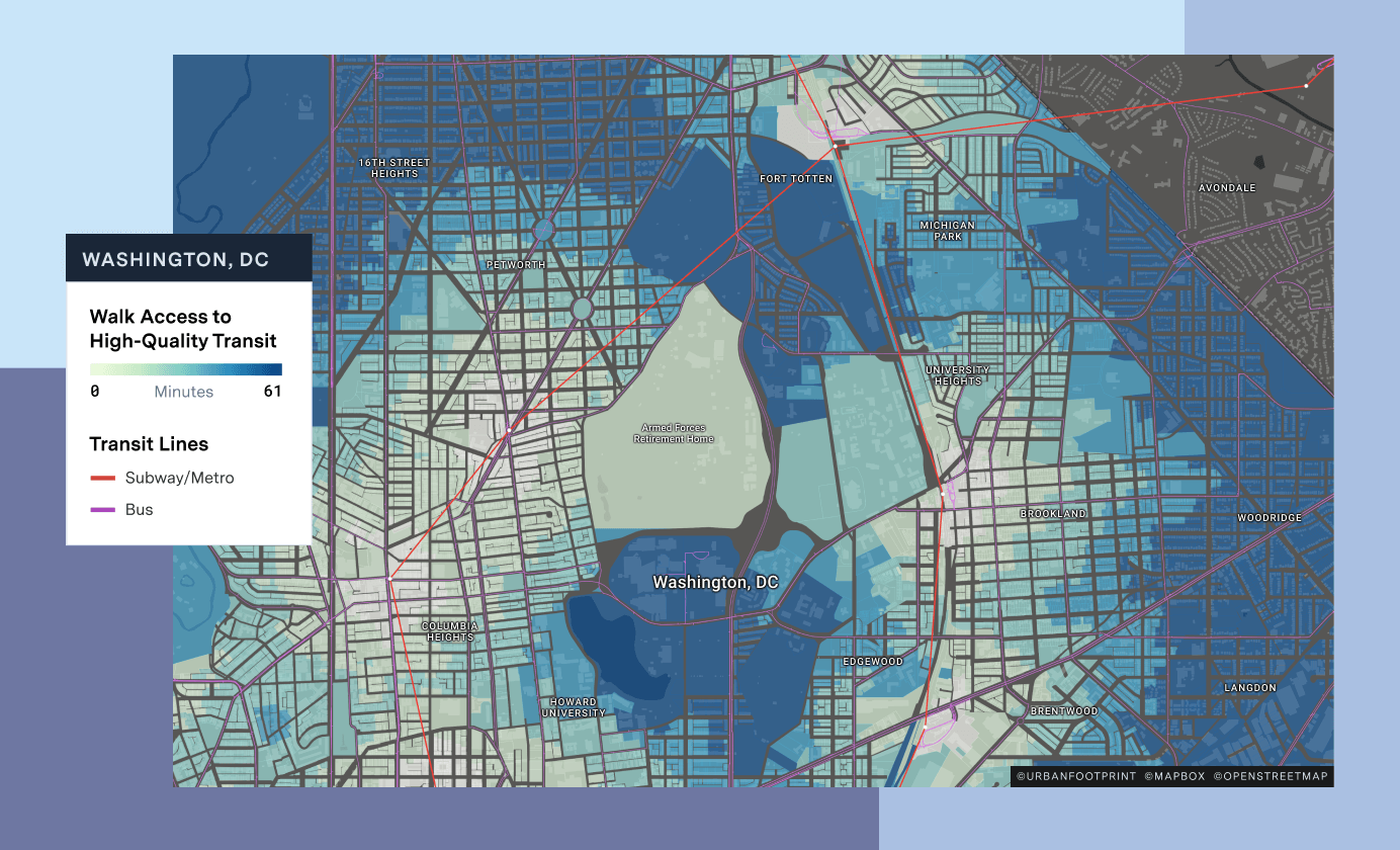
UrbanFootprint is answering these important questions for more cities, practitioners, and businesses everyday. Major media has also used the platform to highlight and support stories about housing, climate, mobility, and the future of cities. The New York Times and National Geographic have explored housing affordability and major urban issues with UrbanFootprint’s data and maps. Bloomberg used the platform to shed light on state policy initiatives to address the California housing crisis, and local news outlets have used the platform to support a variety of stories on the communities we live in.
What’s Next?
As we celebrate this exciting Series A milestone, we wanted to take a moment to share our vision of how we plan to improve and grow UrbanFootprint through 2020 and beyond. Our team is expanding to support a broader push into the urban planning, design, and engineering space and our product is evolving to support a burgeoning family of energy, mobility, and real estate customers. Our customers will see a host of major new features and enhancements, including:
- Mobility: A new transportation and mobility toolset that opens up new possibilities to explore changes to urban transportation systems, from public transit, to micromobility, roadways, and walk and bike infrastructure.
- Better master planning: Finer-grain master planning capabilities, including the ability to assemble and draw new parcels, quickly break up large parcels, and import detailed plans from CAD and other platforms.
- Climate-risk data: New data and features focused on climate-related risk to energy infrastructure and the communities served by utilities and other agencies. We’re proud to be working with Pacific Gas & Electric on advancing their planning and data analysis capacities around heat wave, fire risk, and more.
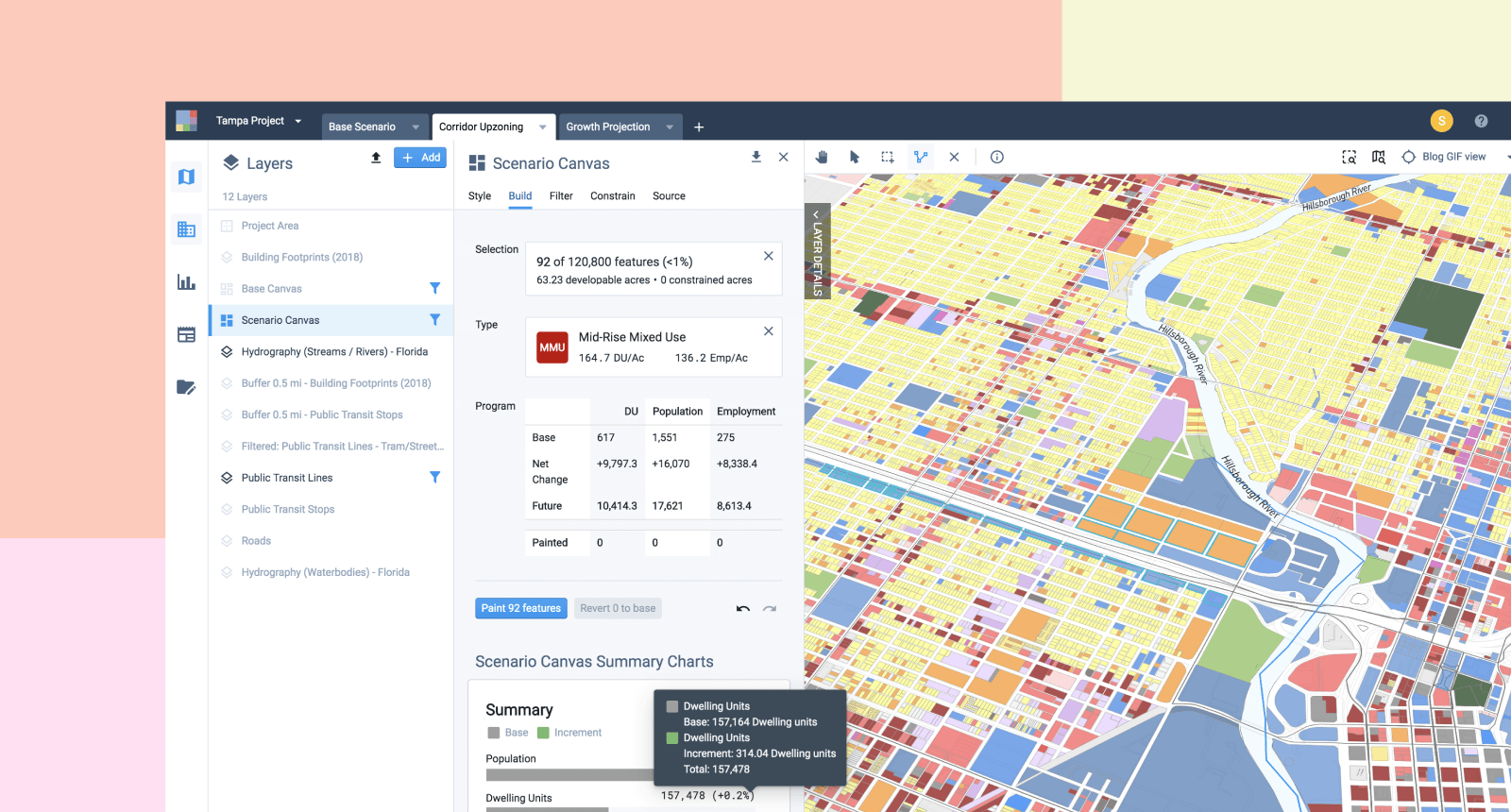
- Bigger, better Base Canvas: Major advancements in our data core, particularly the UrbanFootprint Base Canvas, the industry’s only national parcel-scale land use database. We’re deploying more data and machine learning to increase accuracy, coverage, and localization of this critical dataset, which powers mapping and analysis for any U.S. location.
- Easier collaboration: More collaboration, with enhanced workflows across teams and tools to share work with clients, other organizations, and to communicate with the public and stakeholders.
Our growing customer base is the foundation for our product’s roadmap. Users have been instrumental in helping us decide what to build next, what needs improvement, and what will make their day-to-day experience as urban practitioners demonstrably better and more effective. We pride ourselves on taking this feedback seriously.
We embark on this next chapter knowing there is much work to be done in helping cities realize a more sustainable, equitable, and resilient future, but we can’t think of any goal that is more worth the effort, tenacity, and teamwork it will take to get there. Once again, we send a heartfelt thank you to our team, customers, and investors for helping us take this exciting leap forward.


