UrbanFootprint
Login
Request Demo
  • Solutions
        • Resilience Insights

          Power decision making with curated data and models assembled and intersected to surface insight

        • INSIGHT TYPES

        • Infrastructure & MobilityPhysical infrastructure, modernization, and the transition to electric vehicles
        • Public Service & AdministrationCommunity assistance, resource distribution, and program management
        • –

        • Climate Risk & SustainabilityClimate change, exposure to hazards, and impact analysis
        • Capital Markets & ESGInvestment evaluation, portfolio management, and ESG compliance
  • Technology
        • Our Technology

          The UrbanFootprint platform curates components of our Data Foundations to build Resilience Insights and deliver them through one or more Data Experience

        • DATA FOUNDATIONS

        • Built EnvironmentLand use, buildings, transportation, and infrastructure detail
        • People & VulnerabilitiesCommunity and household characteristics with modeled need
        • Climate & HazardsCurrent and future hazard risks plus land and assets impacted
        • DATA EXPERIENCES

        • AnalystCloud-based GIS mapping and analytics application
        • ExplorerCloud-based map visualization and dashboard application
        • Direct DataFlexible data integration and feeds to customer systems
  • Resources
        • RESOURCE TYPE

        • Case Studies
        • Solution Overviews, eBooks, and Whitepapers
        • LEARN MORE

        • Community Resilience
        • Climate Resilience
        • ESG
        • Social Equity
        • TECHNICAL SUPPORT

        • Product Documentation
        • Contact Us
  • Blog
        • Existing Conditions Assessments Key
          Power Your Next Project with the UrbanFootprint Existing Conditions Dashboard
          Existing Conditions Dashboard Charts Key Image
          Launch Faster with UrbanFootprint’s New Existing Conditions Dashboard
          Eaton Fire Area And Special Wind Regions In Southern California
          Spotlight on Wildfire Risk – How Wind, Weather, and Wildland Development are Fueling Extreme Events
          Sample view of updated transit data in San Francisco
          Fresh Data from UrbanFootprint
          Commercial Property Impacts in Altadena
          Impacts of the LA Fires: Setting the Context for Recovery
          SB6-SanJose@1200w
          Unlock the Powers of Unified Parcel Data with UrbanFootprint
        • View all blog posts
  • About
        • AboutLearn about our story and our mission statement.
        • Learn more

        • LeadershipMeet the faces behind the UrbanFootprint team.
        • Learn more

        • In the NewsNews and writings, press releases, and resources.
        • Learn more

        • CareersWe’re always looking for talented people. Join us!
        • Learn more

  • Login
    • Analyst  ↗
    • Explorer ↗
  • Contact Us
Menu Icon Climaterisk

CLIMATE RISK & SUSTAINABILITY

Define a plan to build climate resilience.

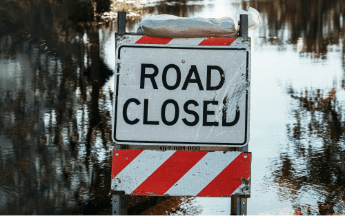
Navigate hazard risk and build resilience against an increasing cadence of natural disasters with a comprehensive and up-to-date detail on climate, community, and market dynamics. UrbanFootprint Resilience Insights deliver quantified views of asset and community risk, vulnerability, and emissions, to support rapid portfolio-wide or single location analysis in any US location.

Get a Demo
Hero Cr
Features Cr 01
Rapidly evaluate single or multi-asset risk across a full range of climate hazards and scenarios
Features Cr 02
Quantify direct and secondary community and financial impacts of climate and environmental hazards
Features Cr 03
Develop mitigation strategies and investment plans with a comprehensive view of community vulnerability and financial tradeoffs
THE PLATFORM

A platform purpose-built to navigate climate risk and drive critical resilience investments

Curated data insights, delivered through powerful software, intersect previously-siloed data to drive more effective risk assessment and resource prioritization, and meet evolving regulatory and compliance requirements

Resilience Insights Foundations

1000s of data sources, metrics, and risk models organized, aligned, and assembled for analysis of any US location

icon-built-environmen

Built Environment

icon-people

People & Vulnerabilities

icon-hazards

Climate & Hazards

Resilience Insights Delivery

Data insights and analysis are delivered via cutting-edge software and data feeds

icon-analyst

Analyst

icon-explorer

Explorer

icon-delivery

DIRECT DATA DELIVERY

Techstack Cr
Trusted by industry leaders and their customers
grey wsp logo
grey aclima logo
grey rmi logo
grey HDR logo
gray dlc logo
grey DCFS logo
grey cdfa logo
grey assured guaranty logo
Logo Secondharvest
Logo Caloes
Logo Aecom
SAMPLE USE CASES

Resilience Insights in action

Comprehensive distributed asset evaluation

Climate impact varies across the country, which means your distributed assets face a variety of regional and local risks. Putting the entire portfolio into view is a challenge, but not anymore. Build intelligence and never wonder:

icon-question

Where will assets face the most severe impact and to which disaster type?

icon-question

Where should we prioritize investments to best serve the community?

icon-question

Where will mitigation investments drive business opportunities?

Usecases Cr 01
Usecases Cr 02

Single campus risk and proximity evaluation

Granular data is the only way to truly see asset assessments in full context at the local level. Know exactly how a critical property, such as a hospital, is embedded in their communities and what factors they are most tied to. Build intelligence and never wonder:

icon-question

Where are capacity and resources constraints of greatest concern for the community?

icon-question

Where will local jobs and businesses be put at risk?

icon-question

Where are high value properties and vulnerable populations concentrated?

Plan for disaster impact on communities

Not every community faces the same risk, which requires population data granularity. When disaster strikes, resources and aid must be distributed effectively. Know where to act fast. Build intelligence and never wonder:

icon-question

Where are populations with underlying conditions that require extra resources?

icon-question

Where are marginalized communities at risk of suspended service?

icon-question

Where can investments support economically depressed disaster zones?

Usecases Cr 03

Learn more about leveraging Resilience Insights to navigate climate change and sustainability challenges

What Is Climate Resilience, road closed sign
Page
What is climate resilience, and why does it matter?
The clock starts now for recovery: assessing the impacts of Hurricane Ian Part I
Blog Post
The Clock Starts Now for Recovery – Assessing the Impacts of Hurricane Ian Part 1
Partnership announcement: UrbanFootprint and Aclima
Blog Post
Introducing the Community Impact and Investment Index, developed in Partnership with Aclima, to Drive Climate Action in American Communities

Talk to
our team

Learn how UrbanFootprint can help you build resilience and make better decisions.

Tweet
Share
Share

Never wonder where

UrbanFootprint logo
Contact Us

    • SOLUTIONS
    • Climate Risk & Sustainability
    • Infrastructure & Mobility
    • Public Service & Administration
    • Capital Markets & ESG
    • FOUNDATIONS
    • Built Environment
    • People & Vulnerabilities
    • Climate & Hazards
    • EXPERIENCES
    • Analyst
    • Explorer
    • Direct Data Delivery
    • RESOURCES
    • Case Studies
    • ESG
    • Community Resilience
    • Climate Resilience
    • Technical Support
    • ABOUT
    • Careers
    • Leadership
    • In the News
    • Contact Us

©2025 All rights reserved.

  • Terms & Conditions
  • Privacy Policy