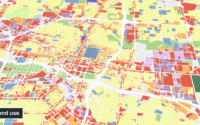
Louisiana’s Department of Children and Family Services deploys more than $1 billion annually to provide nutritional aid and support economic stability for the state’s most vulnerable populations. They partnered with UrbanFootprint to use machine-learning data insights to make their outreach smarter, equitable, and more effective.
UrbanFootprint’s innovative approach to addressing food insecurity and the SNAP Gap through data and technology provides us with powerful data insights to budget resources efficiently, distribute food benefits effectively, and engage communities that are most in need.
Shavana Howard, Assistant Secretary for Family Support at DCFS
UrbanFootprint gives me the necessary tools to bring into meetings and show prioritization visually, empowering open discussion with all relevant stakeholders—asset management, real time-operations, field ops planning—and achieve buy-in in real time.
Elizabeth Cook, General Manager, Advanced Grid Solutions
To build long-term resilience, DLC partnered with UrbanFootprint to help modernize their systems and approach to community and infrastructure planning.
To meet the challenge of COVID-19 and prepare for similar crises in the future, the Center for Planning Excellence (CPEX), a non-profit organization that drives urban, rural, and regional planning efforts in Louisiana, partnered with UrbanFootprint to help policy makers and relief providers prioritize resources and inform equitable interventions.
As Mayor, it is my belief that all decisions should be data driven. Access to the type of hyper-local, dynamic data provided by the COVID-19 Recovery Insights Platform will be valuable in my efforts to develop targeted strategies that address areas of greatest need throughout East Baton Rouge Parish.
Sharon Weston Broome, Mayor-President of Baton Rouge, LA
UrbanFootprint is the perfect tool for the job we do. We’re able to create numerous land use scenarios, measure the impacts and benefits, and easily share the results with our community members and let them decide based on the outcomes. It’s extremely important for us to empower them as decision makers.
Ryan Beck, Vice President of Planning
In anticipation of Utah County’s projected growth of one million people by 2065, Envision Utah used UrbanFootprint to power a streamlined and data-driven community planning initiative.
As a leader in the climate action planning space, Dover, Kohl & Partners decided to expand their capabilities using UrbanFootprint’s built-in scenario planning toolkit and suite of analysis modules.
When it comes to scenario planning for climate action plans, UrbanFootprint provides an excellent shorthand for imagining multiple future scenarios and comparing their environmental performance.
Jason King, Principal & Senior Project Director
We find UrbanFootprint to be extremely helpful in the proposal process. With comprehensive data coverage, you can create insightful maps with very minimal effort. The client is always surprised to see that you have such detailed data before you even have a contract.
Alex Steinberger, Partner
Learn how Cascadia Partners uses UrbanFootprint to win more proposals, save time on existing conditions, and enhance their scenario planning analyses.
More Urban Planning and Design Case Studies
City of San Diego
The City’s Planning Department continues to integrate the use of technology to help improve and cost-efficiently manage the land use analysis and scenario planning process required for each community plan update.
Raimi + Associates
With an unwavering commitment to creating healthy, equitable, and sustainable communities, Raimi + Associates’ work includes developing General and Comprehensive Plans; master plans for transit districts, corridors and neighborhoods; climate adaptation and resilience plans and healthy community plans.
The Nature Conservancy
We worked closely with The Nature Conservancy to build and integrate The Nature Conservancy’s Conservation Module into UrbanFootprint. The Conservation Module was built to help planners and communities measure the impacts of proposed plans and policies across four key areas: water resources, habitat impacts, agriculture, and carbon sequestration and storage.
Placeworks
Onboarding UrbanFootprint vastly improved the data discovery and acquisition process for the PlaceWorks team, supporting easy and cost-effective acquisition of authoritative data and allowing the team to focus more on map creation, scenario modeling, and alternatives analysis.
City of Madison
The thriving City of Madison expects to see a 25% increase in population by 2040. As the city prepares its 2040 Comprehensive Plan update, the need for an enhanced public transit system via bus rapid transit (BRT) emerged as a key component in supporting a socially equitable future for a growing and increasingly diverse population.
DPZ
DPZ is a world-renowned urban planning and design firm. Founded in 1980 by Andres Duany and Elizabeth Plater-Zyberk, two founding members of the Congress for New Urbanism, DPZ’s work is dedicated to creating environmentally resilient and economically thriving places. The DPZ team brings nearly 40 years of experience and expertise to planning projects at every level; from large-scale regional plans to the detailed nuances of regulatory zoning and code reform.
University of Michigan
The University of Michigan’s Taubman College of Architecture and Urban Planning houses top-tier programs in architecture, urban design, and urban planning. In keeping with the school’s high academic standards, Assistant Professor of Urban Planning Robert Goodspeed turned to UrbanFootprint to bring cutting-edge data science and planning technology into the classroom.
Association of Monterey Bay Area Governments
AMBAG joined UrbanFootprint’s free California Civic program this year to enhance the planning process for the upcoming Metropolitan Transportation Plan/Sustainable Communities Strategy (MTP/SCS).
Join the hundreds of teams using UrbanFootprint
Get in touch to learn how we could help your team.
Using UrbanFootprint has helped us go beyond general benefits and estimates to quantify specific predicted outcomes. We are now able to put numbers to solutions and project how each scenario will impact our efforts to increase transit ridership and reduce VMT.
Ben Zellers, Planner, Comprehensive Planning & Regional Cooperation, City of Madison
Ready to learn more? Contact our team to discover how to get quick locations insights with UrbanFootprint.
Already a customer? Log in