


If you’re interested in creating a project like this, let us know!
A customer recently asked, “Can UrbanFootprint analyze the property values of single-family homes near parks for a given city?” This use case is a perfect example of how easy it is to get location insights with UrbanFootprint’s out-of-the-box parcel data.
Rather than wrestle with raw parcel data, UrbanFootprint users can simply start a parcel-level project for a city of their choosing to view a detailed land use map in minutes. Parcel-level projects can be created in any county with a population greater than 45,000, covering about 85% of the U.S. population.
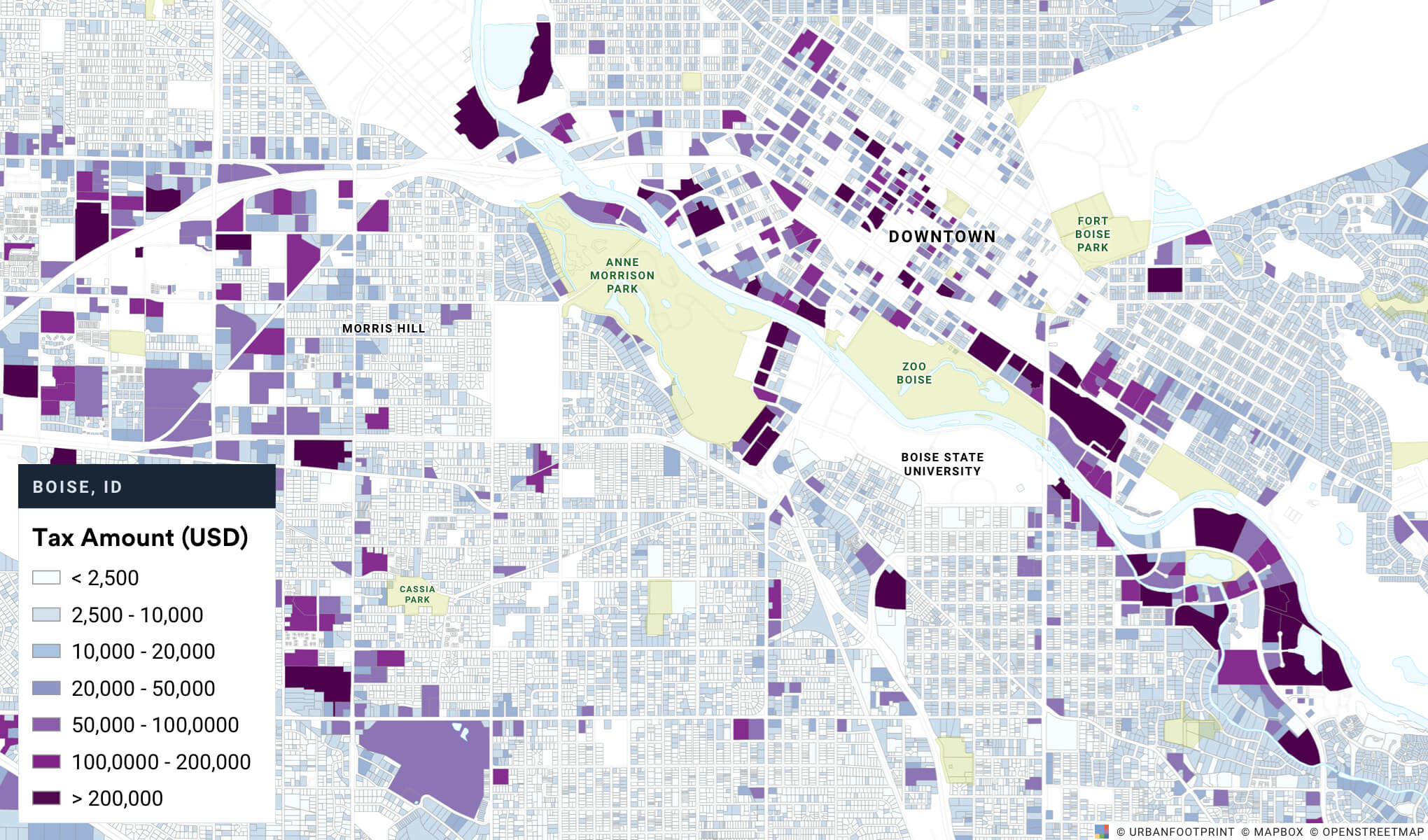
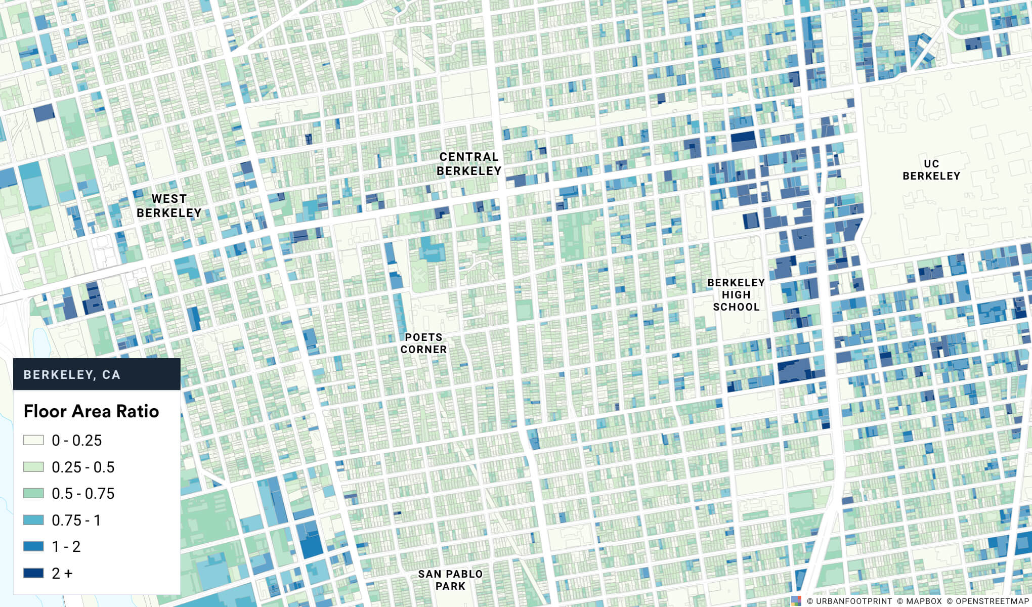
To explore insights on property values near parks, UrbanFootprint users can quickly layer additional Parcel Reference Data from our extensive Data Library. As we see below, this layer includes information on land use, assessor’s land and improvement values, lot size, building areas, and addresses.

How might proximity to parks influence property value? Let’s look at the data.
For our customer use case, let’s evaluate single-family home prices near parks in Seattle. We’ll start by focusing on the Total Property Value (Land Value + Improvement Value) data in the Parcel Reference Data layer.
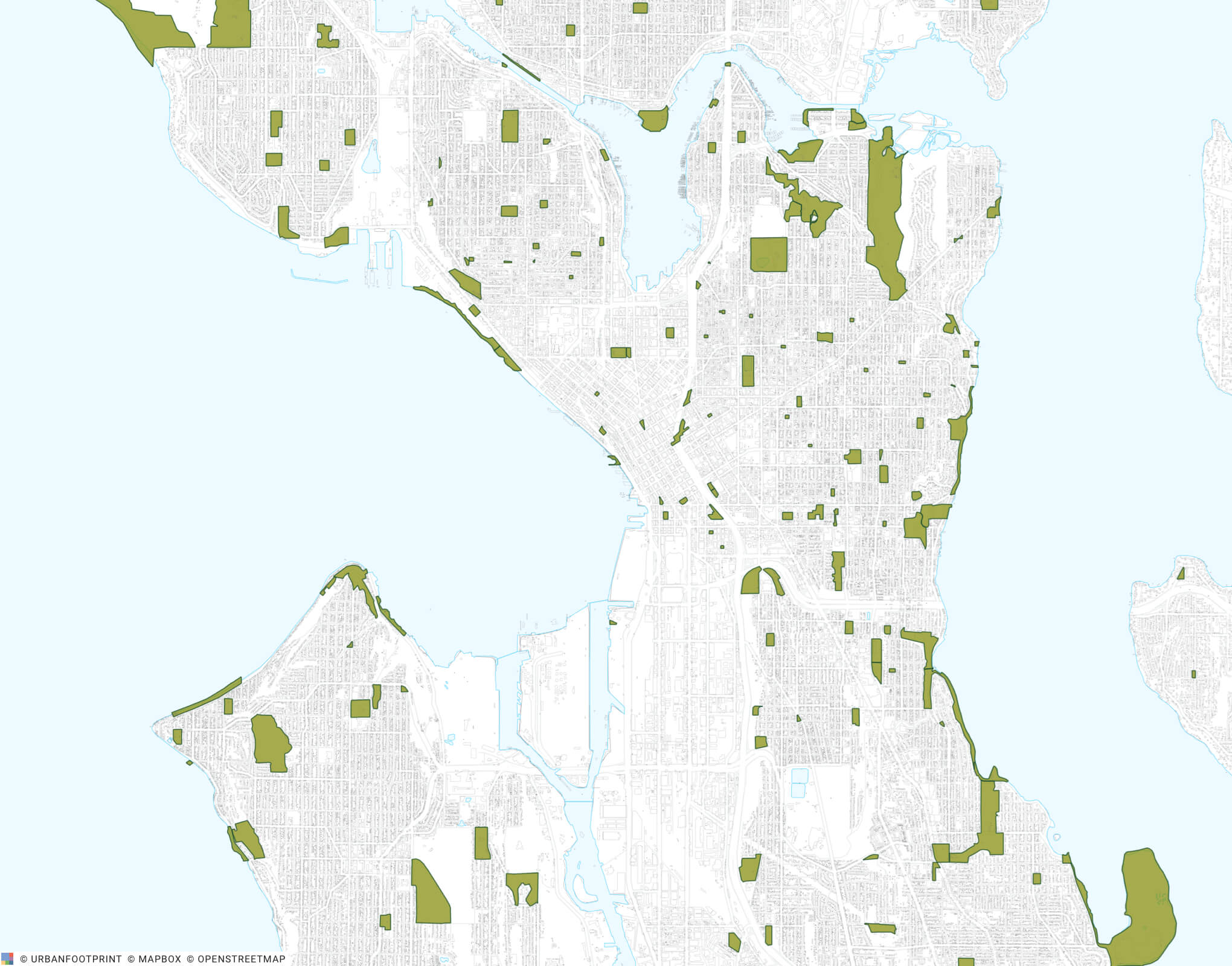
First, we’ll create a project in Seattle and add the “Parks and Open Space” layer.
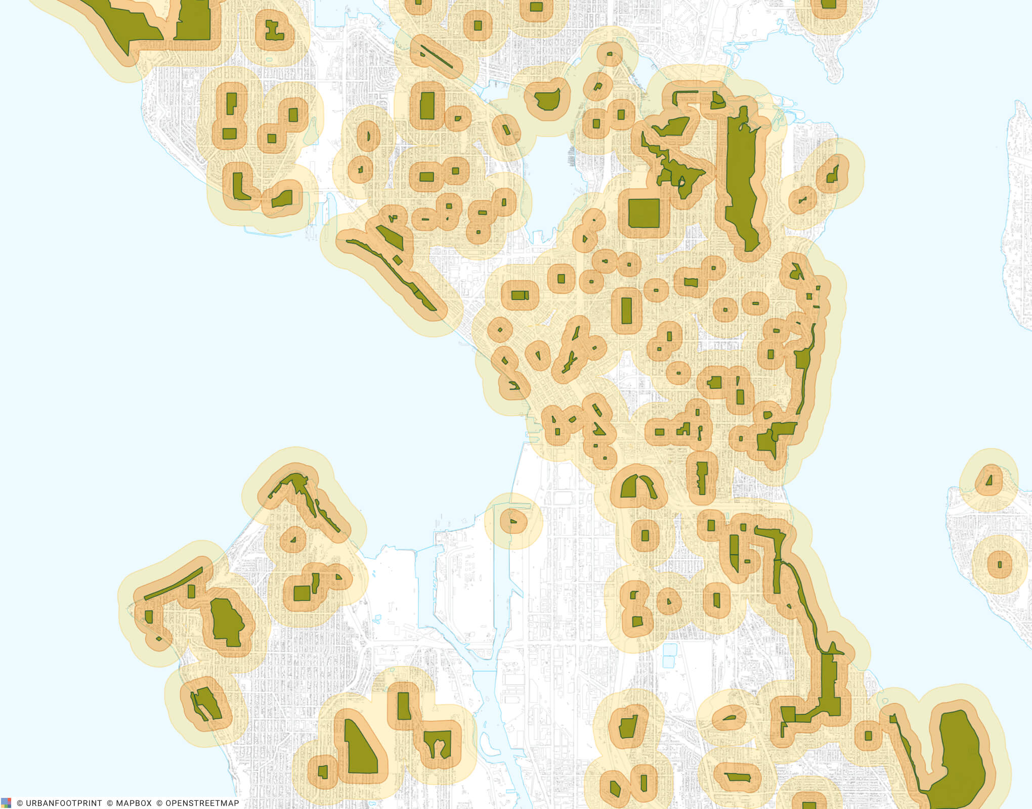
Next, we can create a couple of buffers (0.1 miles and 0.25 miles) around the parks so we can filter for parcels near parks.
Now, we’ll filter the parcel canvas to include only single-family homes within these buffered areas. Here’s a zoomed in look at a few neighborhoods in Seattle.
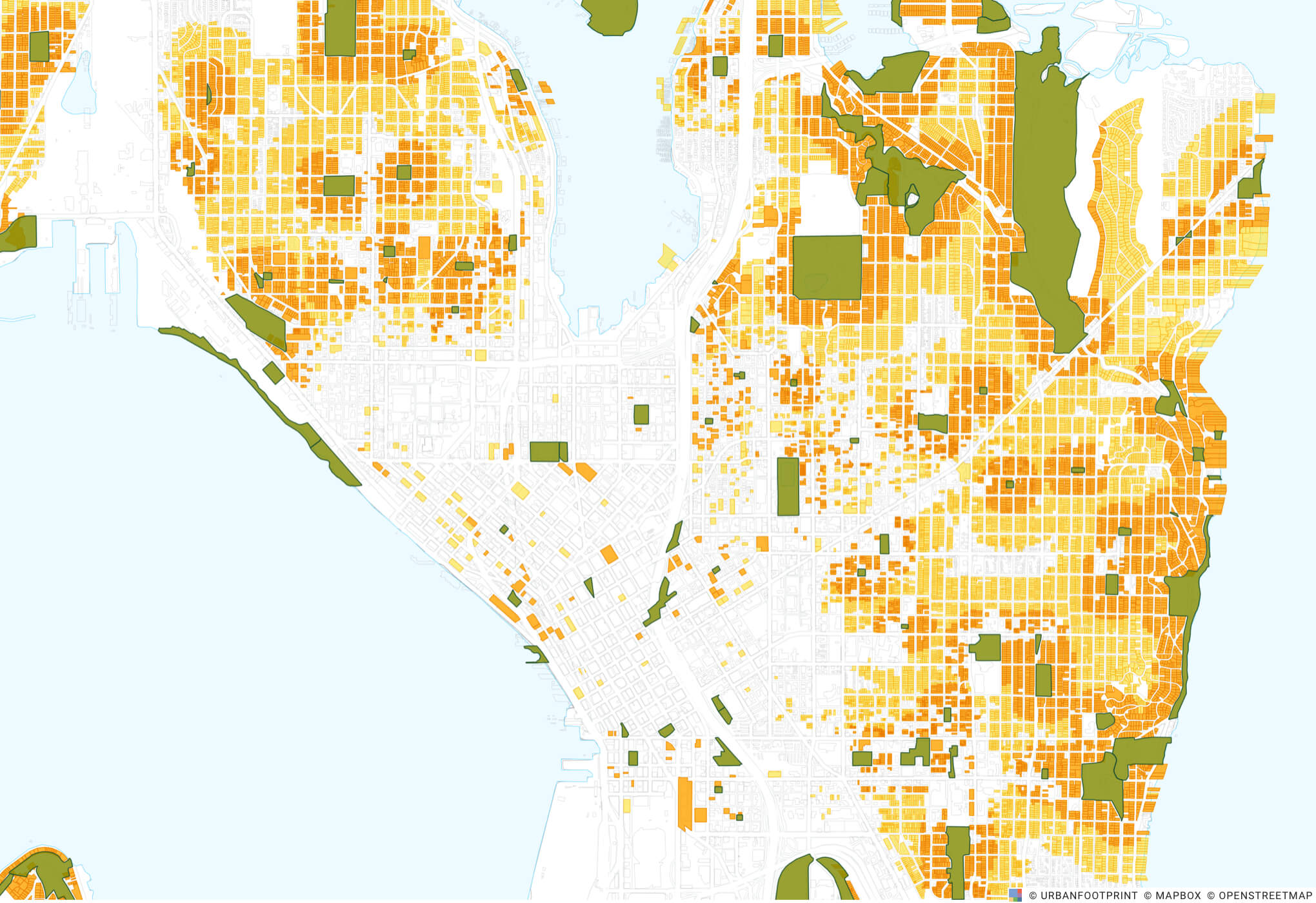
By joining this filtered set of parcels with the parcel reference data, we can quickly see how property values for single-family homes increase as we get closer to parks.
UrbanFootprint’s Parcel Reference Data make it easy to compare the average property value increase for single-family homes that are closer to parks.
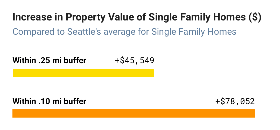
So how does proximity to a park impact the property value of single-family homes in Seattle? According to the Parcel Reference Data, when compared to the average property value of single-family homes in Seattle, single-family homes within a 0.25 mile buffer of a park see an average increase of $45,459, while single-family homes within a 0.10 mile buffer of a park see an average increase of $78,052.
This is, of course, a simplistic insight that doesn’t account for a number of other factors like the age of the building, building size, and more (which are also available for analysis in UrbanFootprint). However, we hope this has sparked your curiosity to try this out for yourselves!
Interested in exploring Parcel Reference Data in your community or planning project?
Talk with our team and learn how to set up your own analysis in minutes. We’ll share how to map insights from thousands of preloaded datasets, build future scenarios, and analyze impacts on transit accessibility, emissions, energy use, and more.
Have a question or comment? Let us know! We’d love to hear from you. Tweet us your thoughts or send us a note.
