Envision Utah Maps a Community Vision for the Future of Utah County with UrbanFootprint
How Envision Utah Leverages UrbanFootprint’s Robust Scenario Planning Capabilities
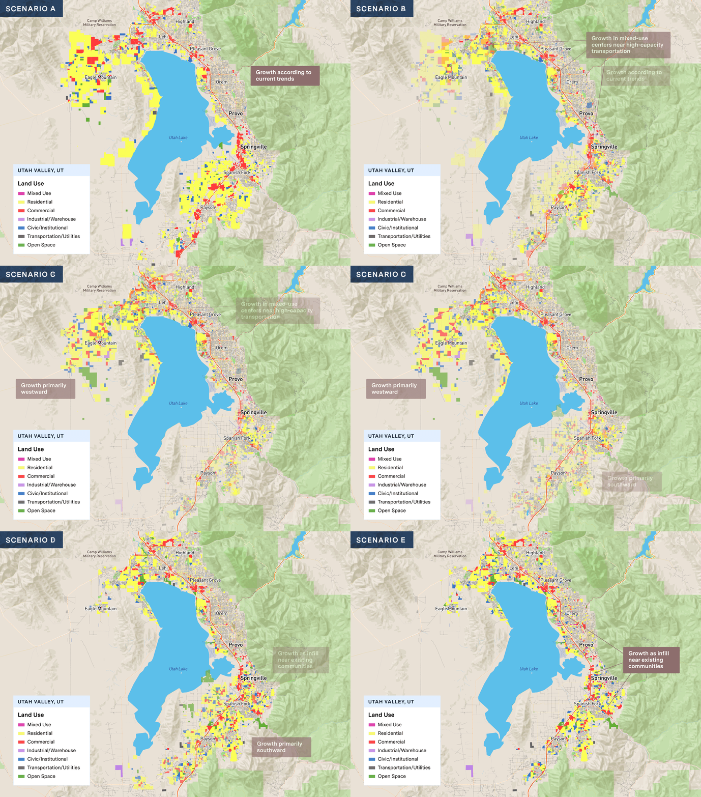
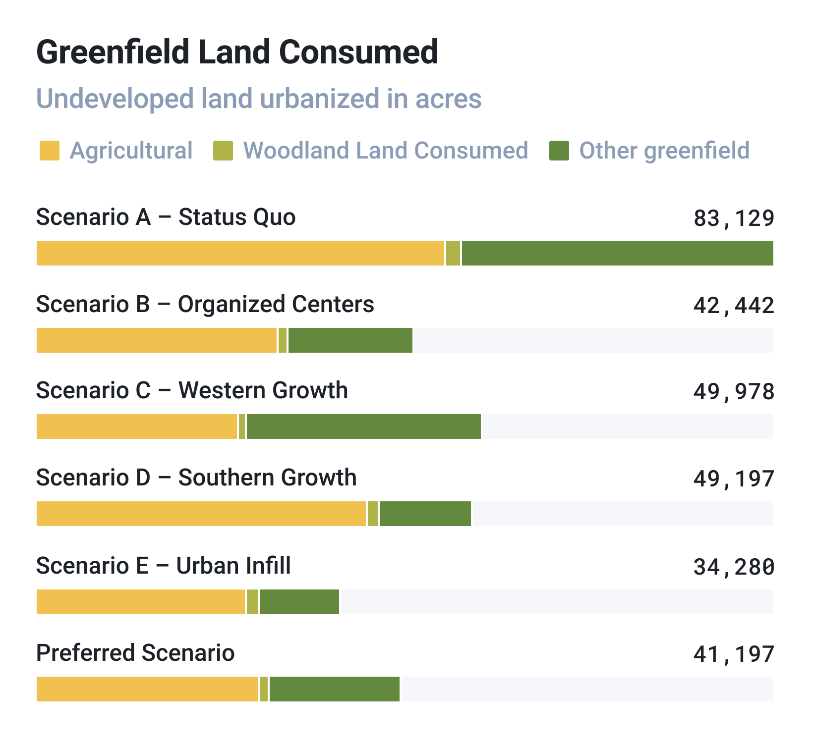
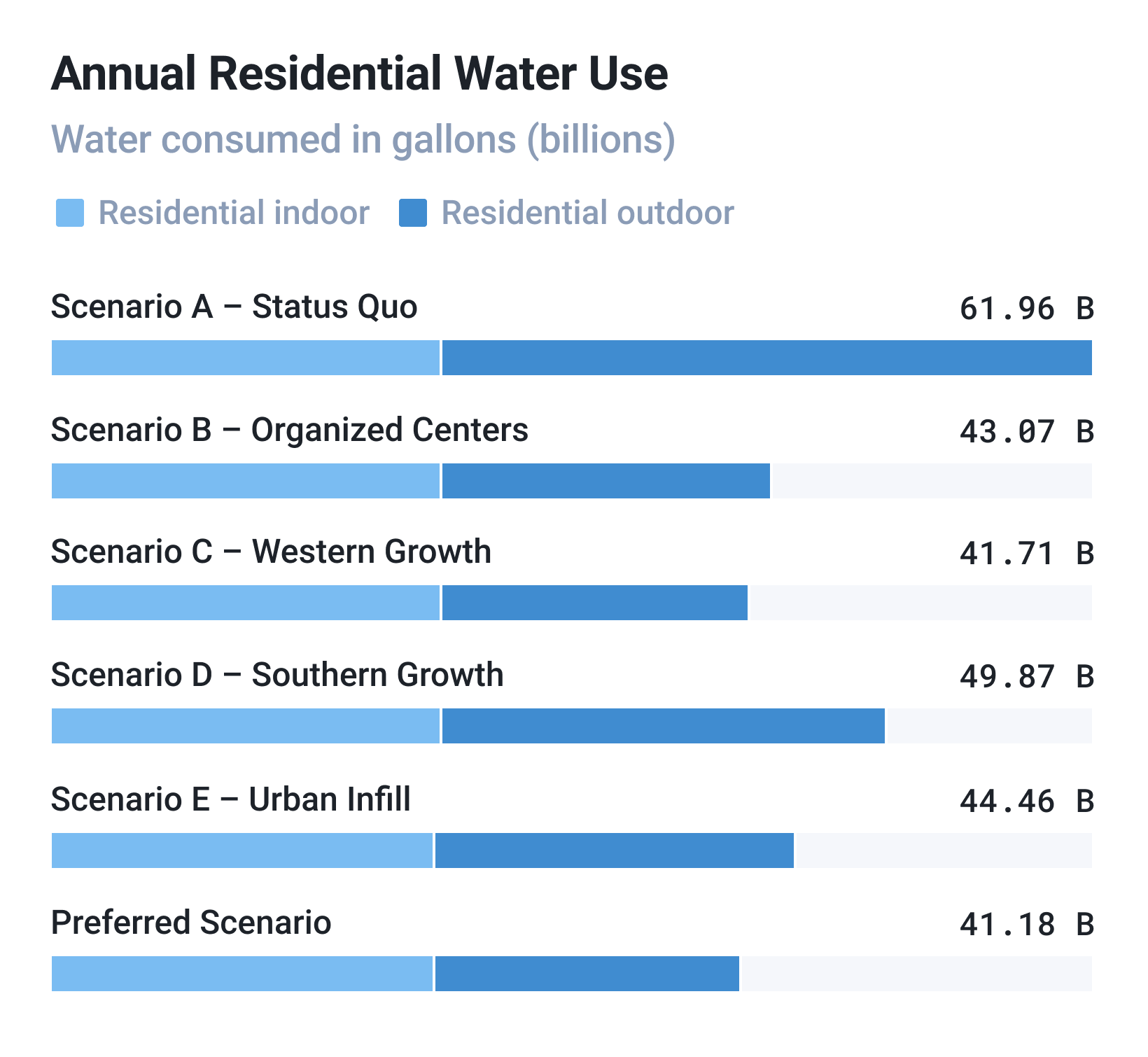
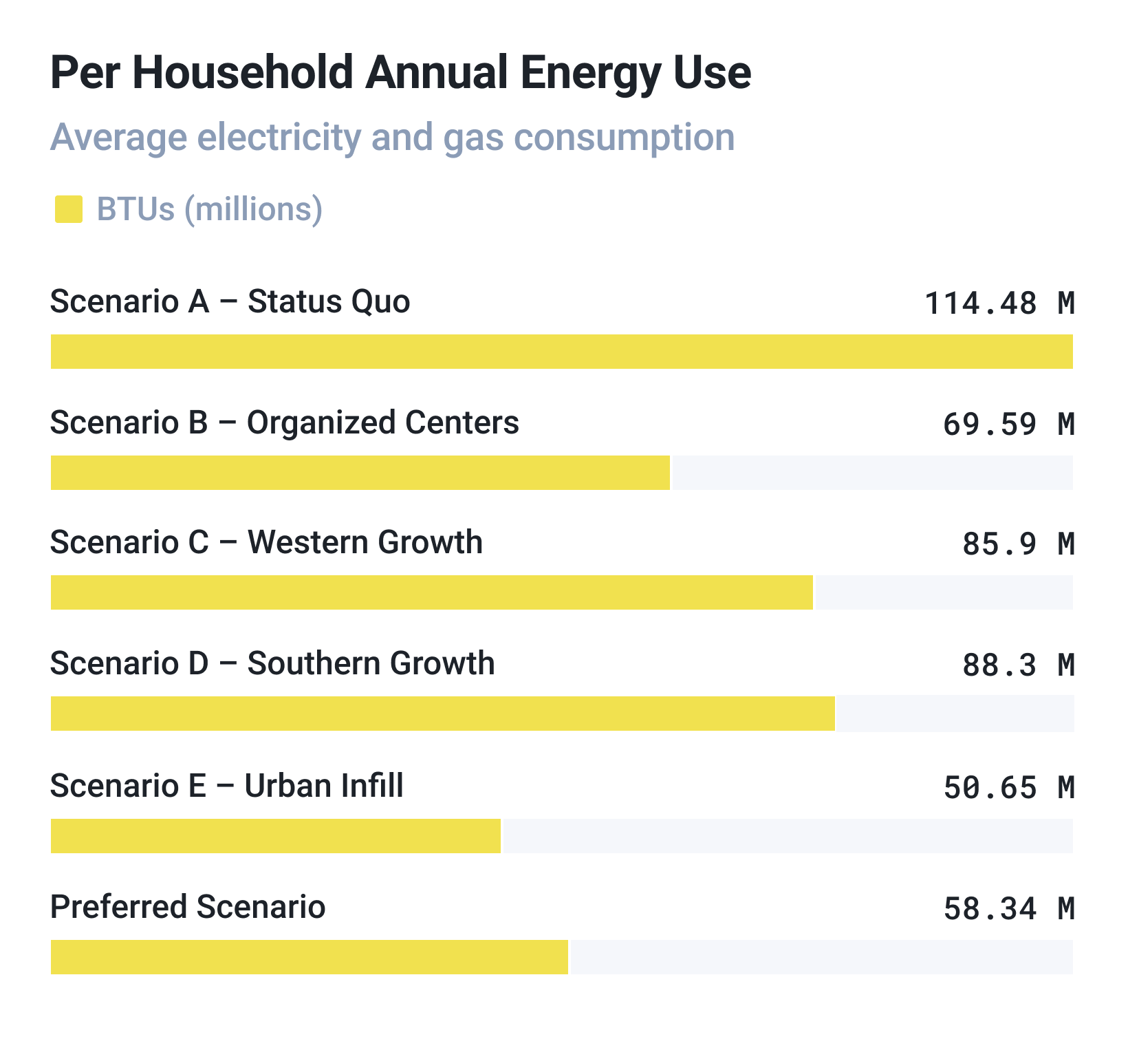
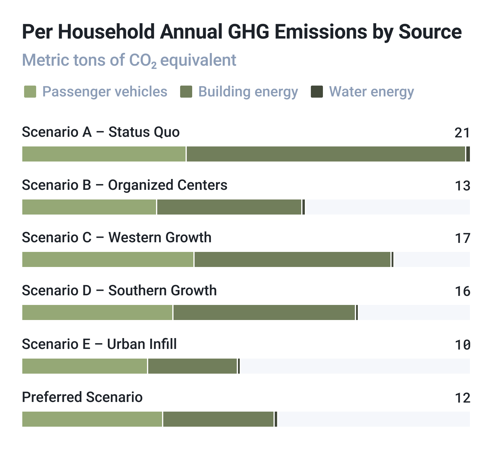
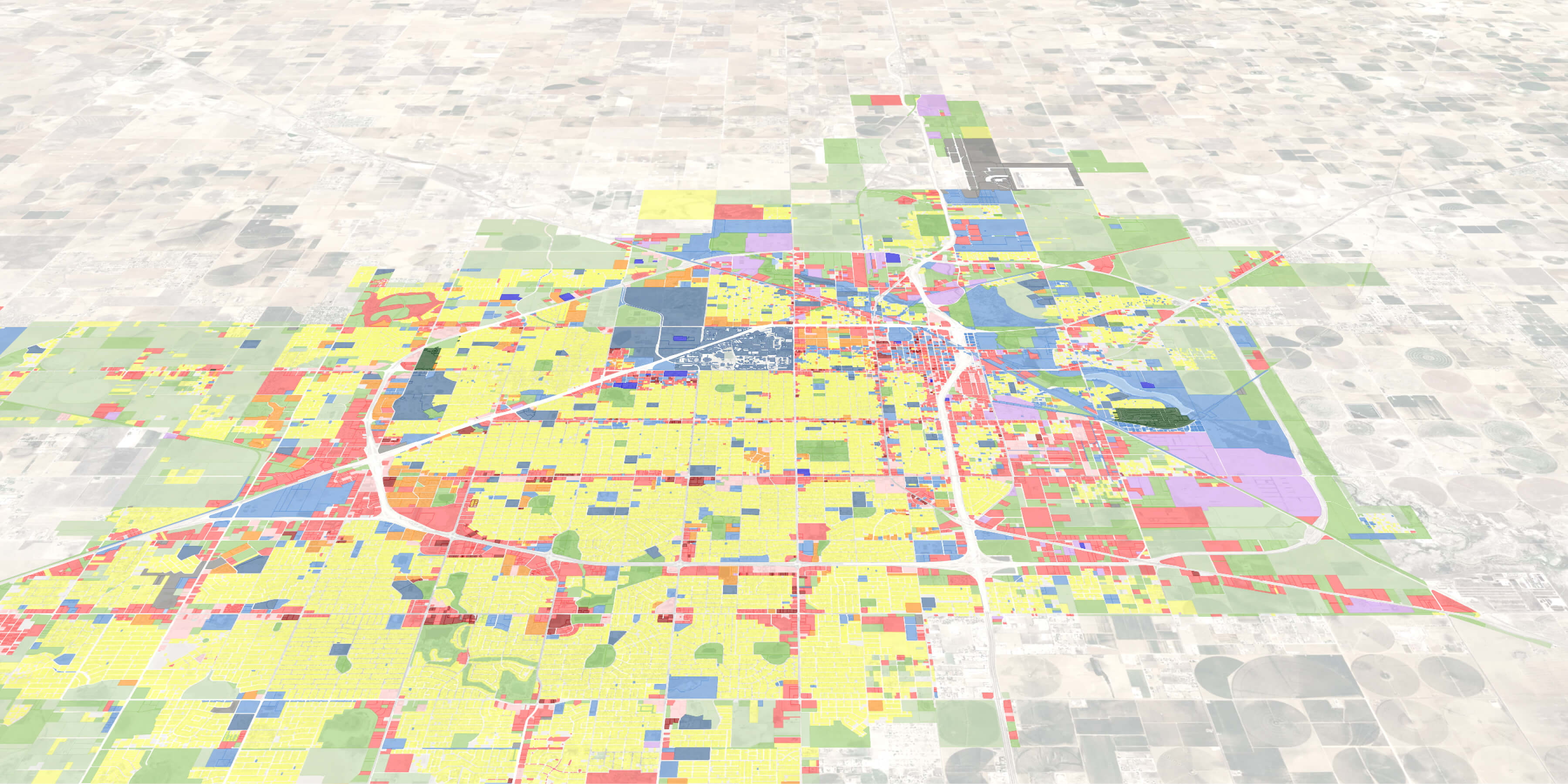
Established in 1997, Envision Utah engages businesses, government agencies, community leaders, and local residents to build a strategic and sustainable vision for Utah, covering key planning issues like air quality, education, agriculture, transportation and more. In 2018, Envision Utah launched the Valley Visioning project to create a community-supported vision for growth in Utah County, one of the fastest growing counties in the U.S. Valley Visioning was the first major project in which the nonprofit used UrbanFootprint for its mapmaking and scenario planning. Specifically, they leveraged the platform to create different land use scenarios of the expected growth targets, and then presented the scenarios to the public for feedback.
Compared to their former toolset, the Envision Utah team found that UrbanFootprint dramatically streamlined the entire planning process, as Vice President of Planning Ryan Beck explains: “UrbanFootprint is the perfect tool for the job we do. We’re able to create numerous land use scenarios, measure the impacts and benefits, and easily share the results with our community members and let them decide based on the outcomes. It’s extremely important for us to empower them as decision makers.” Until the Valley Visioning project, the nonprofit had used a combined system of desktop GIS and spreadsheets for its scenario planning. But that process has always demanded a steep learning curve and been altogether unwieldy, whereas the team found UrbanFootprint to be intuitive and easy to use, allowing them to get up and running in half a day.
