Case Study
Case Study
The COVID-19 pandemic has given rise to an economic and social crisis impacting an unprecedented number of Americans all over the country. In Louisiana, long-standing disparities have only intensified, as COVID-19 further compounds the effects of those inequities, magnifying the distress experienced in many communities. In order to respond and build an effective recovery strategy, state and local leadership need to map and measure the scope, scale, and distribution of the crisis and its underlying drivers.
To meet that challenge, and prepare for similar ones in the future, the Center for Planning Excellence (CPEX), a non-profit organization that drives urban, rural, and regional planning efforts in Louisiana partnered with UrbanFootprint to dynamically measure and map social vulnerability and economic stress, and to help policy makers and relief providers prioritize resources and inform equitable interventions. As Camille Manning-Broome, President and CEO of CPEX, noted: “Deploying data and information that provides a nuanced, place-based understanding of how our built environment is serving our residents is essential to expediting recovery, aligning resources with the most effective interventions, tracking impacts, and building the resilience our state needs to thrive in the future.”
As Mayor, it is my belief that all decisions should be data driven. Access to the type of hyper-local, dynamic data provided by the COVID-19 Recovery Insights Platform will be valuable in my efforts to develop targeted strategies that address areas of greatest need throughout East Baton Rouge Parish.
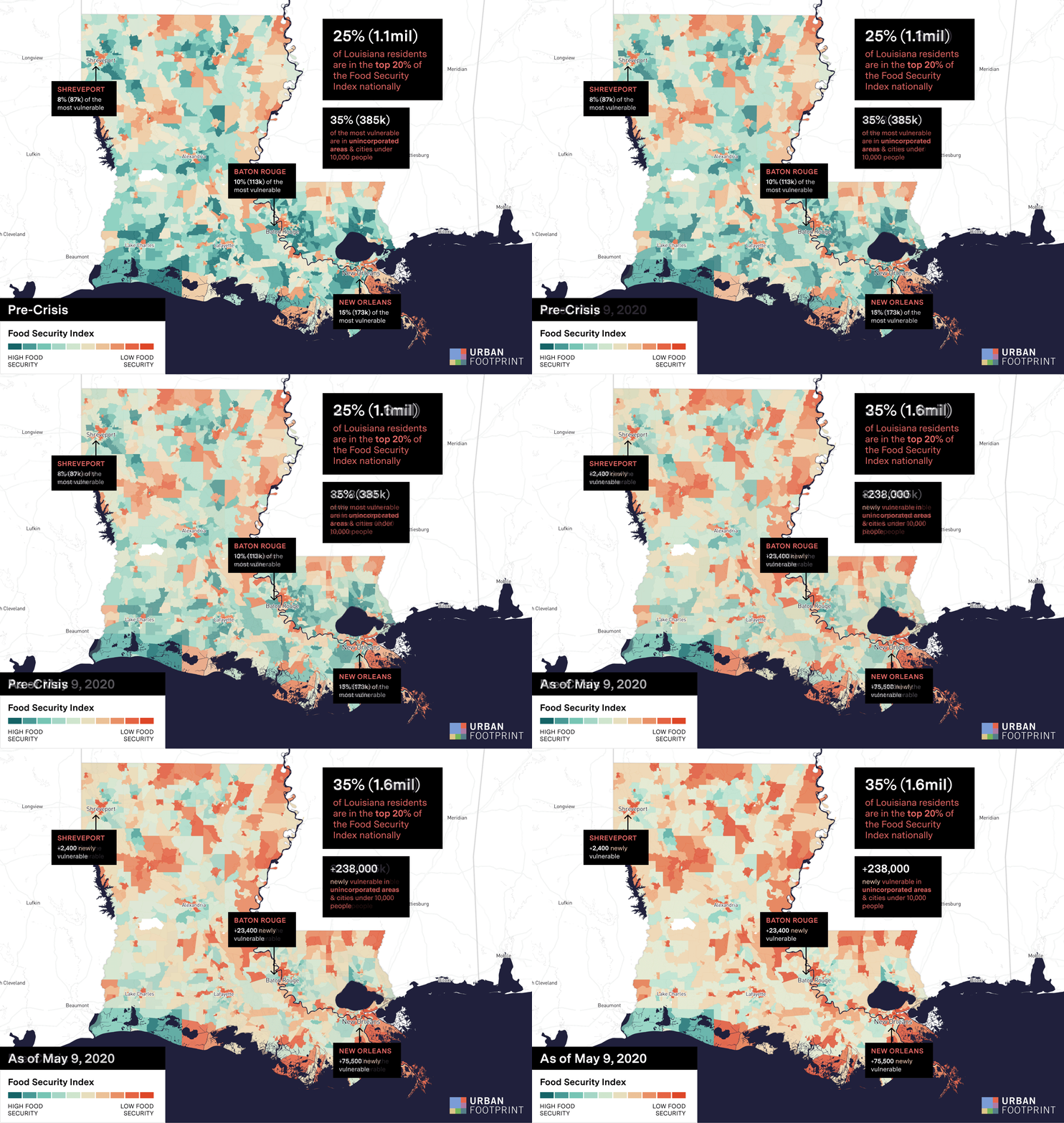
UrbanFootprint launched a series of advanced Social Vulnerability, Economic Stress, Health, and Accessibility indices to reveal where critical services are needed across and within American cities. Due to the escalating food access crisis in Louisiana, the indices were deployed as the backbone of a statewide Food Security Index to support agencies, cities, and food banks across Louisiana. The analysis measures the risk arising from a combination of socio-economic factors, jobless claims and economic stress, pre-existing health conditions and lack of grocery stores. A number of key insights have emerged:
Beyond providing an understanding of the larger crisis, UrbanFootprint and CPEX are helping officials and community groups close the gap between supply and demand by identifying potential food distribution locations that can reach the most at-risk residents. Mike Manning, President & CEO of the Greater Baton Rouge Food Bank, noted that the platform “is providing granular information on areas where our work against food insecurity is needed most or needs to be intensified. As a result, we are better able to focus our response and maximize the impact of our efforts for our communities.”
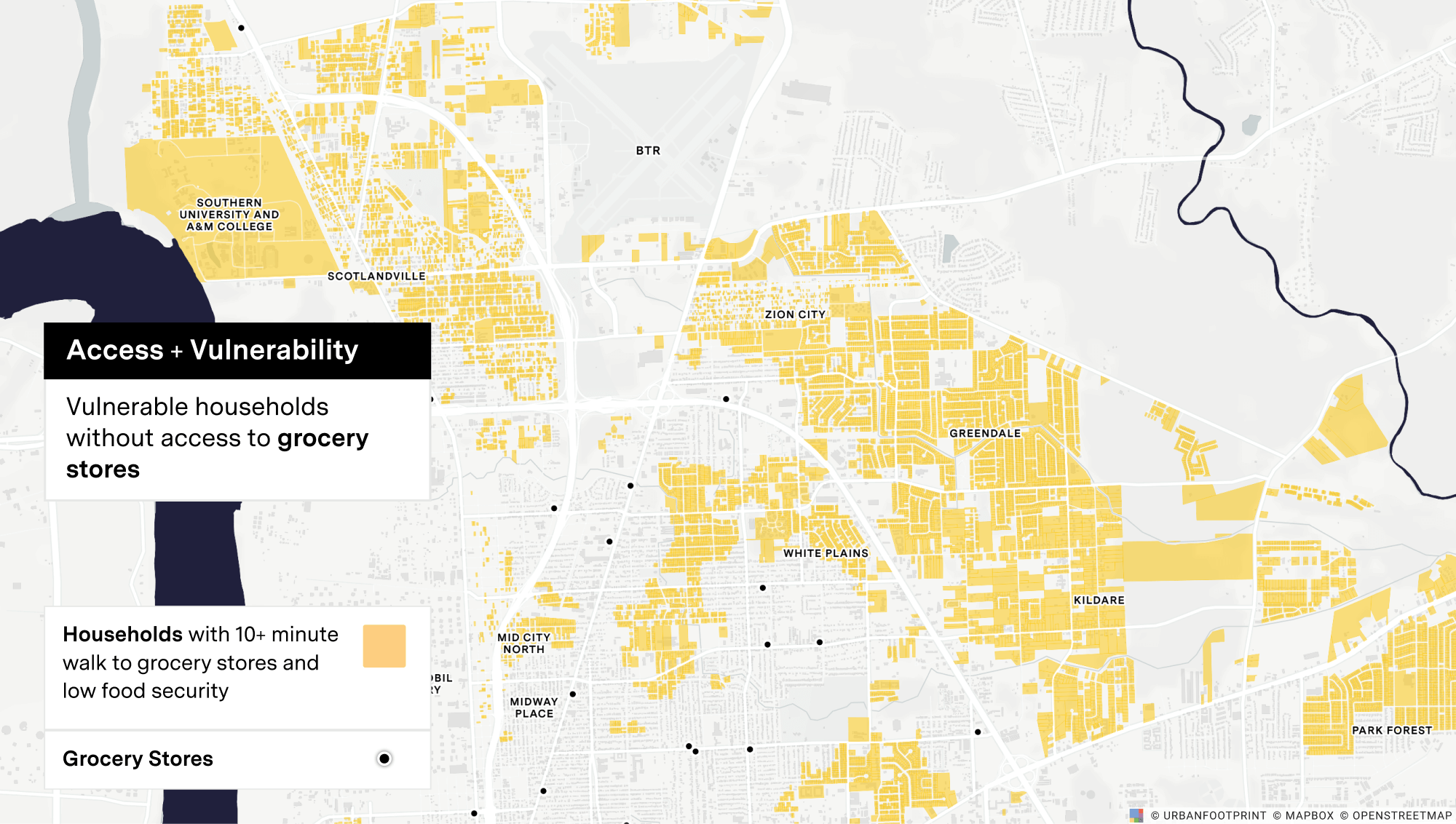
As an example of this work, the UrbanFootprint map below identifies households at high risk of food insecurity.
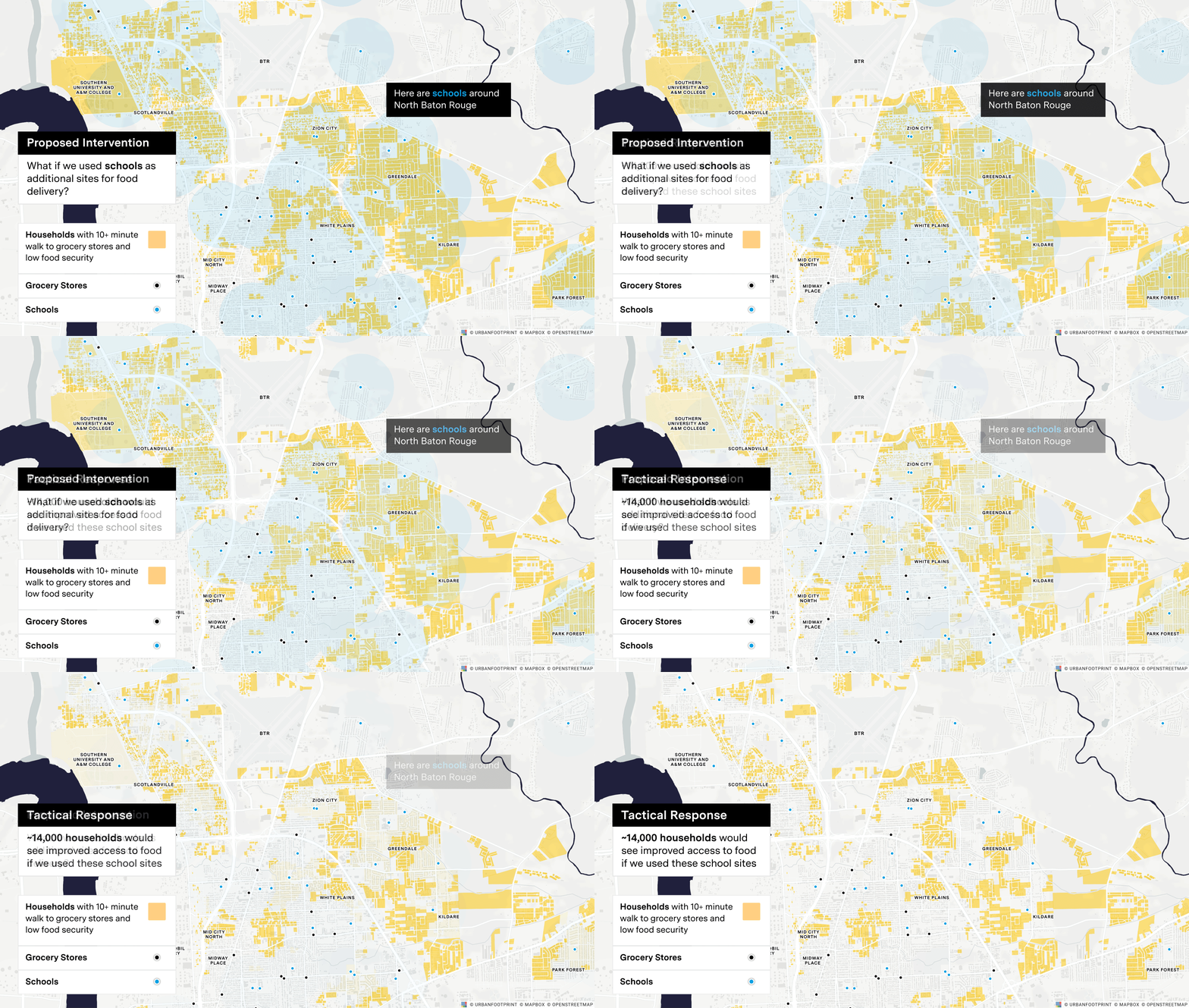
In the exhibit below, we analyzed a proposed intervention of using schools as additional food distribution sites and determined about 14,000 households would see improved access to food in this scenario.
To learn more about our food security analysis work with CPEX and the State of Louisiana, visit our blog to view the full report.
More case studies
CASE STUDY
CASE STUDY
Ready to learn more? Book a demo and discover how to get quick locations insights with UrbanFootprint.
Already a customer? Log in