San Diego Sustainable Communities Strategy
Challenge: San Diego County Prepares for Growth Without Sacrificing Greenhouse Gas Emissions Reduction Goals
San Diego County is the second most populous county in California, and will grow from 3.1 million people to 3.8 million by 2035. The county is striving reduce greenhouse gas emissions, but is challenged by the prevailing suburban pattern in much of the county.
Solution: Advanced Scenario Modeling Unveils a Fresh Vision for San Diego County
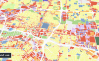
The Calthorpe Analytics team deployed the UrbanFootprint platform to build and model a range of regional land use scenarios to support the development of the San Diego Association of Governments’ (SANDAG) 2015 Sustainable Communities Strategy/Regional Transportation Plan.
Results: San Diego Supports Emission Reduction Targets with Compact, Transit-Oriented Development
The plan developed and adopted by SANDAG prescribed a judicious land use framework with more compact housing options and complete, walkable communities along with a renewed focus on public transit options like commuter and light rail to reduce auto-dependency and decrease VMT.


