


As cities and states across the U.S. deploy shelter-in-place and social distancing measures to ‘flatten the curve’ of COVID-19, medical facilities are struggling with spikes in caseload that threaten to overwhelm their capacity. Public agencies and hospitals are quickly taking steps to handle the influx of new patients, including considerations for setting up new testing sites, standing up alternate care sites, and in some cases repurposing underutilized structures and previously closed facilities. The question is, how can we help hospitals and agencies find where to place these facilities to extend care and testing capacity?
UrbanFootprint is working with public agencies and hospitals to help answer critical emergency response questions. In our example study below, we performed an analysis of potential alternate care sites in Los Angeles where caseloads are rising rapidly. Before we dive into the example, we also wanted to acknowledge that the process of establishing alternate care sites of course requires taking many additional steps to meet regulatory requirements. Our goal in this post is to share how data and mapping can provide a useful starting point in building a list of potential choices. UrbanFootprint provides daily COVID-19 incidence and mortality data to pinpoint areas with a potential surge in demand for patient care. With up-to-date information in our mapping and planning platform, our team of planners, data scientists, and engineers are helping public agencies and front-line organizations to quickly compare COVID-19 case load data to existing hospital bed capacity.
In a potential overflow scenario, where can agencies and hospitals place alternate care sites to expand bed capacity?
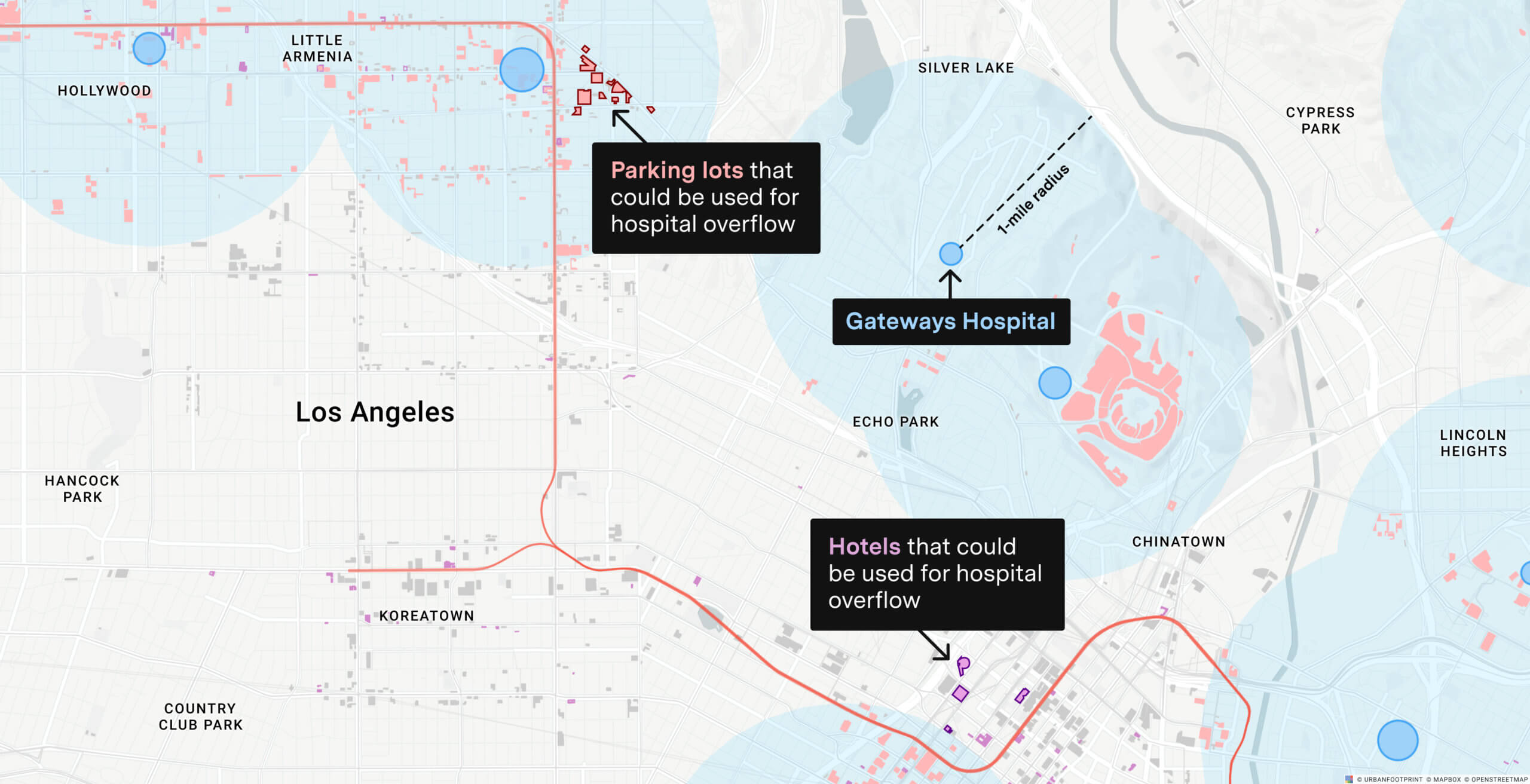
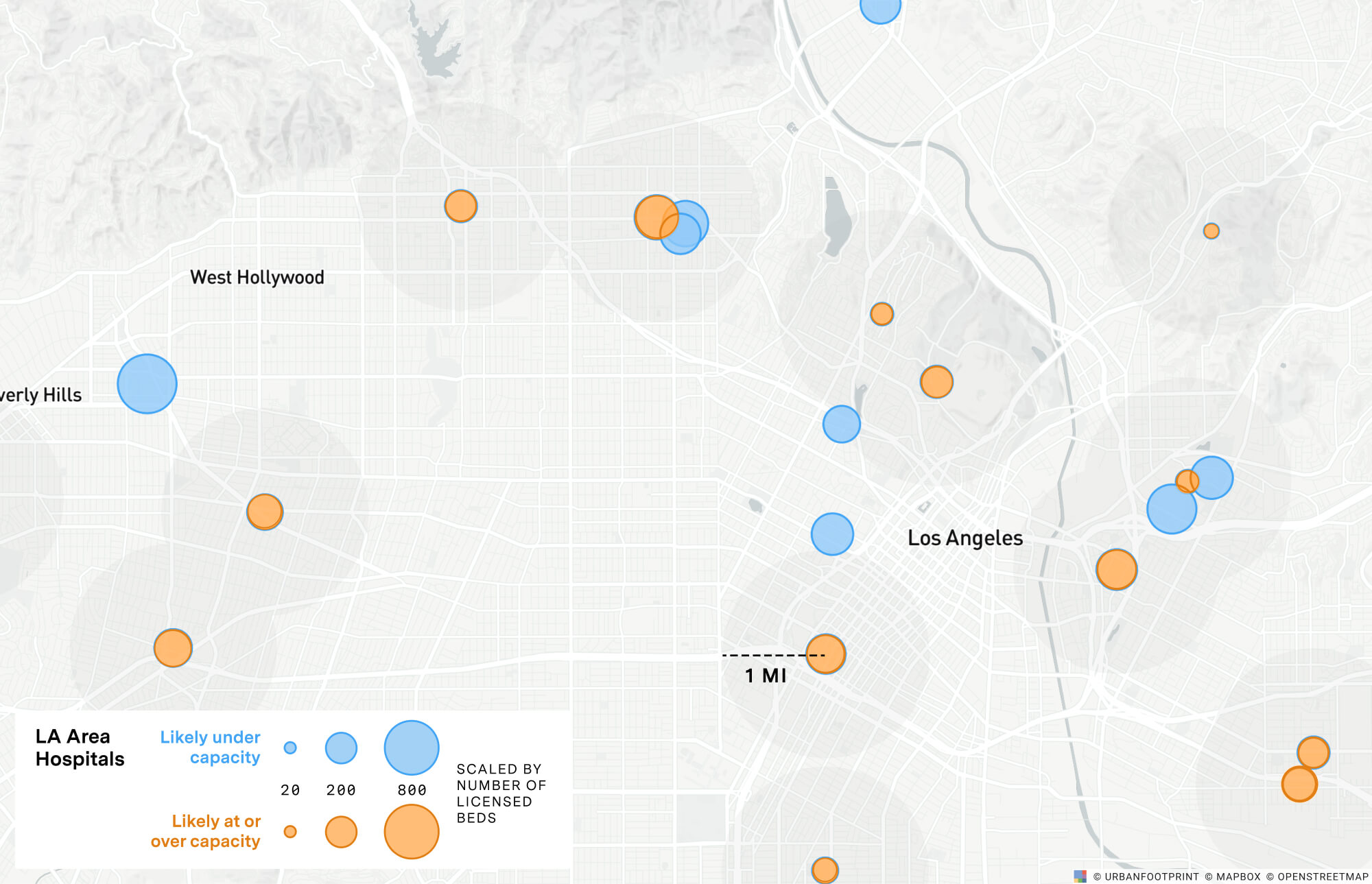
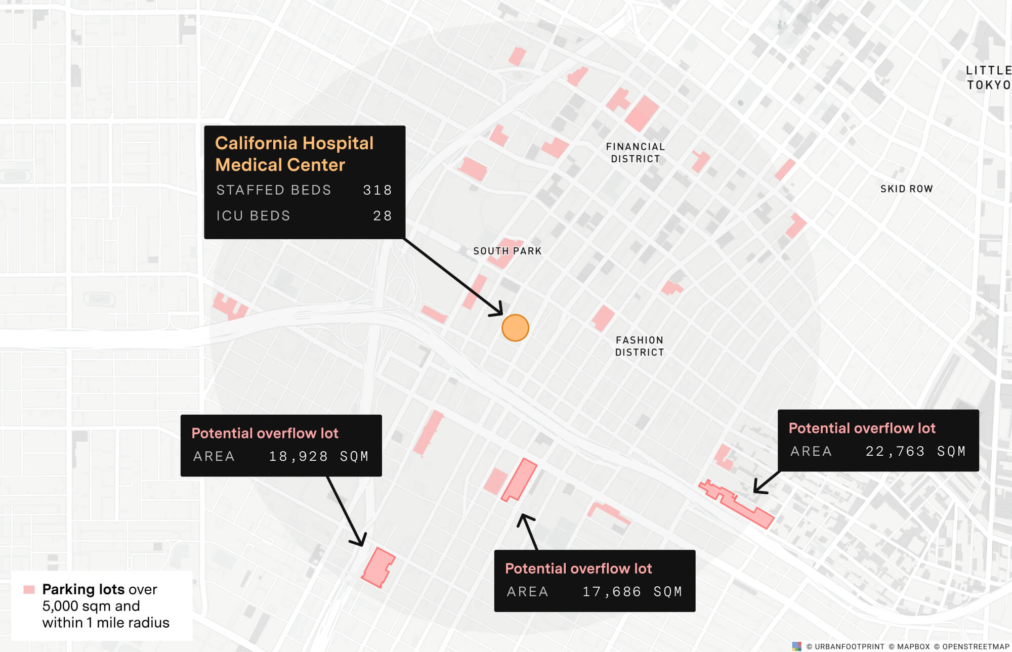
For an initial site suitability study in Los Angeles, we started by using UrbanFootprint’s data core and analysis tools to search for locations that might be considered for alternate care or mobile field medical sites, with a focus on facilities where hospital bed capacity is low or already exceeded.
Next, we searched for nearby sites that may be considered for alternate care sites. As the CDC notes, alternate care sites are “typically established in non-traditional environments, such as converted hotels or mobile field medical units.” The California Department of Public Health also points out that more examples may include “National Guard armories, civic sports centers, convention centers, community centers, and the like.” For the purpose of this example study, we focused on searching for hotels in addition to surface parking lots, where there may be space for mobile field units, within a mile of existing medical facilities.
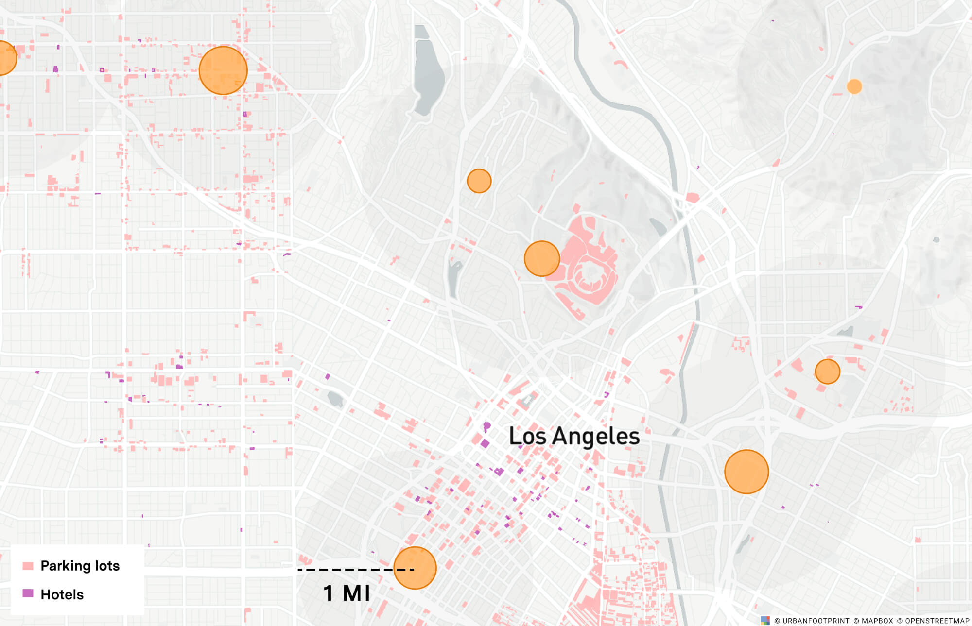
These potential overflow sites can be further filtered based on size, proximity, and accessibility to existing hospital sites and the general population. This provides a start in understanding where and how public agencies can help mobilize medical facilities to expand capacity for patient care.
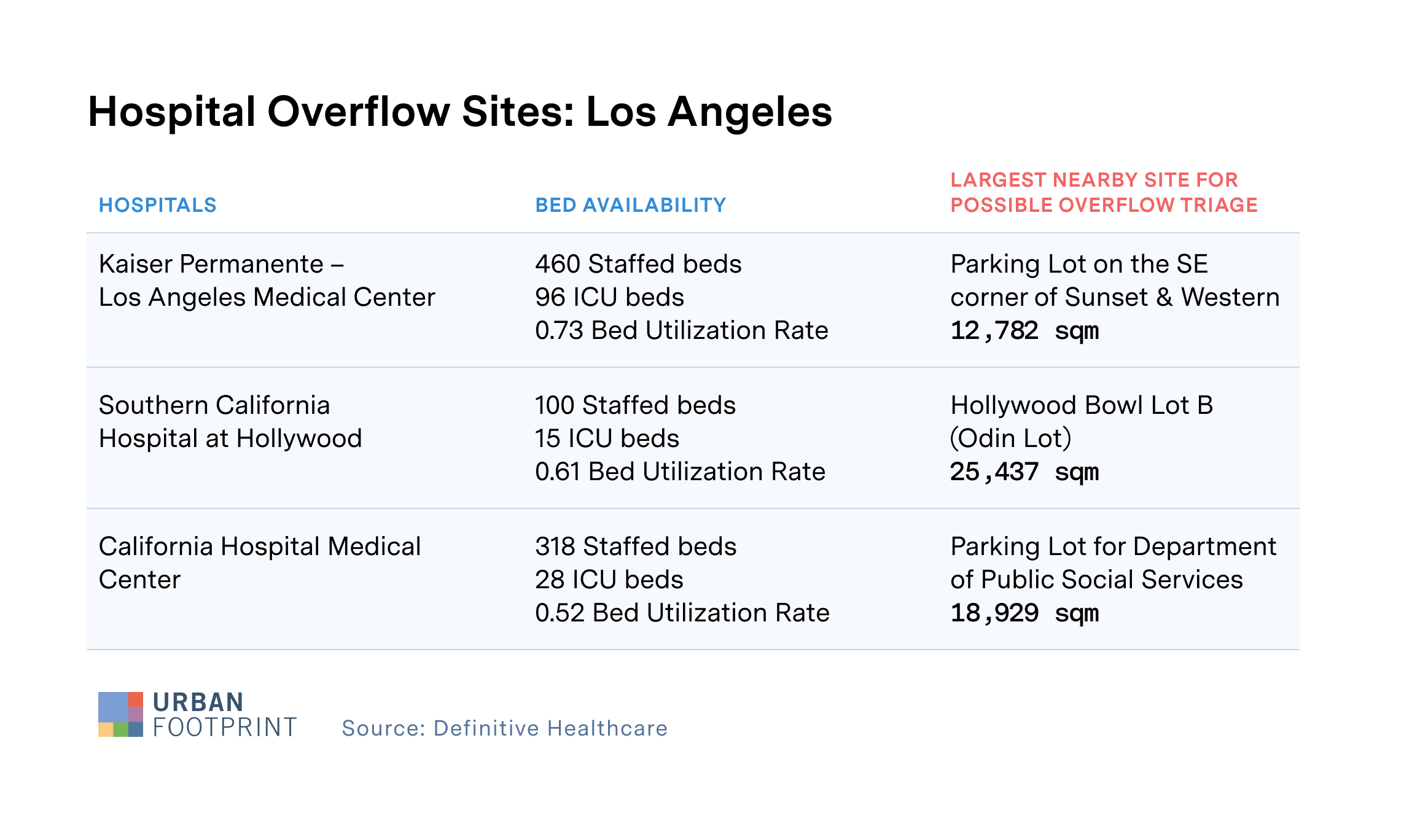
In the chart below, we’ve selected three Los Angeles hospitals that have no capacity to expand based on their existing licensed-beds-to-staffed-beds ratio and identified the largest nearby site for potential alternate care sites.*
How many people could access these potential alternate care sites via public transit?
The transit accessibility of these sites is critical to both staff at the existing hospital locations and the population they serve. This is particularly important for those that may not have access to an automobile.
In an initial analysis of transit accessibility to existing Los Angeles hospitals compared to accessibility with the potential alternate care sites below, we can quickly understand how transit access is improved across the area.
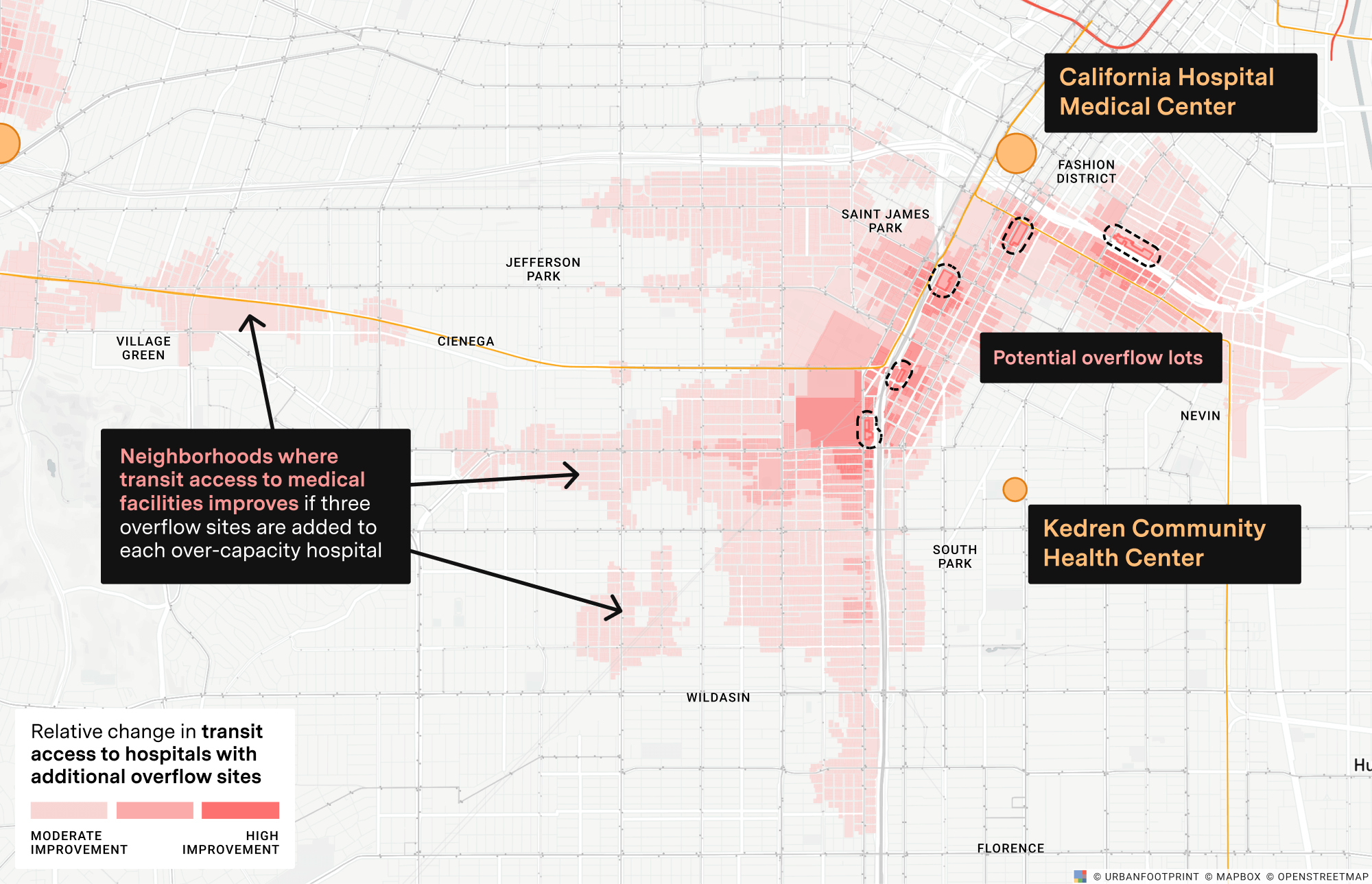
Of course, this dynamic is changing rapidly as public transit systems reduce service amidst necessary social distancing directives and the resulting decreases in ridership and revenue. (We’ll be evaluating these potential impacts in more detail in a follow-up report.)
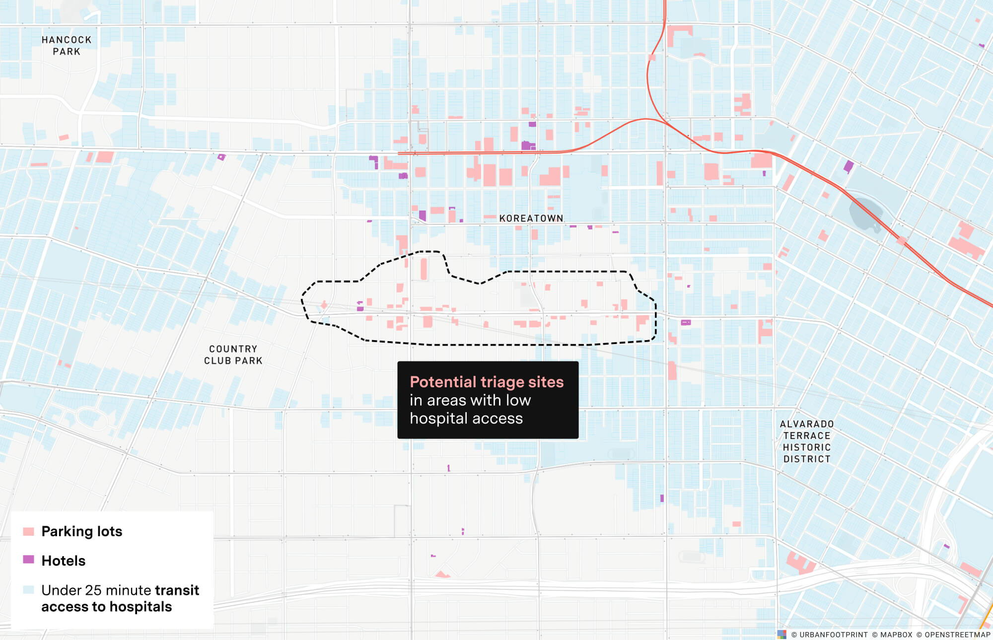
Where might agencies place additional alternate care and testing sites to better support neighborhoods with poor access to medical facilities?
In our new ‘shelter-in-place’ reality, where we are trying to limit movement to reduce disease transmission, it’s also important to step back and look at neighborhoods with poor access to medical facilities, and thus where additional testing and mobile field medical sites could be needed, even when those are sites are not within close proximity of existing hospital facilities.
To answer this question, we need to identify which neighborhoods have poor access to existing hospitals and understand which sites within these areas could serve as new alternate care or testing sites. Below is an example of this analysis near the Koreatown neighborhood in Los Angeles.
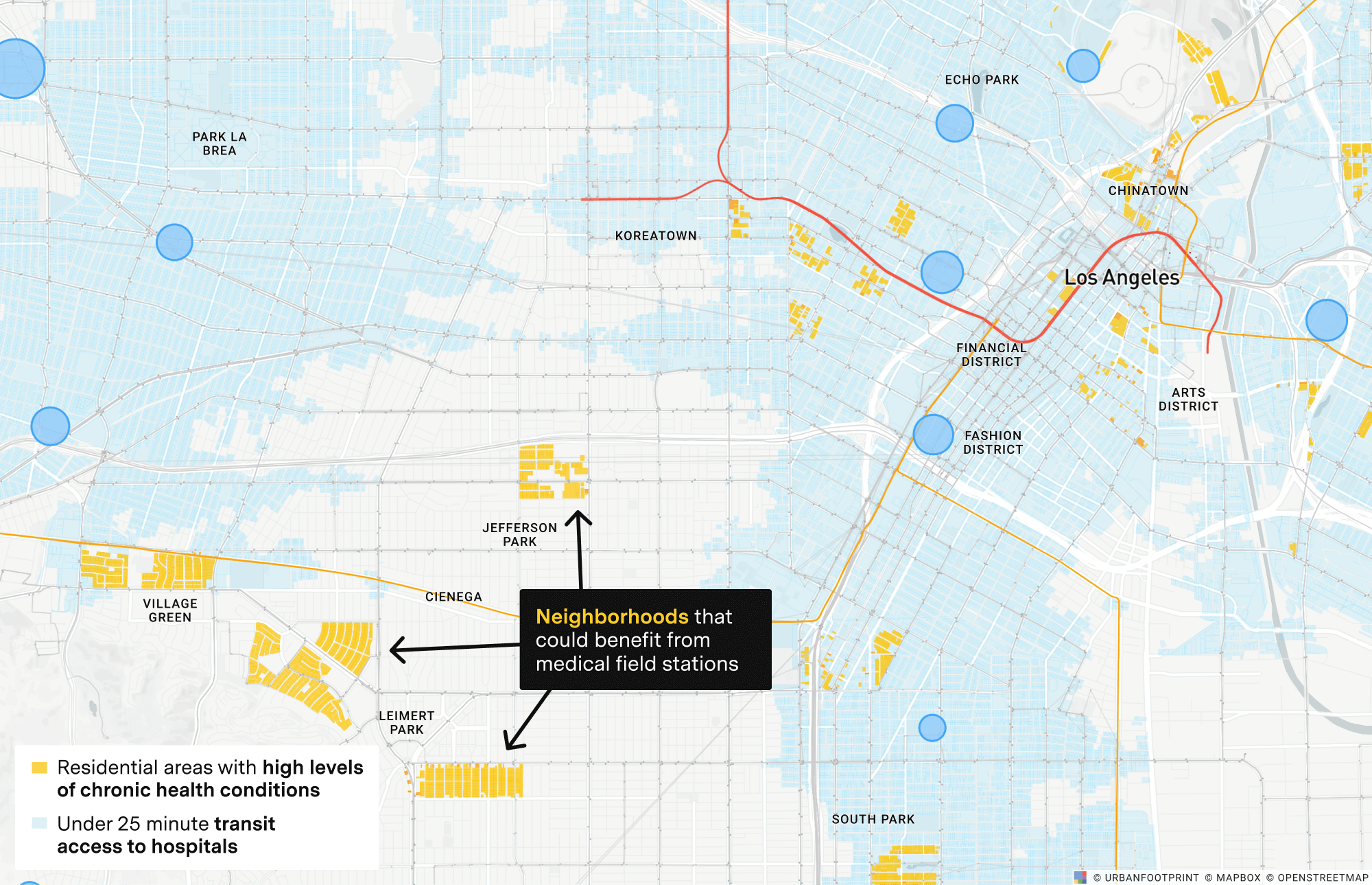
Where should we plan for additional alternate care or mobile medical field stations to better serve vulnerable populations?
Furthermore, it’s especially important to highlight gaps in access to medical services for areas with a higher concentration of at-risk populations – those with underlying health conditions, extreme poverty, and other key factors.
In the map below, we can see Los Angeles neighborhoods Jefferson Park and Leimert Park have higher than average levels of chronic health conditions and lower transit access to hospitals, suggesting these areas could benefit from additional medical field stations.
We are continuing to monitor and update hospital capacity data to help front-line organizations evaluate potential alternate care sites and testing locations to expedite emergency response. We will post more insights here as we work to evaluate the ripple effects of increasing unemployment and economic hardship in the wake of COVID-19 and our efforts to assist public agencies in identifying potential sites for enhanced and expanded social and economic support services.
Have a question? Let us know. We’d love to hear from you.
