Leverage comprehensive and reliable data to navigate disclosure requirements, understand climate and community risks, and opportunities across investment portfolios and single asset assessments. UrbanFootprint Resilience Insights deliver a deep and actionable understanding of climate risk, community context, and social vulnerability at any scale, for all US locations.


Curated data insights, delivered through powerful software, intersect previously-siloed data to drive more effective risk assessment and resource prioritization, and meet evolving regulatory and compliance requirements.
1000s of data sources, metrics, and risk models organized, aligned, and assembled for analysis of any US location
Data insights and analysis are delivered via cutting-edge software and data feeds

Optimize your financial portfolio in the face of growing risk and uncertainty with multi-dimensional insights at the intersection of climate and community vulnerability. Build intelligence and never wonder:
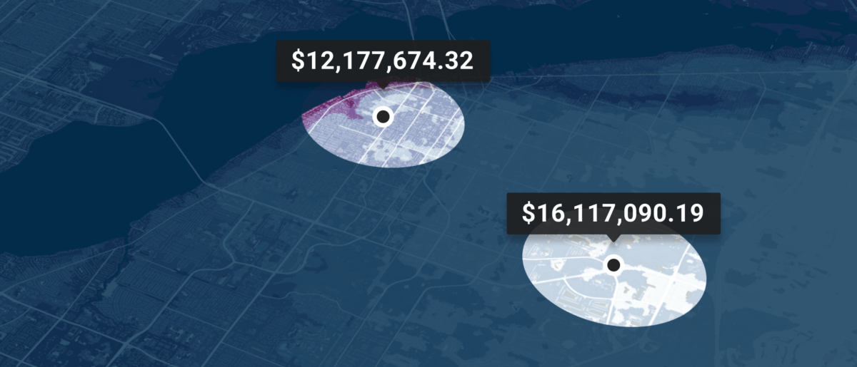
Where will my financial holdings be faced with the greatest climate risk?
Where is community vulnerability highest in the context of my portfolio?
Where should I invest to balance my portfolio against these risks?


Building a strong portfolio requires constantly adding new bonds and holdings. Evaluate new bonds efficiently to maximize ROI by leveraging thousands of parcel level data points on land use, buildings, and people. Build intelligence and never wonder:
Where will a bond I invest in have minimized climate risk exposure?
Where can an investment have greatest community impact?
Where are the most stable bonds located?
Manage capital investments according to ESG requirements, future regulations, and investor preferences. Understand where disadvantaged communities can benefit from greater financial investment. Build intelligence and never wonder:
Where will my investments have the greatest economic impact?
Where are communities vulnerable to natural disasters?
Where are health risks most prevalent?

Learn how UrbanFootprint can help you build resilience and make better decisions.