


As 2023 comes to a close, the UrbanFootprint Climate and Hazards team is thrilled to look back on a year of significant progress and innovation. Our unwavering commitment to enhancing technical capabilities, including developing and deploying five new proprietary models, has allowed us to better quantify current and future risk to any location, parcel or asset across the US.
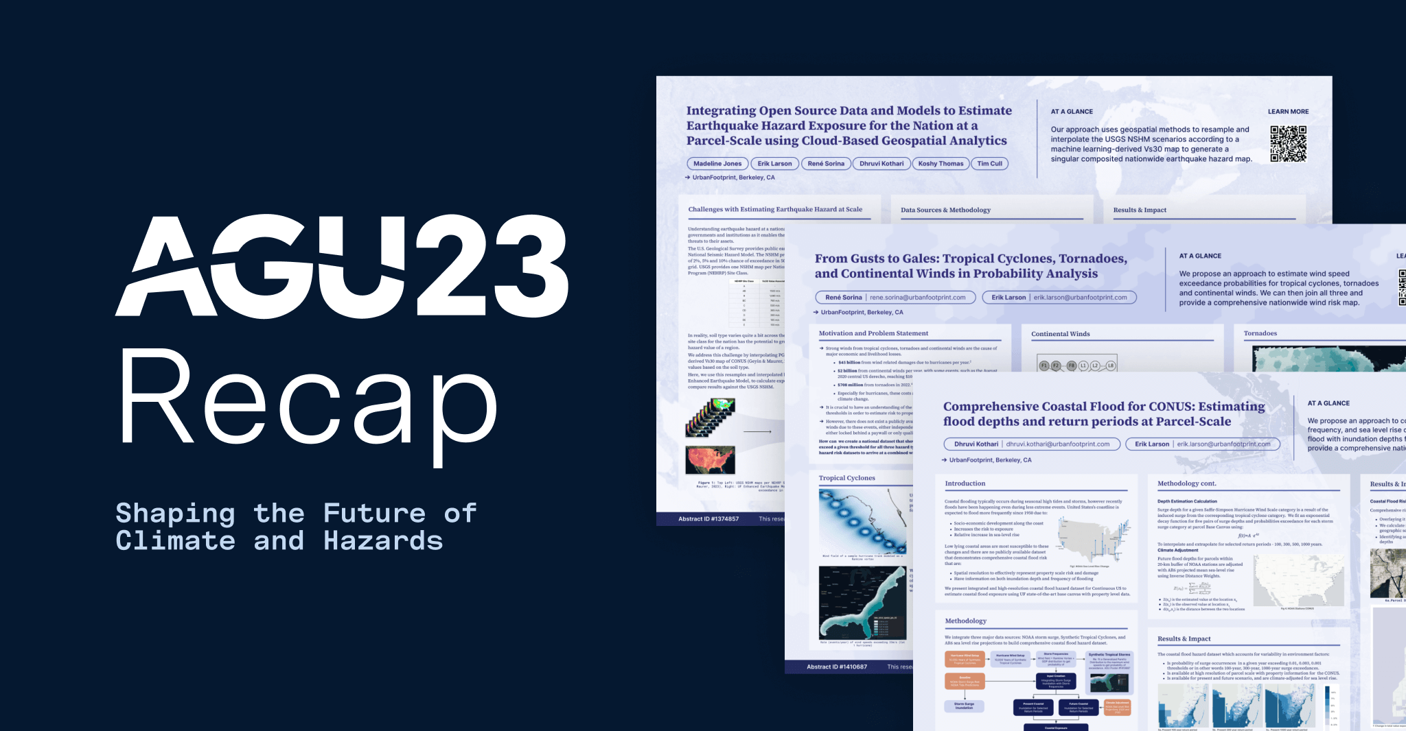
One of the highlights of this remarkable year was the opportunity to showcase some of these technical advancements to our peers at the prestigious American Geophysical Union (AGU) 2023 Fall Meeting in San Francisco, California. AGU attracts a diverse audience of over 25,000 scientists, including academics, researchers from public institutions, industry experts, students, and policymakers. It serves as a platform for the global scientific community to exchange insights and discoveries related to climate change.
AGU 2023 Highlights: Showcasing Our Cutting-Edge Climate Science
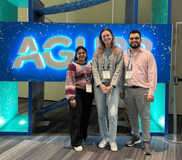
Dhruvi Kothari, Maddie Jones, and René Sorina from the UrbanFootprint Climate and Hazard team presented their work at AGU 2023.
Coastal Flood Risk
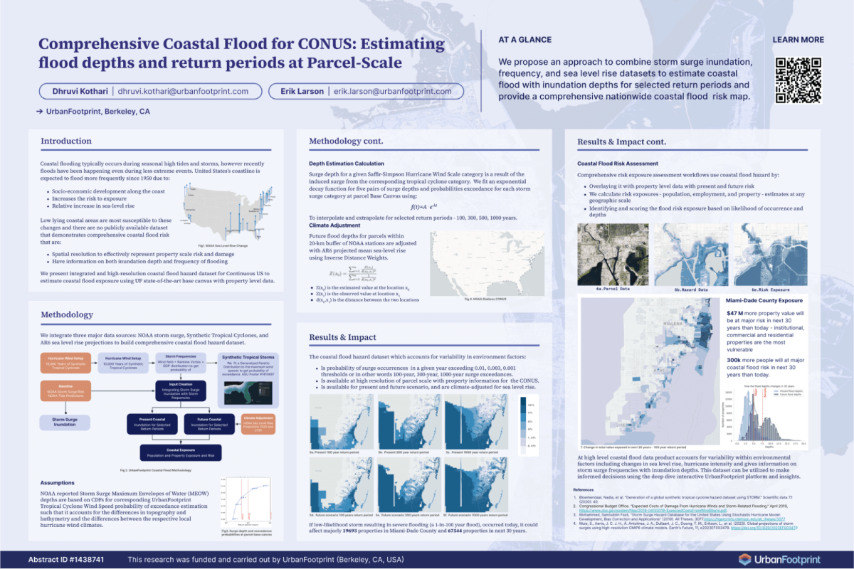
Dhruvi Kothari Data Scientist, presented her comprehensive, parcel-scale nationwide coastal flood risk map. This groundbreaking research brings together public sea level rise and storm surge data sets with UrbanFootprint Tropical Cyclone probabilities.
This delivers precise estimation of the frequency and severity of coastal flooding for surge events with annual chances of 1%, 0.3%, and 0.1%. Using the UrbanFootprint Tropical Cyclone probabilities enables storm surge risk assessment due to cyclonic events both now and into the future. Leveraging this data, in conjunction with the UrbanFootprint Base Canvas parcel-level data, allows us to better quantify the risk to population, jobs and property. For example, we found that 300,000 more people and 47 million more in property value will be at risk of inundation in the next 30 years than are today.
Earthquake Hazard Exposure
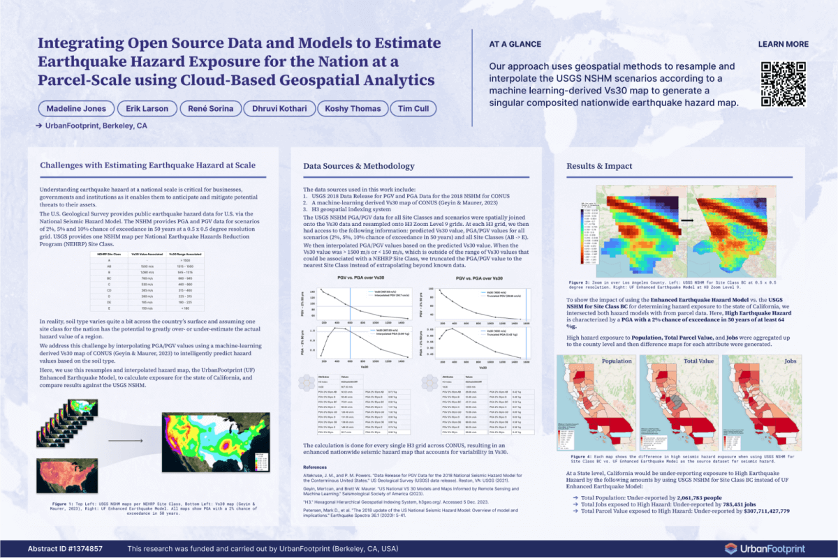
Maddie Jones, Senior Geospatial Data Engineer, presented her Earthquake Risk model for the contiguous United States. This research produces a single seismic hazard map that accounts for variability in soil type. Combining the USGS National Seismic Hazard Model (NSHM) with a machine learning-derived Vs30 map of the contiguous United States (Geyin & Maurer, 2022), we resample and interpolate hazard values provided by USGS based on the Vs30 prediction.
Having the site class-appropriate PGA and PGV values in a single map enables analysis at scale and removes the need for cross-referencing multiple maps. Furthermore, this model offers high-resolution downscaled earthquake hazard assessments that reveal nuanced risk features beyond USGS data – leading to meaningful differences in hazard risk. For example, by applying our earthquake risk model to California, we found that risk is being under-reported by approximately 2,000,000 people.
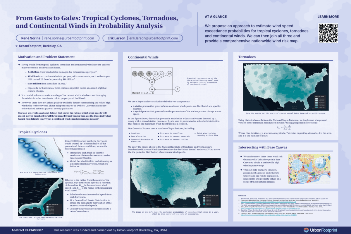
Comprehensive Wind Risk
René Sorina, Senior Data Scientist, unveiled three new proprietary wind models. These models cover Tropical Cyclones, Non-Cyclonic Winds (or continental, straight-line winds), and Tornadoes. The Tropical Cyclone work uses 10,000 years of synthetic hurricane tracks, representing present conditions and 40,000 years of future projected synthetic tracks from Bloemendaal et al. (2020,2022), and models the hurricane wind field along each track. This allows us to calculate the distribution of damaging hurricane wind both now and into the future.
Continental winds are modeled using a machine learning approach based on the NIST damaging winds database. The modeled damaging winds are consistent with ASME engineering maps, however, our model contains much more detail, especially around topography.
Finally, we modeled tornado winds using the NOAA severe storm database. Completing these three wind risk models enables holistic views of wind risk and wind impact in the future. When intersected with the UrbanFootprint parcel-level Base Canvas, these models provide a detailed understanding of wind risk to populations, households, and property values.
Looking Ahead: Shaping the Future of Climate and Hazards Data
We are proud to share some of our proprietary Climate and Hazards work at AGU and engage in many thoughtful discussions with scientists from the public and private sectors, as well as academia. These discussions underscore the pressing need for high-quality, comprehensive risk data.
At UrbanFootprint, our unique “parcel-up” approach remains at the forefront of our mission. We focus on creating an understanding of risk and climate impact at the most granular level possible and scale it across the United States. As we close the chapter on AGU 2023, we look forward to an exciting 2024, where we aim to deliver even more comprehensive insights and risk models.
Want to stay up-to-date with our latest advancements? Visit our Climate Models and Methodologies page to explore the future of climate risk assessment and stay ahead of the curve in climate analysis and decision making.
