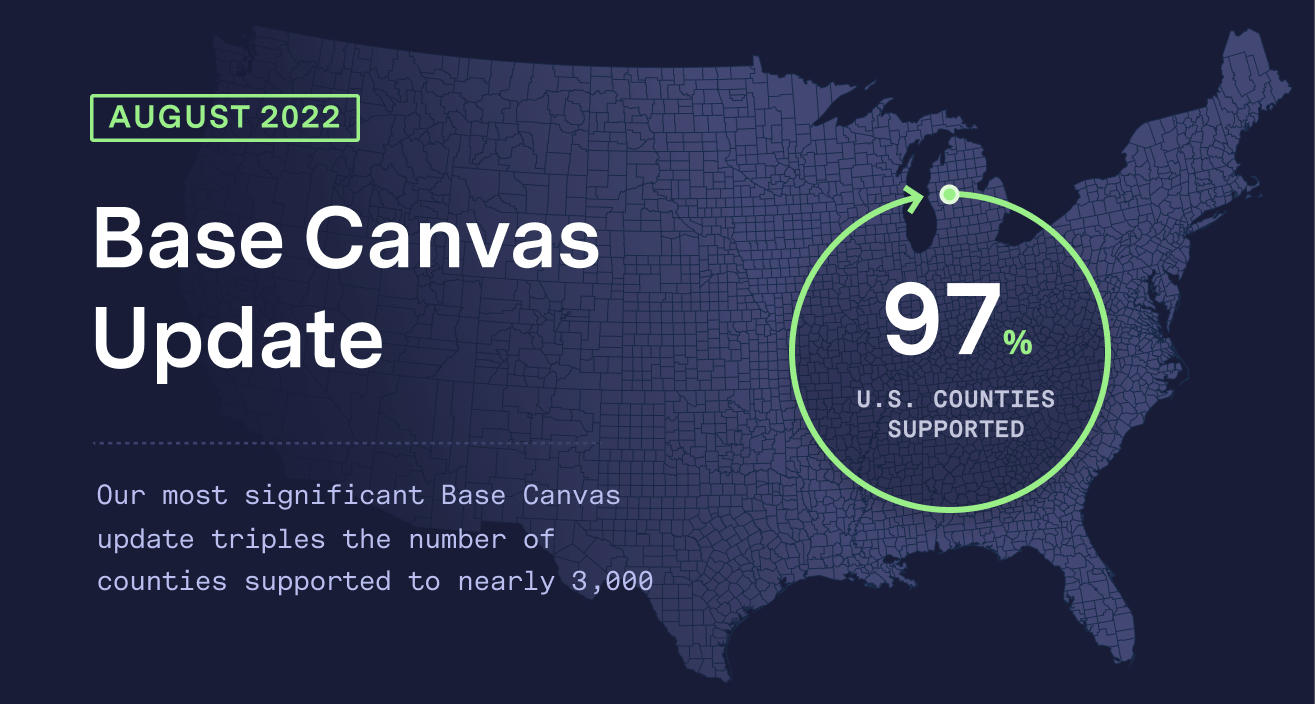
Our Most Significant Base Canvas Update Now Covers 160 Million Parcels and Triples the Number of Counties Supported to Nearly 3,000
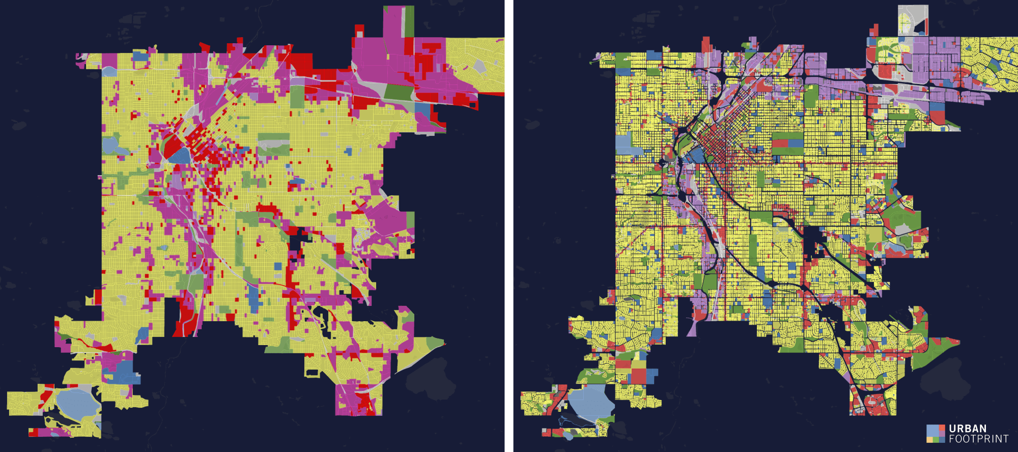
The UrbanFootprint Base Canvas is the most comprehensive land use data source available anywhere. Leveraging dozens of data sources and powerful data science, our Base Canvas unifies nearly all the land, buildings, and people in the US into a singular national data resource.
Our Base Canvas is dynamic and ever evolving, and this latest iteration is our most significant update yet. UrbanFootprint Analyst, Base Canvas Essentials, and our other data products built atop the unmatched Base Canvas foundation, now offer the most comprehensive, nationwide land-use data available anywhere—and we remain committed to making them even better long into the future.
The August 2022 update brings our Base Canvas closer than ever to complete parcel coverage across the entire United States. With the addition of detailed land use data for nearly 2,000 counties, the Base Canvas now includes more than 160 million parcels across nearly 3,000 U.S. counties, covering 97% of the nation. Now more than ever, users will be able to answer critical “where” questions for any place across the country and remain confident the answers are grounded in consistent data. Zoom in or out to specific areas of focus and never doubt the data will be available to support your mapping and modeling needs.
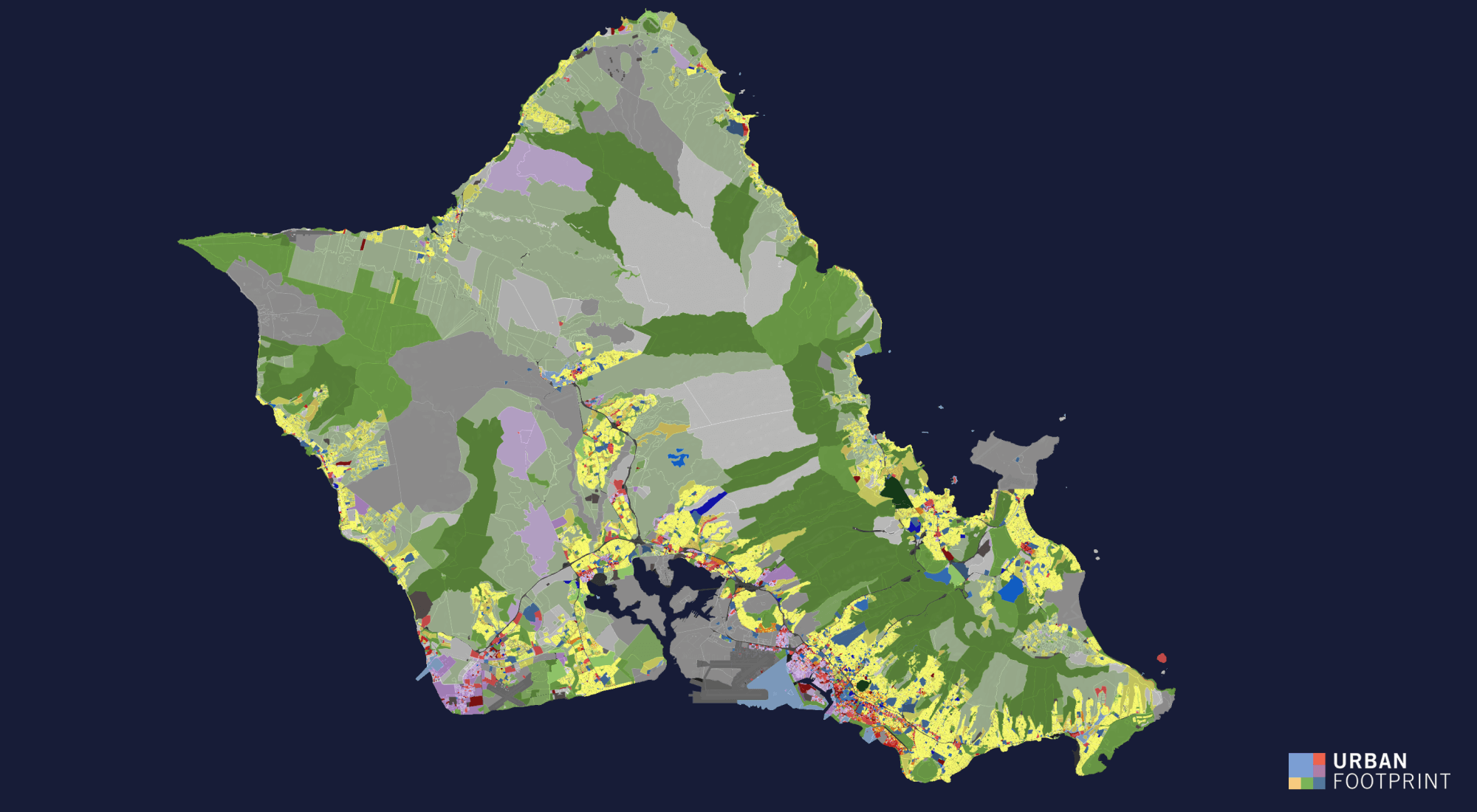
This update also offers improved typing of commercial land uses across the nation. We’re leveraging detailed and up-to-date point-of-interest (POI) data to more carefully reflect the changing built environment and assure that our data is accurate and true to the current state of land use.
We’re thrilled to be rolling out this expanded coverage and latest release to our customers. It’s part of our commitment to provide users with the highest quality, most comprehensive and currently available data to inform improved decision making and modeling capabilities. No other solution on the market offers this breadth and depth of land-use detail—all from a single source.
Curious to see if your own community is covered by our Base Canvas? Schedule time with one of our experts today!