


As the leading provider of Resilient Decision Intelligence, we strive to enable organizations tackling society’s greatest and most urgent challenges to make optimal decisions. Our goal at UrbanFootprint is to deliver the best tools available to surface the critical answers that you and your team need.
This means providing the best data related to the built environment, climate and hazards, and people and vulnerabilities. It also means giving you the power and flexibility to create projects that align with the type of analysis you want to run, at scale.
To that end, we recently launched our new General Analysis project type available within Analyst today. This feature enables customers to create larger projects that cover wide geographic areas.
The Challenge: Why General Analysis Projects Are Needed
We often work with customers who have assets that are spread across many states, and the most consistent feature request we’ve received in the last few years has been to create larger projects.
Until now, it has been challenging to work with highly granular data across large territories, because it was more than a browser-based geospatial environment could handle. We created General Analysis projects to address this challenge.
The Solution: Why General Analysis Projects are Valuable
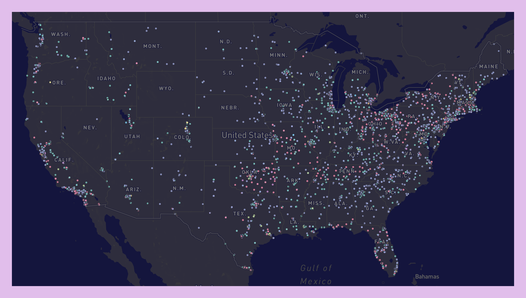
With General Analysis projects, you can now create larger projects spanning entire metropolitan areas, states, or service territories, or even the whole country, where scenario planning tools are not needed. These projects still include core data and geospatial tools, allowing you to add, filter, and join reference layers.
The benefit of General Analysis projects is the ability to navigate reference layers with ease to quickly make maps exploring existing conditions. This project type saves time, reduces repetition, and forms the stepping stone to allow massive scale projects to become a reality.
Note: While not currently available in General Analysis projects, core functionality around scenario building, the base canvas, and our analysis modules are still available via Land Use Analysis projects.
How it Works
Creating a General Analysis Project is straightforward. Just follow the steps below:
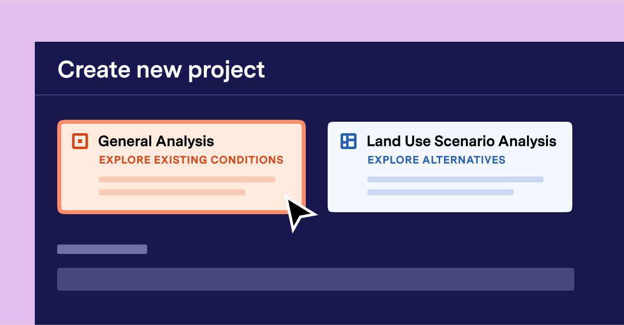
- Click Create Project in the upper right corner of the screen, or click your project name in the upper left corner.
- Make sure “General Analysis Project” is selected from the project type options.
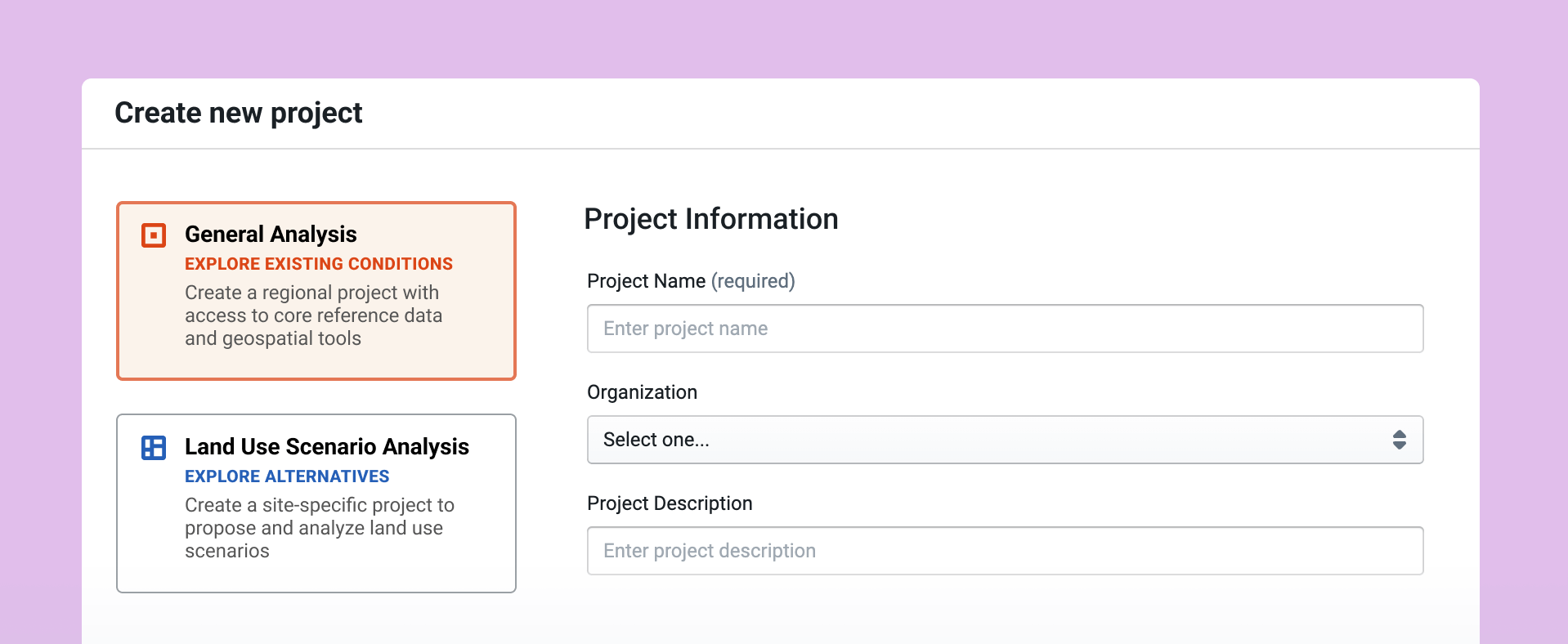
You will then need to enter project information. The fields include:
- Project Name–Enter a name for your project. (After the project is created, it is possible to change the name via Organization Settings if you have an Admin or Owner role.)
- Organization—Select your organization, or the organization that the project should be associated with if you have access to more than one organization. Other users in the organization you select will be able to view or edit the new project based on their permissions.
- Project Description (optional)—Enter a description for your project. This will be displayed in your organization’s Projects page.
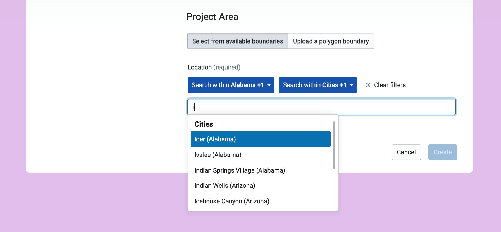
Next in the workflow, define your project area. You can select from available boundaries or upload a project area boundary. Project area boundaries can consist of multiple polygons.
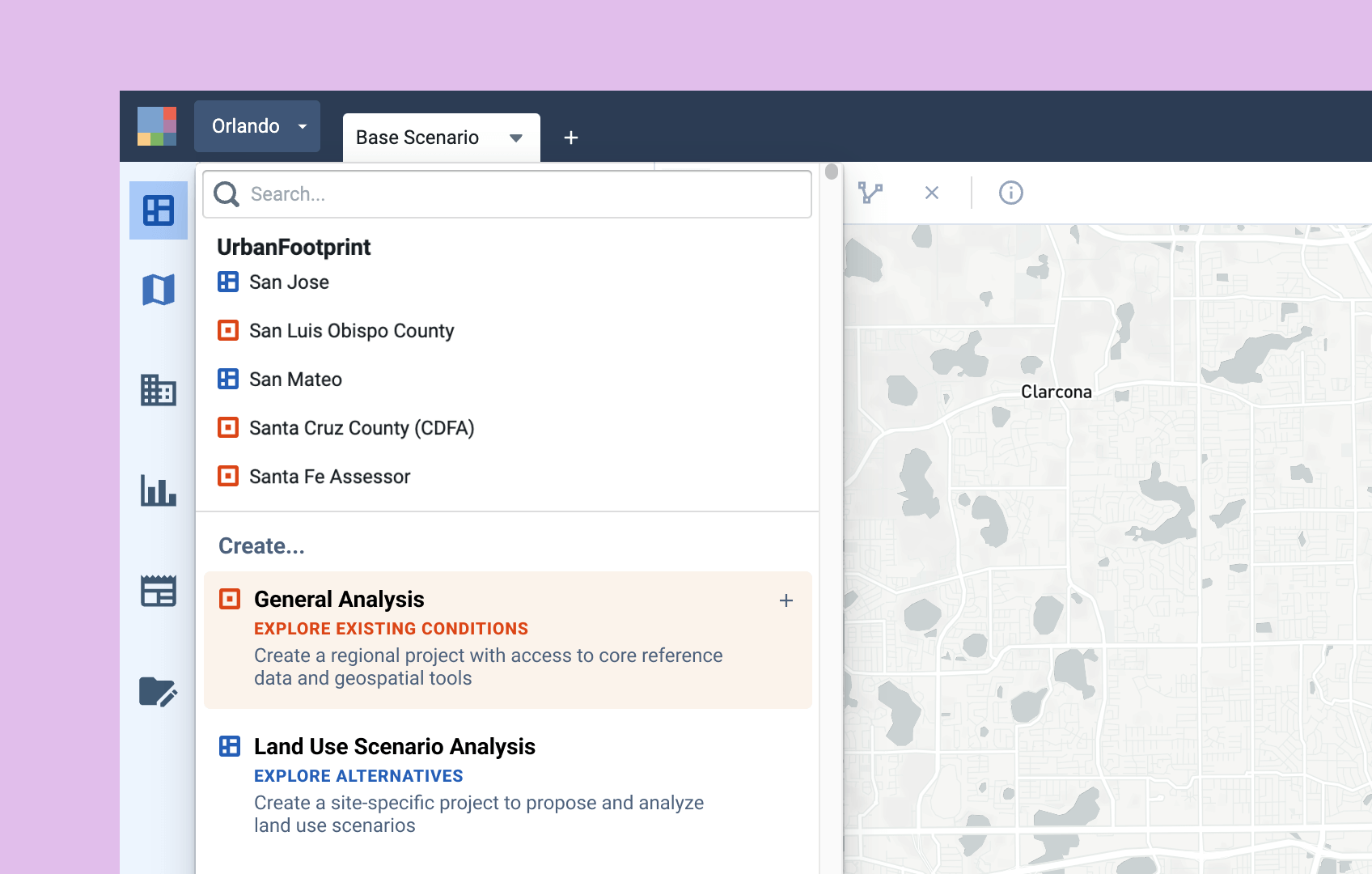
- To select from available boundaries (the default option): Begin typing the name of your location in the Location field. UrbanFootprint will list available places (including cities, towns, and other census-designated places), counties, and core-based statistical areas (CBSAs) according to what you type.
- To upload a custom project boundary: Select Upload a polygon boundary. Then, either drag and drop your polygon boundary file into the target area that appears, or click within the target area to open your operating system’s file browser and choose your file. UrbanFootprint supports GeoJSON, GeoPackage, or zipped shapefile format. You can easily create a polygon boundary in GeoJSON, GeoPackage, or zipped shapefile format at GeoJSON.io.
Larger Projects are Now a Reality
The newly introduced General Analysis Project feature is a significant enhancement that simplifies the process of working across large areas, saving time and effort while reducing redundancy. UrbanFootprint users can now more easily obtain answers to complex, large-scale, and critical questions, empowering them to make informed decisions and build resilience more efficiently.
