


If you’re interested in creating a project like this, let us know!
Over the last few years, attention to the city curb in planning policy has grown by leaps and bounds. In 2017, Wired proclaimed, “To see the future of cities, watch the curb.” That same year, NACTO (National Association of City Transportation Officials) released a whitepaper on curb management in the era of new mobility. The discussion has only heated up since, with CityLab recently pointing to Donald Shoup as one key figure in bringing parking and curbside access to the forefront of urban policy and planning debates.
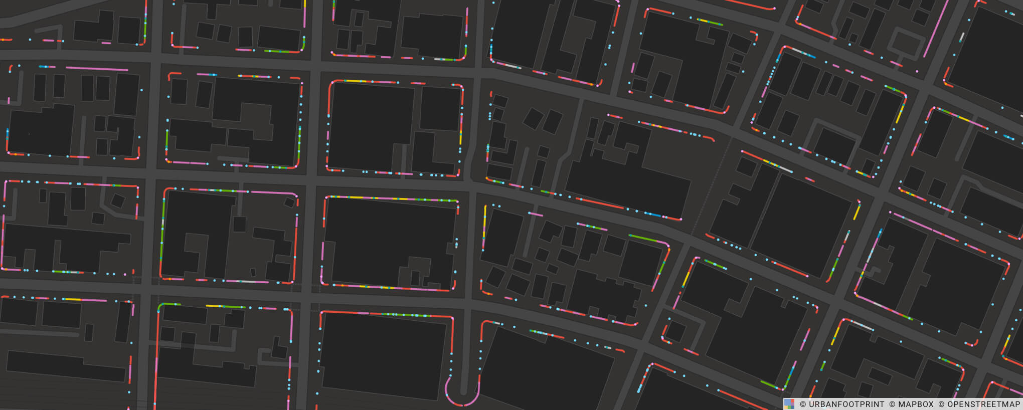
Over the last two years, several companies have risen to the challenge, taking steps to help cities analyze new modes of mobility, such as scooters and e-bikes, and to assist in parsing cities’ existing curbside policies. SharedStreets, a non-profit dedicated to helping cities organize their street-linked data, and Coord, a Sidewalk Labs spinout that helps cities catalog their curb data, both employ a data management format known as “linear referencing.” This data format is valuable for holding parking data in a consistent and easily machine-analyzable format, but can prove challenging for cities or transportation and planning consultants to wrangle.
With UrbanFootprint, we make ingesting this type of high-resolution curb data a breeze. Once loaded into UrbanFootprint, users can not only evaluate the curb data itself, but also bring in dozens of other processed datasets to analyze in the context of our national, parcel-level land use canvas.
In the following example, we will demonstrate how to use curb data made available through Coord’s “open curb data” project. This particular dataset was generated by Coord as part of the Startup in Residence program and the City of San Diego. You can learn more about the residence here and the program, more broadly, here.
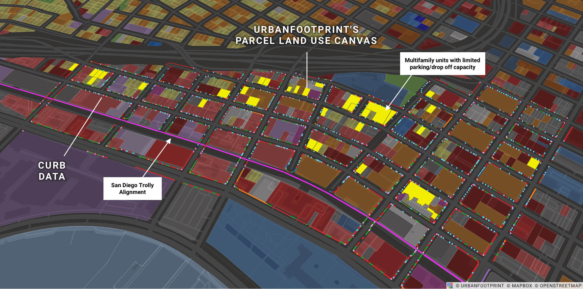
After the curb data is loaded into UrbanFootprint, we can get quick answers to key questions such as whether multifamily units have effective pick-up and drop-off access in just a few clicks. In the above example, an UrbanFootprint user filters the view to highlight multifamily parcels that lack pick-up or drop-off access adjacent to their property.
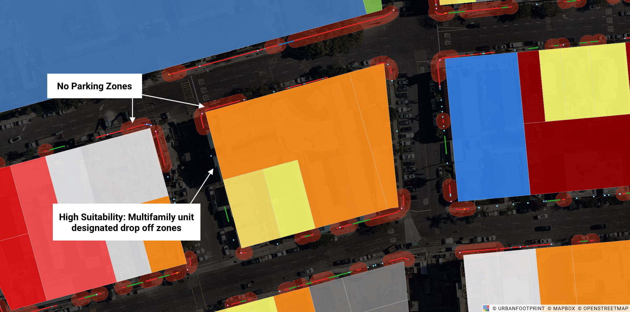
With UrbanFootprint, rapid access to exact figures on the number of households and persons impacted by curb regulations, for example, makes designing drop-off policies and curb capacity estimation a data-driven process. Furthermore, the ability to understand existing conditions and future policy impacts with a deep bench of high-resolution reference data empowers local and state regulators, as well as their consultants, to keep pace in a rapidly changing mobility ecosystem.
Ready to take your curb data to the next level?
Book a demo with our team and learn how to set up your own curb policy analysis in minutes. We’ll share how to quickly add curb data to UrbanFootprint to map existing conditions, glean additional insights from thousands of preloaded datasets, build future scenarios, and analyze plan impacts on transit accessibility, emissions, energy use, and more.
Have a question or comment? Let us know! We’d love to hear from you. Tweet us your thoughts or send us a note.
