


If you’re interested in creating a project like this, let us know!

Along with transit, circulation data is essential for any planning project and a key driver of urban development and land use patterns. TIGER roads data from the U.S. Census has been the go-to nationwide, circulation layer for planners. While TIGER includes a comprehensive delineation of all roads in the U.S., it offers limited data about the associated functional class and use of roadways (e.g. arterial, local, etc).
To fill in these essential gaps, we leveraged OpenStreetMap data (which is built on TIGER data) to map existing road networks according to their functional classification as well as additional bicycle and pedestrian infrastructure. With UrbanFootprint’s new, curated circulation layers, it’s now even easier to visualize detailed road network data for any U.S. location and filter this data for potential site selection based on specific criteria.
Pull the slider left and right to see the difference between TIGER data and UrbanFootprint’s curated OSM road layers in Atlanta, GA. Note the greater detail for functional classification provided by OSM.
Map detailed circulation networks with UrbanFootprint’s preloaded data layers
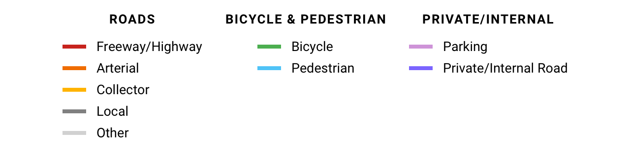
UrbanFootprint’s three new circulation layers make it easy to map existing circulation networks. These three layers are Roads, Bicycle and Pedestrian, and Private/Internal Roads.
- The Roads layer shows all roadways classified by function, including freeway/highway, arterial, collector, and local. UrbanFootprint users can also map functional class with even greater detail to include elements like freeway on/off ramps and alleys.
- The Bicycle and Pedestrian layer delineates bicycle lanes, bicycle paths, and dedicated pedestrian paths. In some locations, like in downtown Atlanta, this layer includes the sidewalk network, while in other locations, it does not.
- The Private/Internal Roads layer includes private roads, internal roads, and parking lots.
Let’s take a look at a few examples in Atlanta, Georgia. Below, you can click on the blue tabs to toggle between the Roads, Bicycle and Pedestrian, and Private/Internal Roads layers.
All three circulation layers are shown by default. Click on the blue tabs to toggle the layers off and on.
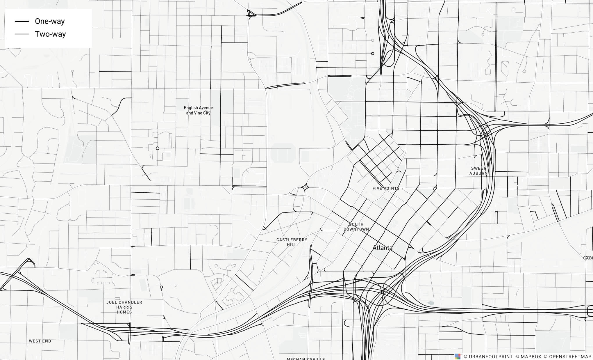
With the Roads layer, you can also map the location of bridges, tunnels, and one-way streets. In the example below, UrbanFootprint highlights one-way streets in downtown Atlanta.
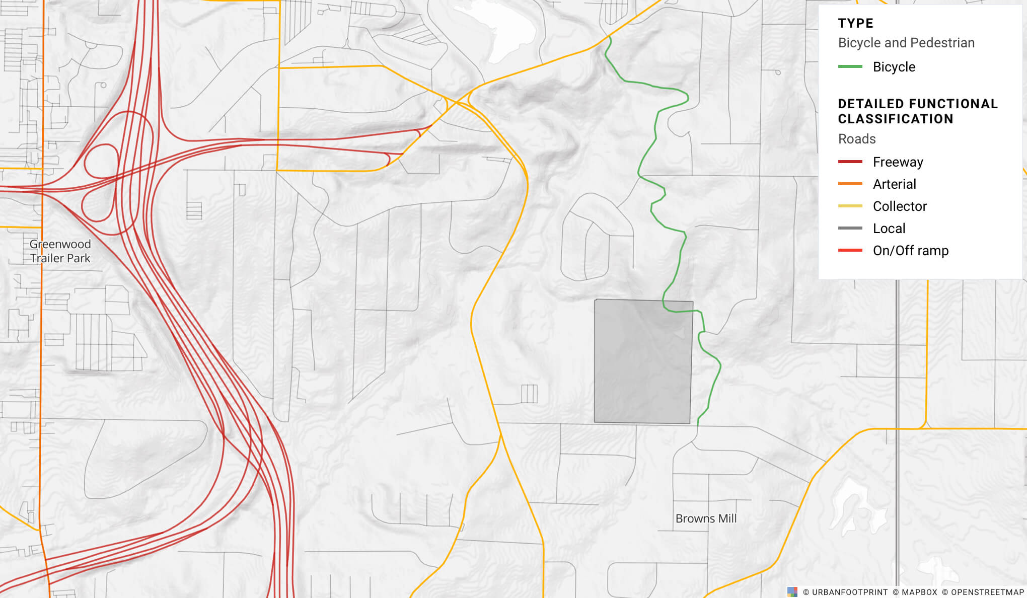
Map existing networks for master planning
When creating master plans, it’s important to know the location of existing circulation infrastructure and how to connect to it. In this map, you can easily locate freeway on/off ramps and bicycle/pedestrian trails.
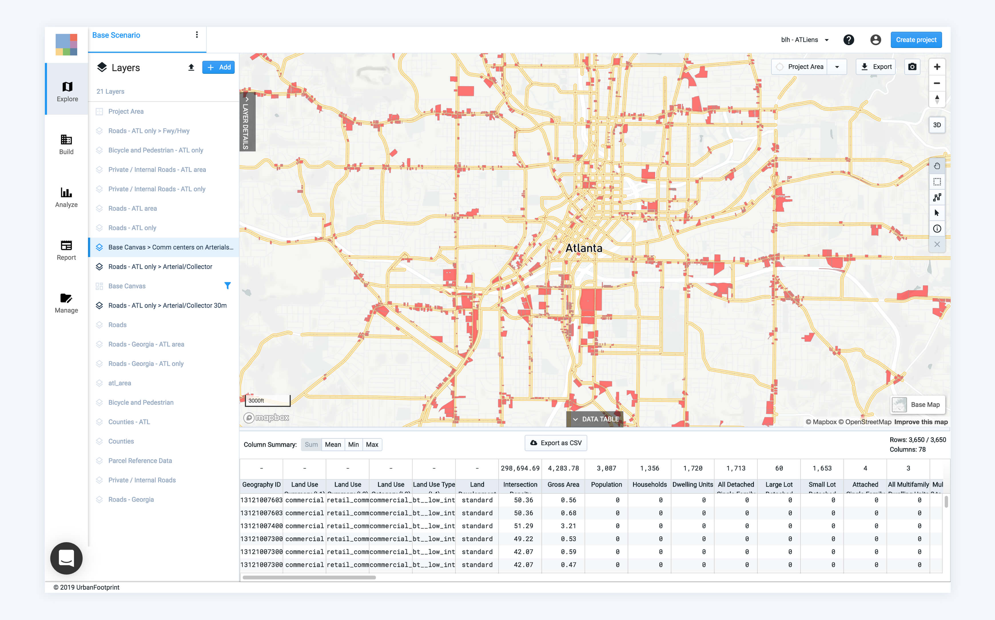
Identify parcels based on circulation network attributes
Using the roads data and UrbanFootprint’s out-of-the-box land use data, you can also ask questions like “Where are all the commercial centers on arterial and collector streets?” In the exhibit below, UrbanFootprint is able to quickly filter this data to highlight commercial parcels that intersect with arterial and collector roads.
Discover how to extract road network insights for your city or project
Ready to learn more about mapping road networks in UrbanFootprint? We invite you to book a demo with our team. We’ll share how to map existing circulation conditions in minutes and how to explore thousands of additional, preloaded datasets.
Have a question? We’d love to hear from you. Tweet us @UFplatform or drop us a line.
