The UrbanFootprint platform curates components of our Data Foundations to build Resilience Insights and deliver them through one or more Data Experience
We worked closely with The Nature Conservancy to build and integrate The Nature Conservancy’s Conservation Module into UrbanFootprint. The Conservation Module was built to help planners and communities measure the impacts of proposed plans and policies across four key areas: water resources, habitat impacts, agriculture, and carbon sequestration and storage.
The Nature Conservancy Works with UrbanFootprint to Build Innovative Tech for Green Communities
Challenge: Advocating for Nature in a Hot Political Climate.
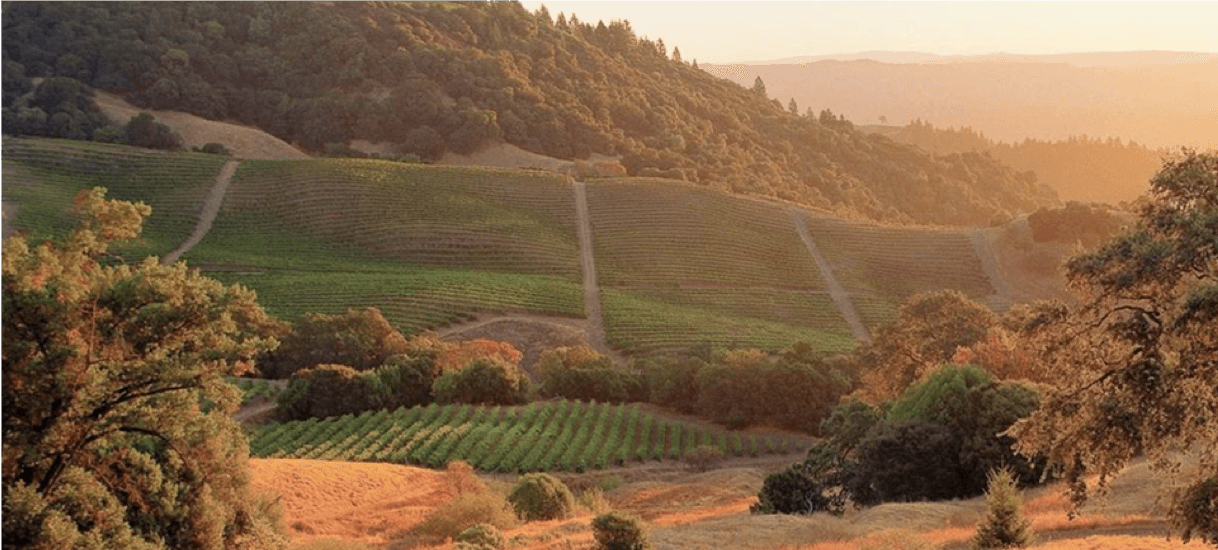
The Nature Conservancy has protected over 119 million acres of land since their founding in 1951. Yet today’s political realities make addressing our most urgent conservation challenges, including climate change adaptation, tougher than ever. As we prepare for a doubling of global city population by 2050, it’s imperative for sustainable land use and nature conservation to be a focal point in planning and policy.
Solution: Clear Communication of Impacts to Natural and Working Lands Builds Better Policy
We worked closely with The Nature Conservancy to build and integrate The Nature Conservancy’s Conservation Module into UrbanFootprint. The Conservation Module was built to help planners and communities measure the impacts of proposed plans and policies across four key areas: water resources, habitat impacts, agriculture, and carbon sequestration and storage. By standardizing land cover types, reference data, and calculated model inputs, the Conservation Module allows planners, policymakers, and advocates to quickly analyze existing conditions and understand the impacts and benefits of future growth scenarios on nature and ecosystem services.
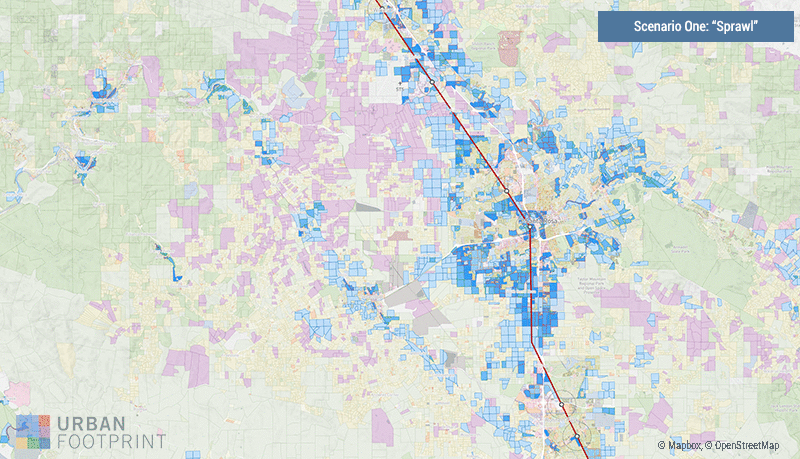
In partnership with the The Nature Conservancy, the Sonoma County Agricultural Preservation and Open Space District, and the Regional Climate Protection Agency (RCPA), the Conservation Module was used to support an UrbanFootprint-powered planning process in Sonoma County. As Sonoma sought a path to support housing growth with minimal impact on the environment, a range of scenarios were created to evaluate the costs and benefits of each option. Scenarios ranged from lower-density suburban growth patterns to higher-density housing options with an emphasis on infill development around the Sonoma-Marin Area Rail Transit (SMART) line and stations.
UrbanFootprint displays the base canvas of existing conditions for Sonoma County along with the SMART transit line and stops. Blue indicates the placement of each scenario’s new growth.
The Conservation Module quickly quantified the impacts of the three scenarios. When compared to a lower-density, suburban growth pattern, a transit-oriented, infill scenario:
Protected 16,000 acres of natural land.
Yielded climate change mitigation benefits from protected carbon stored in vegetation and soils equivalent to getting over 100,000 cars off the road per year.
Protected 92 acre-feet of groundwater recharge, equal to the water use for 455 households per year.
Maintained 3,000 acres of natural vegetation within floodplains attenuating flood risk for downstream residents.
Saved 5,000 acres in drinking water source watersheds.
Kept 3,000 acres barrier-free for wildlife movement.
“In the early days, when it came to land use planning and development, we really didn’t know what nature was around us and what it provided to communities – until it was gone. We didn’t have the data, and later when we did, it was cumbersome to access and hard to get a full picture,” said Elizabeth O’Donoghue, Director of Infrastructure and Land Use at The Nature Conservancy. “But, science and technology has changed the game. When we developed the Conservation Module, it was our hope to see it implemented in planning software like UrbanFootprint. The potential for planners across California to have this information on lands, waters and wildlife at their fingertips is key to the future of healthy community planning now and into the future.”
While the Conservation Module is only available in California for now, we look to scale this feature across the nation. Clear communication of science-driven conservation and planning impacts to planners and stakeholders plays a critical role in building sustainable communities and protecting our natural resources and working lands.