The UrbanFootprint platform curates components of our Data Foundations to build Resilience Insights and deliver them through one or more Data Experience
The University of Michigan’s Taubman College of Architecture and Urban Planning houses top-tier programs in architecture, urban design, and urban planning. In keeping with the school’s high academic standards, Assistant Professor of Urban Planning Robert Goodspeed turned to UrbanFootprint to bring cutting-edge data science and planning technology into the classroom.
The University of Michigan Teaches the Future of Planning with UrbanFootprint
The University of Michigan wanted to bring the latest planning tech to students without losing classroom time to extensive software training.
The University of Michigan’s Taubman College of Architecture and Urban Planning houses top-tier programs in architecture, urban design, and urban planning. In keeping with the school’s high academic standards, Assistant Professor of Urban Planning Robert Goodspeed turned to UrbanFootprint to bring cutting-edge data science and planning technology into the classroom.
As part of a graduate elective course on scenario planning methods (URP 526: Scenario Planning), students learned to develop scenarios for local neighborhoods in Ann Arbor, home to the University of Michigan. After conducting detailed trends analysis and stakeholder research, the students decided to create scenarios focused on three major uncertainties: a shift towards renewable energy, the evolution of regional land use patterns, and public transit investments.
The class turned to UrbanFootprint to create and analyze neighborhood land use scenarios consistent with their qualitative visions.
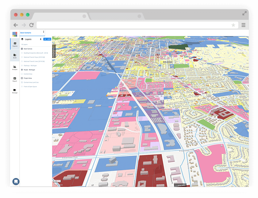
UrbanFootprint land use map of Ann Arbor, Michigan at the parcel scale.
With hundreds of built-in planning datasets and intuitive scenario planning workflows, students were able to focus more on critical thinking and planning methodology rather than complex GIS technology.
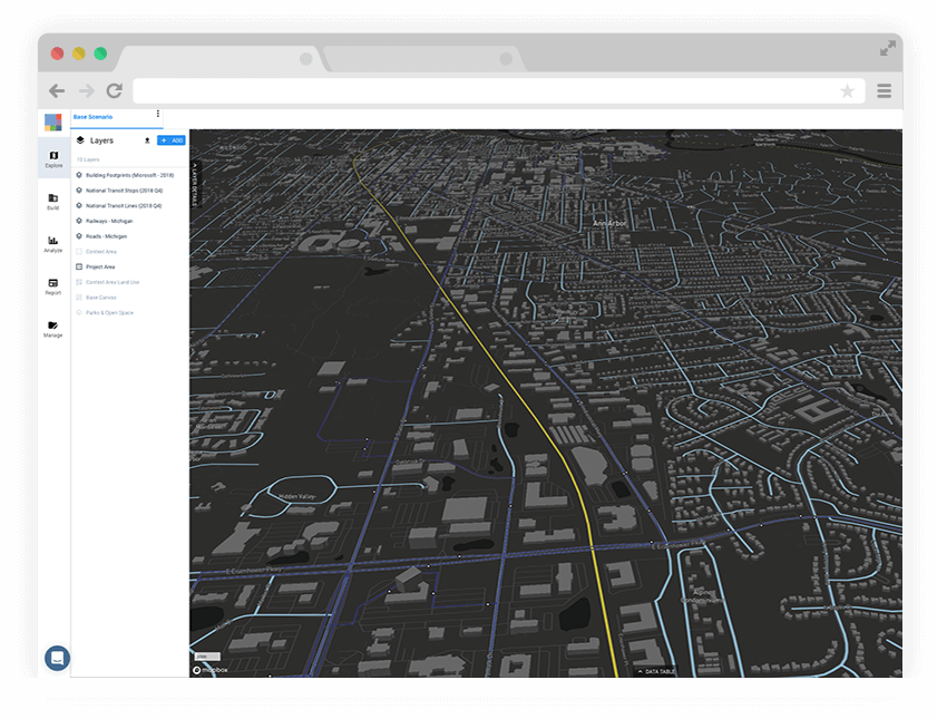
UrbanFootprint circulation map of Ann Arbor, Michigan.
Robert Goodspeed explains, “UrbanFootprint offers a unique analytical approach which I think really benefits planning students. Students were able to move past the more mundane aspects of data management and collection, which are so often a time-consuming pre-requisite for scenario planning, and instead focus on sketching and discussing their ideas.”
UrbanFootprint streamlines planning workflows and data management, allowing students to focus on planning methodology and the consequences of different land-use decisions, rather than managing data and installing software.
Goodspeed went on to share that compared to previous years teaching this course, he was able to spend more classroom time focused on planning methodology and concepts rather than teaching to the specific technology. “UrbanFootprint served my goal of allowing the students to focus on the scenario concepts without getting tripped up on GIS hiccups,” explained Goodspeed. “The fact that UrbanFootprint is web-based, has an easy-to-use interface, and is preloaded with very sophisticated data layers saved us quite a bit of valuable classroom time.”
In addition to significant time savings on data management, students could discover the power of quantitative scenario analysis through the use of UrbanFootprint’s built-in suite of analysis modules. With just a few clicks of a button, students were able to test and measure the impacts of their land use decisions on key outcomes such as greenhouse gas emissions, vehicle-miles traveled, transit accessibility, household costs, and more.
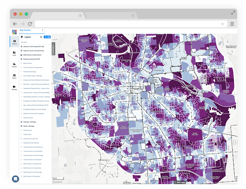
UrbanFootprint displays walk accessibility to the nearest transit stop. Darker shades of purple indicate a further walking distance.
“UrbanFootprint hit the mark in helping students understand the power and potential of scenario-planning. The rich analytics helped students quickly see the impacts of various land use changes and supported engaging class discussion,” shares Goodspeed. “It was a very effective teaching tool in its ability to introduce planning tech to students while maintaining focus on key planning concepts.”
Goodspeed plans to expand his use of UrbanFootprint to include a week-long lab on scenarios as part of a required graduate course covering planning methods.
Ready to learn more? See UrbanFootprint in action.
Curious to learn more about UrbanFootprint Academic? Read our blog to learn more about the program and book a demo with our team.