


At UrbanFootprint, we’ve built our software platform with not only the most comprehensive, nationwide land-use database available, but also the most versatile features in scenario planning. Today we’re excited to announce a significant extension of those planning capabilities: Parcel Gridding. With this powerful new feature, users are now able to split existing parcels to redevelop urban sites or plan entirely new neighborhoods. As part of our development roadmap to streamline master planning workflows, Parcel Gridding is the first feature to be released among several more planned in the future.
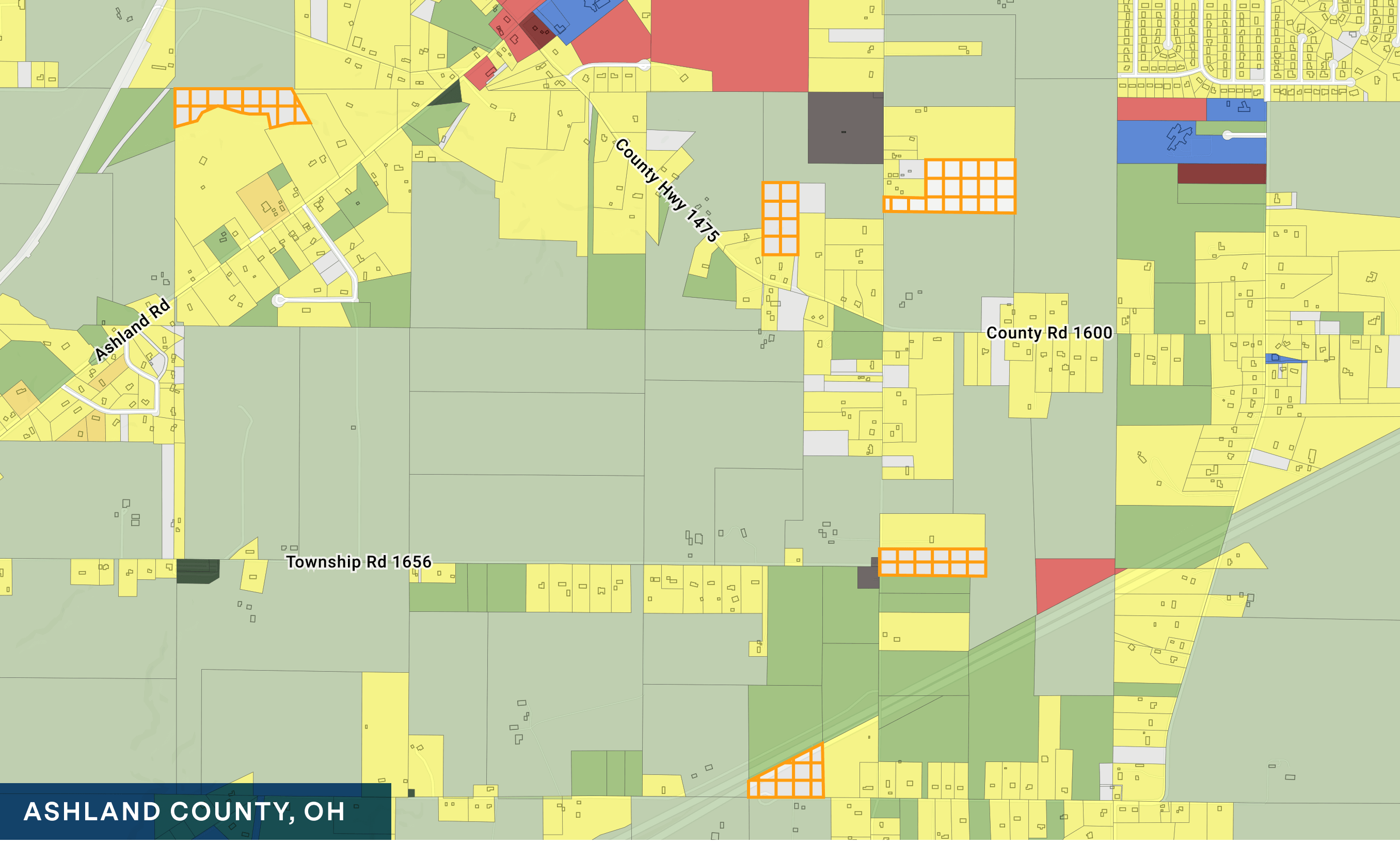
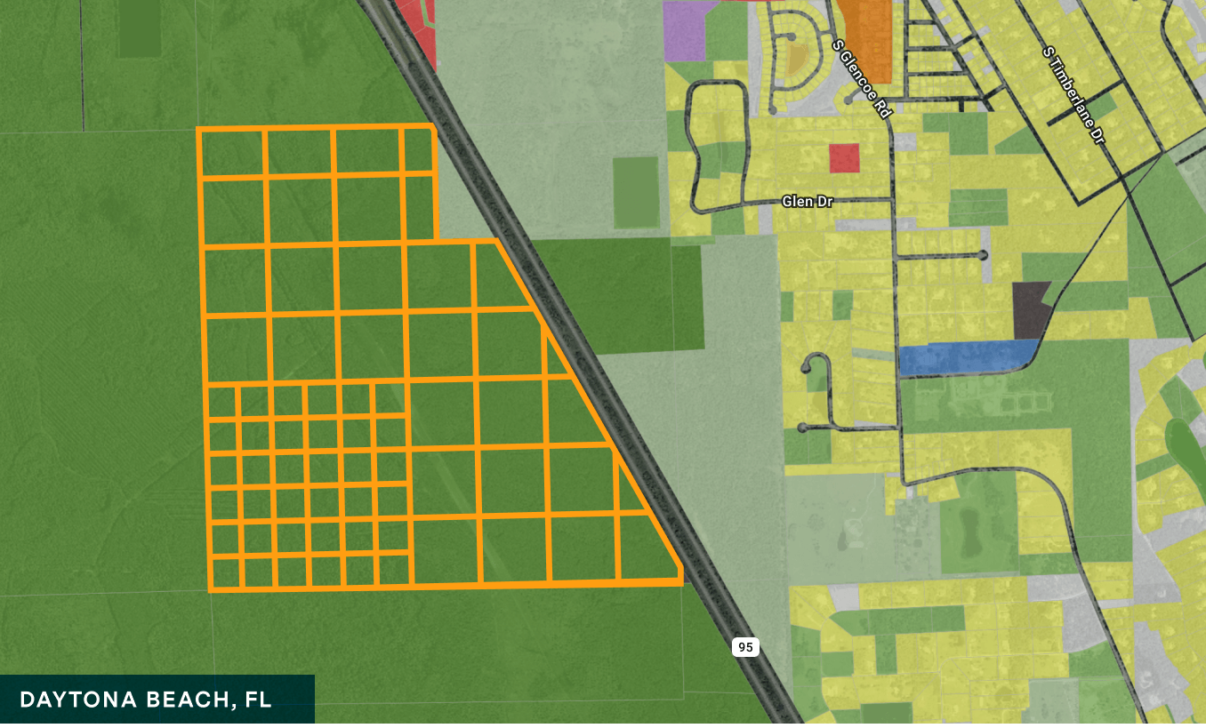
The Parcel Gridding feature is highly versatile and can be used for many different types of master planning projects:
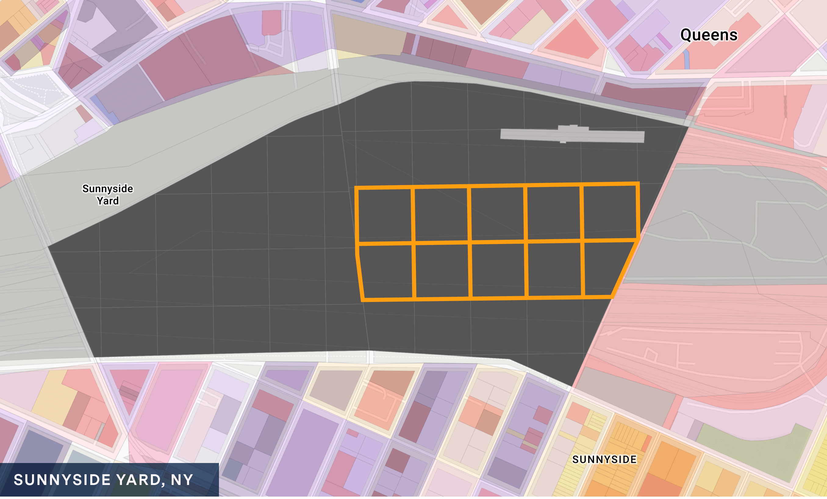
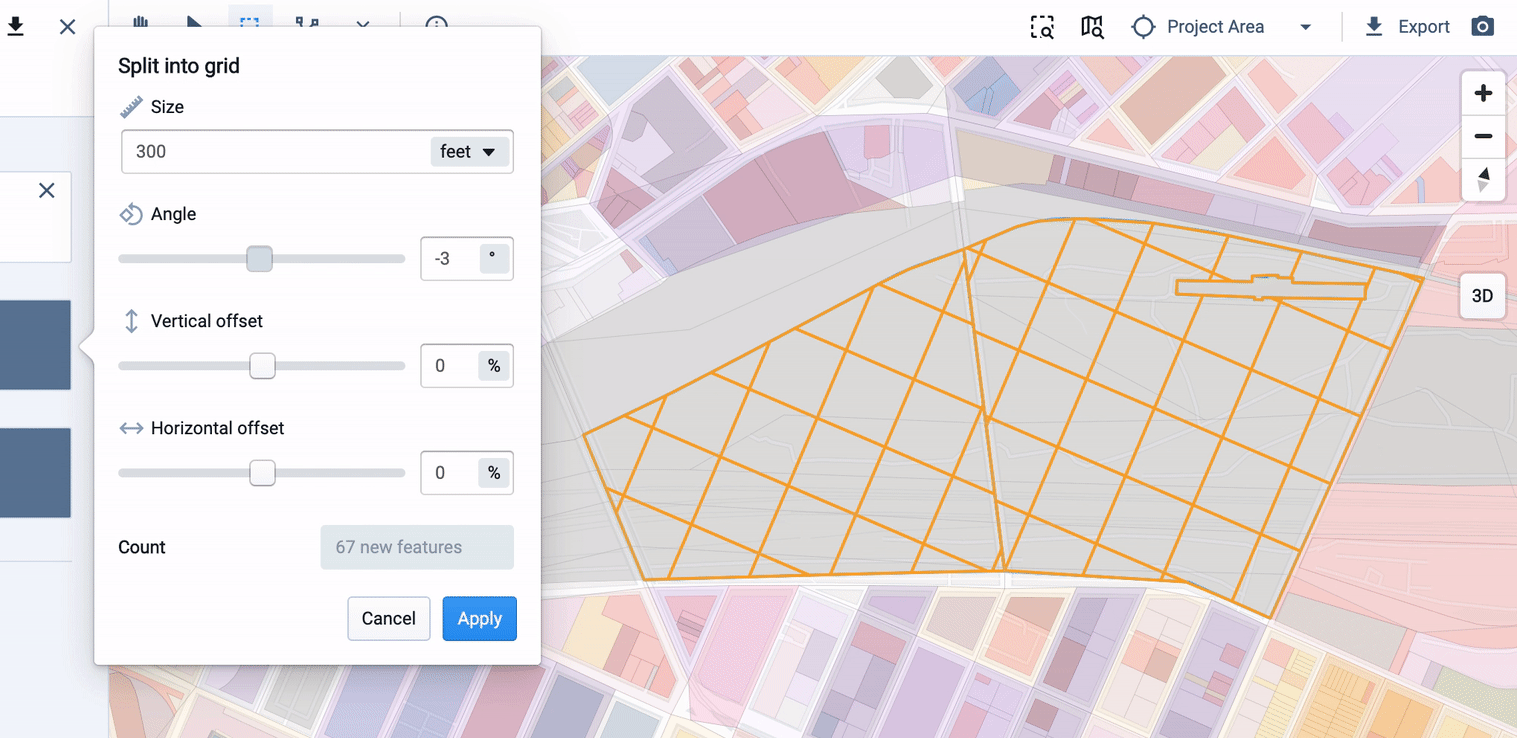
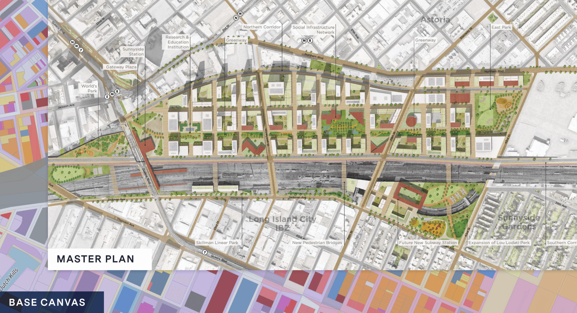
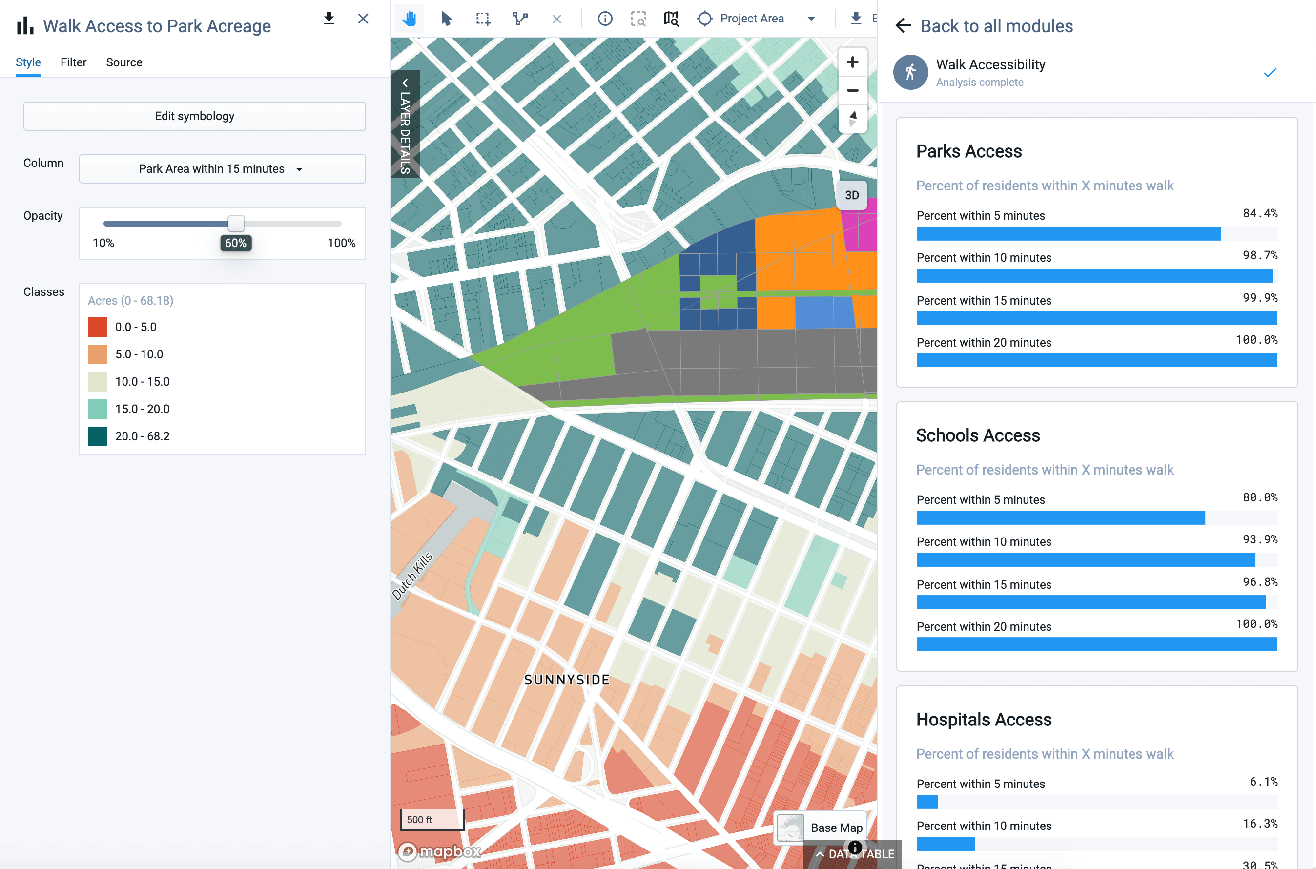
To demonstrate the new Parcel Gridding feature in action, we’ll step through an example based on the Sunnyside Yard Master Plan in Queens. The plan, a collaboration between Amtrak and the City of New York, would place a deck over the rail yard, creating space for 12,000 affordable housing units and 60 acres of parks and other public amenities.
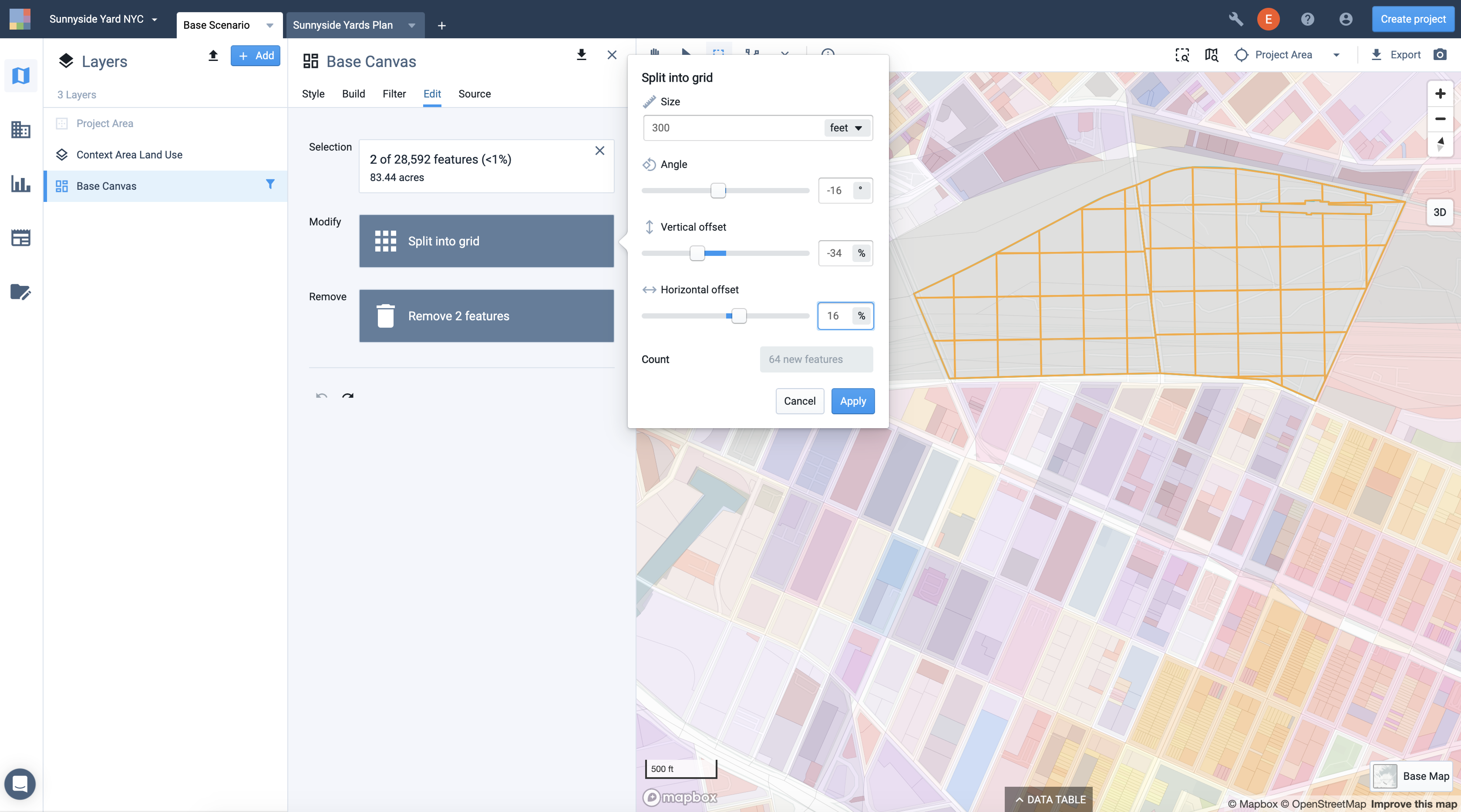
First, we created a new project and selected the parcels we wanted to grid. Then, we specified 300-foot blocks for the new parcels. This step was easily accomplished as this new feature allows you to set the grid size and position the grid so that it aligns with the surrounding parcels and street network.
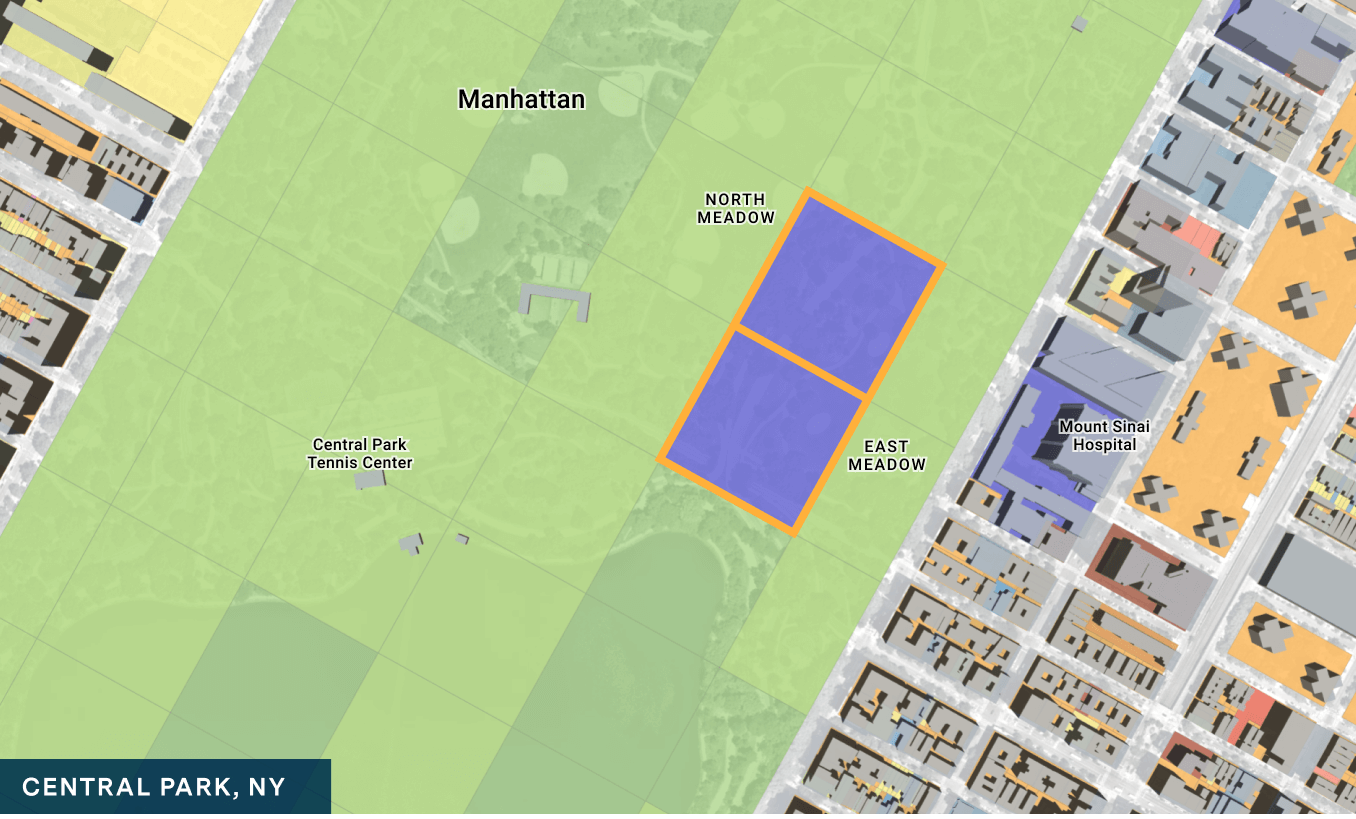
After a series of fine-grained adjustments using the Parcel Gridding feature, we painted updated land uses for the newly drawn parcels according to the master plan: High-rise residential towers to the north, adjacent to existing high-density development; Mid-rise residential buildings in the center; and new schools, libraries, child care centers, health centers and parkland.
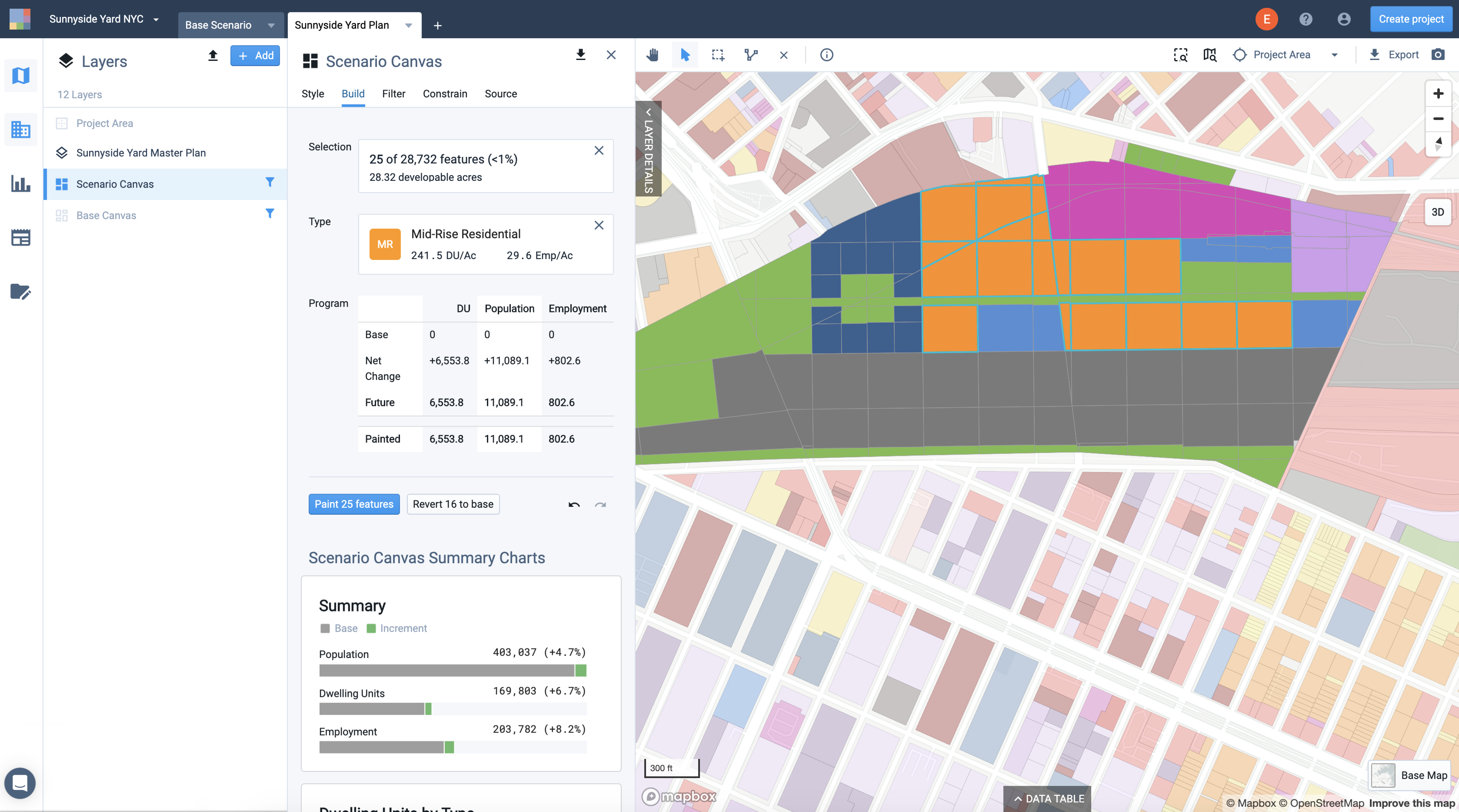
Finally, we ran UrbanFootprint’s analysis modules to compare the base condition with the new development in terms of key resource consumption, transportation, and walk and transit accessibility metrics.
As our example demonstrates, Parcel Gridding – the first of several new master planning features to be released – integrates seamlessly with UrbanFootprint’s existing scenario planning and analysis capabilities. Be sure to keep an eye out for our upcoming mobility planning features, which will allow you to combine UrbanFootprint’s powerful master planning with modeling investments in transit infrastructure.
As with any aspect of the UrbanFootprint platform, we encourage you to tell us about your experience with the new Parcel Gridding feature and how we might improve it in the future. Feel free to email us or contact us directly through the platform’s messaging app. We look forward to hearing from you as we continue to expand UrbanFootprint’s master planning capabilities.
Please note that Parcel Gridding is available only for newly created projects as of May 1, 2020. Create a new project to get started!
