Today we’re excited to announce a dramatic new update to UrbanFootprint that’ll make your scenario planning even easier—Painting 2.0 is here! With this vast improvement to the painting feature, you can now quickly fine-tune your building program on-the-fly to build precisely the scenarios you need.
The biggest change? Painting 2.0 gives you the power and flexibility to override and directly specify residential and employment attributes of UrbanFootprint Building and Place Types. This lets you customize them much faster than before—and gauge impacts instantly. It’s now easier than ever to work across the full range of project scales, from detailed master plans to regional land-use scenarios.
To demonstrate Painting 2.0 in action, let’s step through an example based on the Sunnyside Yard Master Plan in Queens (which we also used to show off our parcel gridding feature). The plan, a collaboration between Amtrak and the City of New York, would place a deck over the rail yard, creating space for 12,000 affordable housing units and 60 acres of parks and other public amenities.
First, in the Sunnyside Yard master plan example below, we’ll select four parcels and update the Building Type to “High-Rise Mixed Use”, according to information from the proposed master plan. The “Summary” cards display existing land use on the left (zero housing units and zero square feet of commercial space) and a preview of the updated numbers on the right for population, dwelling units, employees, and square feet of building floor area.
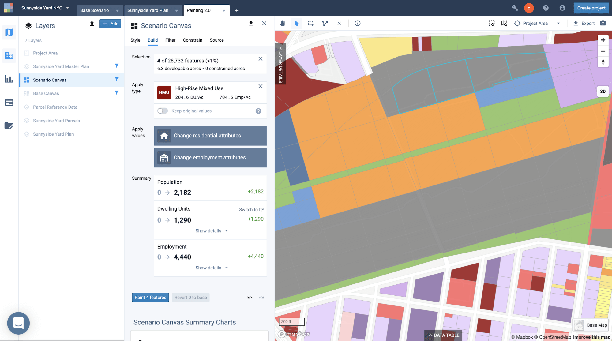
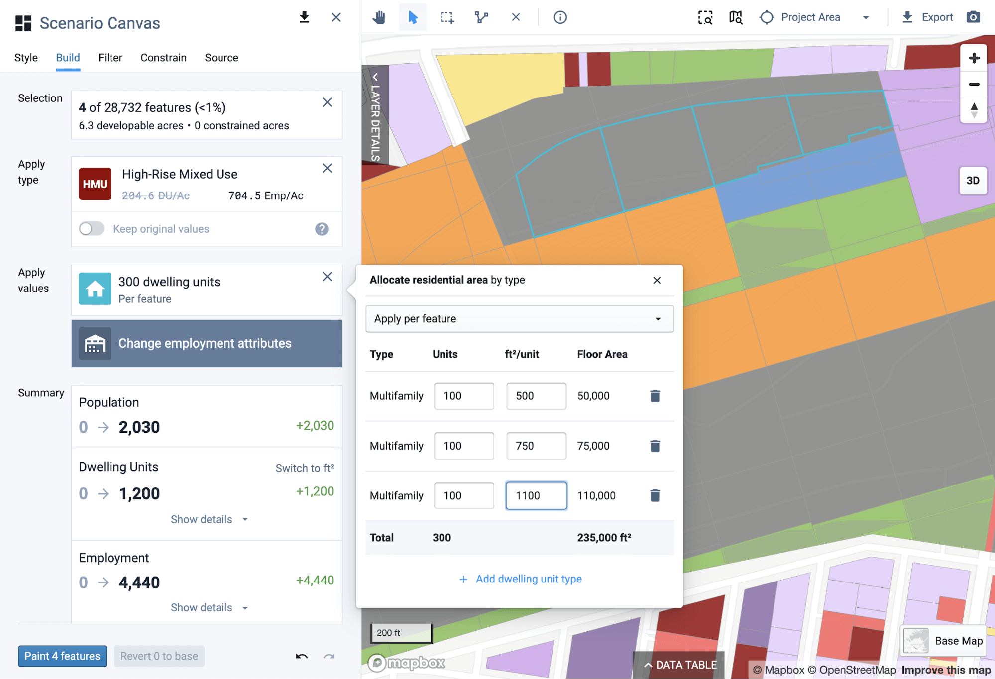
Next, instead of accepting the default residential values from the building prototype, we can choose to override them using the new Painting 2.0 capabilities. Whereas UrbanFootprint’s land use prototypes are density-based with per acre values, the new capabilities allow us to “Apply per feature” instead (in this case, per parcel). Painting 2.0 also allows us to input several different sizes of multifamily apartments. The result is that, independent of the size of each selected parcel, each will get exactly 300 new dwelling units (100 studios, 100 one-bedroom units, and 100 two-bedroom units).
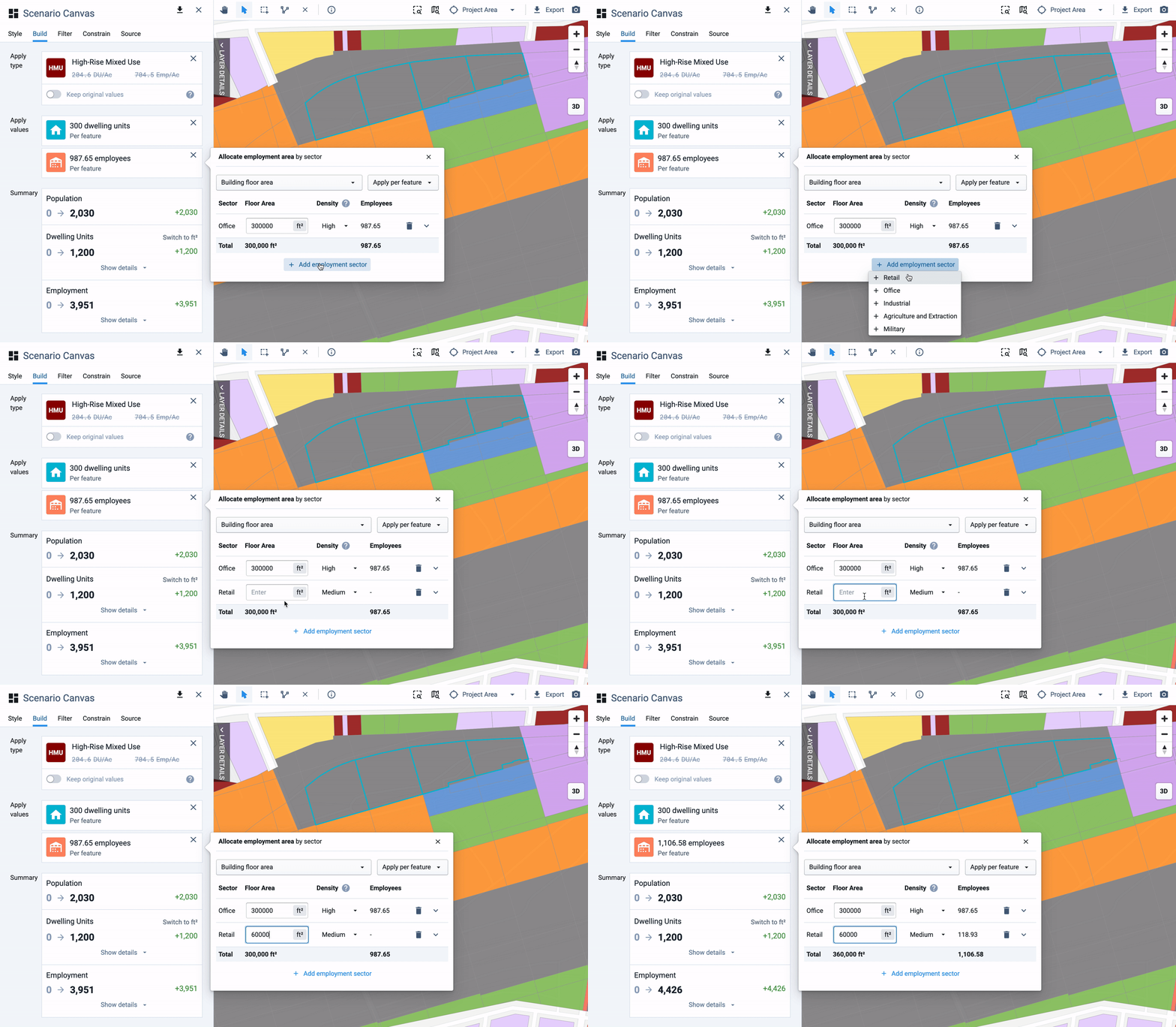
We’ll then apply “per feature” overrides for employment as well. This results in exactly 360,000 square feet of office and retail floor area on each selected parcel. Inputting floor area also shows how many associated employees will result from the paint. This is automatically calculated through square feet per employee assumptions. In this example, we’ll choose high employment density for office and medium density for retail floor area.
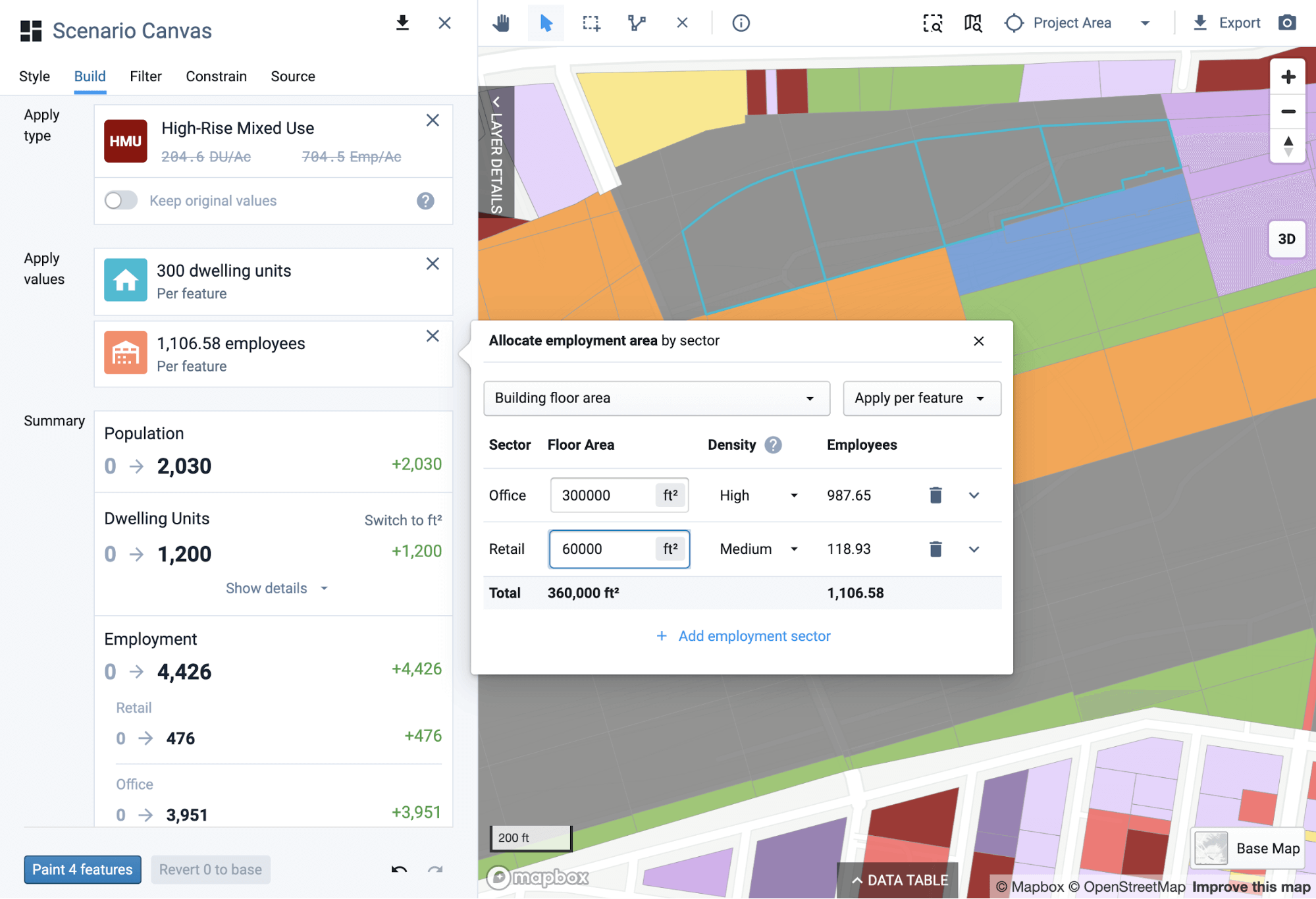
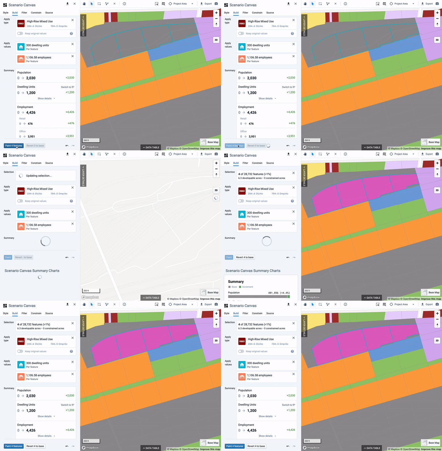
Finally, we’ll click on “Paint 4 features” to add the new dwelling units, households, and employment to our scenario.

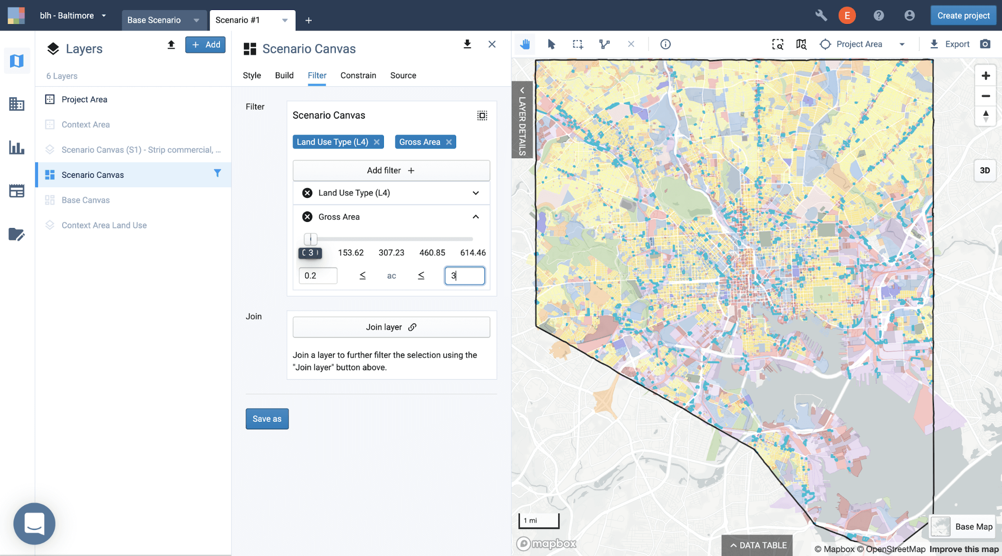
Now, let’s see how we can use the power of Painting 2.0 at the regional or city level. In the City of Baltimore, we’ll select all the low intensity strip commercial parcels between 0.2 and 3 acres using a filter (which returns 775 developable acres).
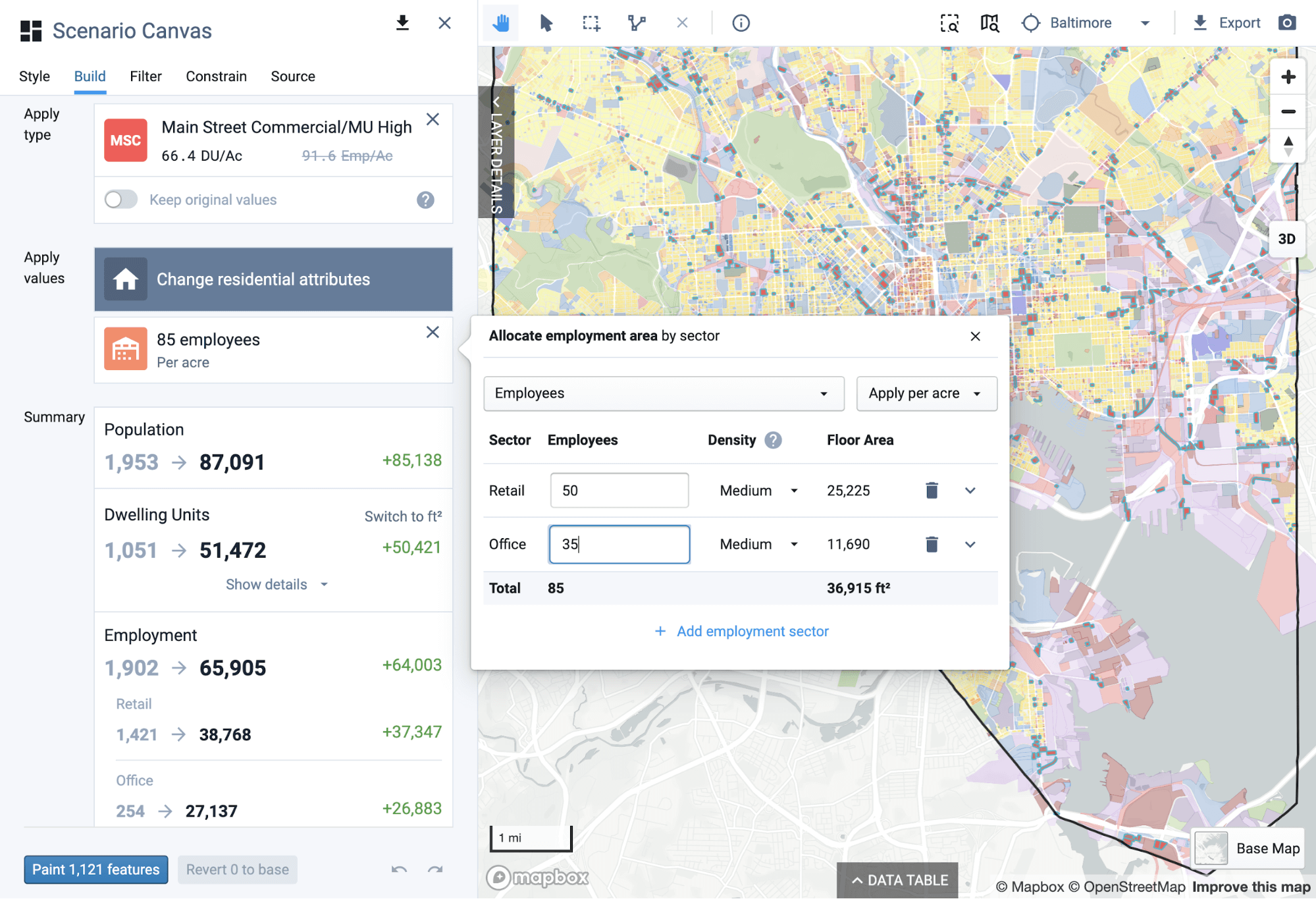
We then see what the result of mixed use redevelopment for the selected parcels would look like citywide. We start by selecting an appropriate mixed use building type. At the city or regional scale, it’s usually easier to work with per-acre densities than applying “per feature”. We’ll override the default employment values from our mixed use prototype, but choose to accept the default residential values. At this scale, it’s also often easier to use employees as the input in place of building floor area. In this example, we’ll specify 85 retail and office employees per acre (which is equivalent to 37K square feet of commercial floor area).

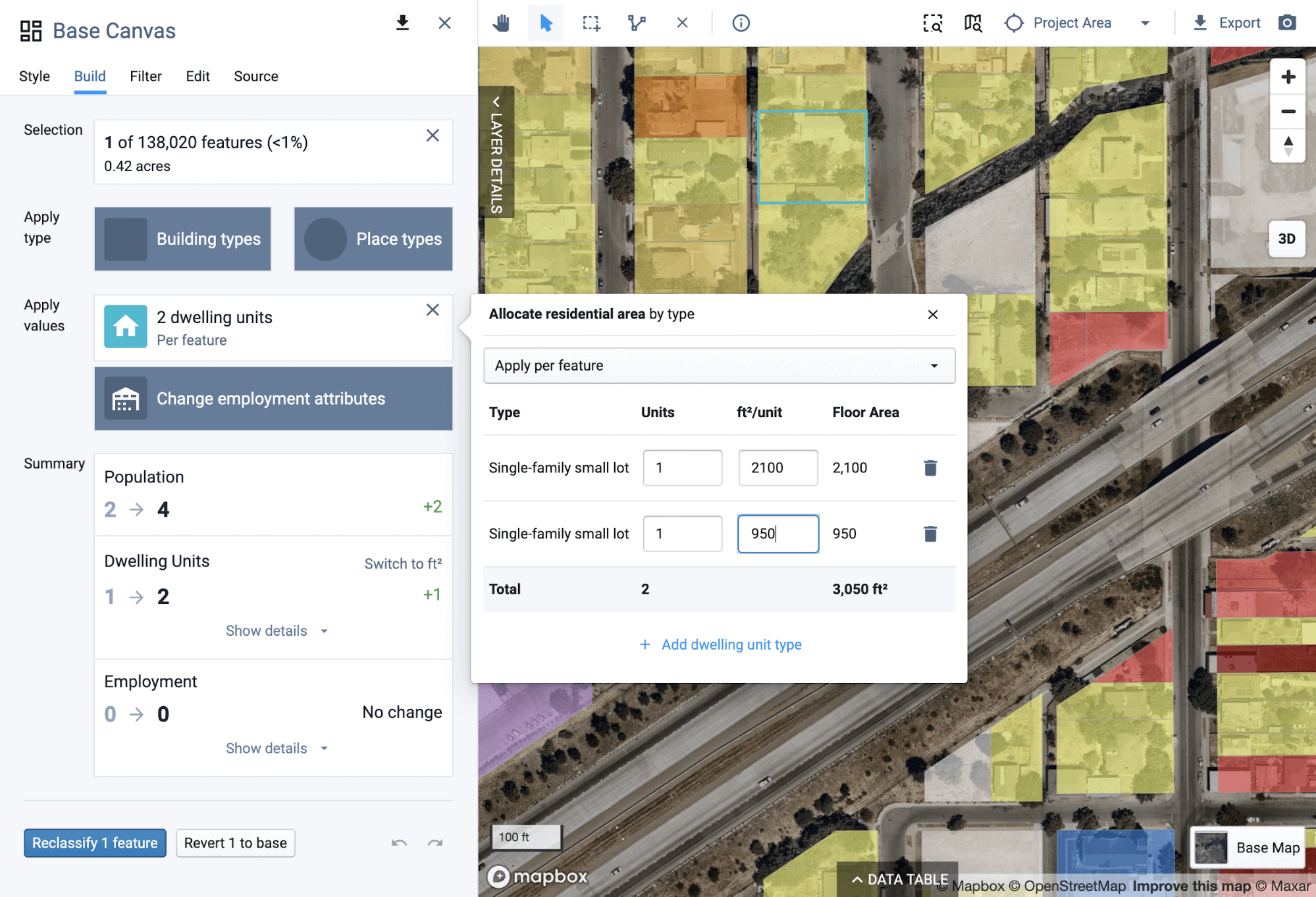
Finally, we’ll demonstrate how you can use Painting 2.0 to precision edit existing conditions in the base canvas. For example, let’s say we were working on a plan in Fresno, CA and we identified a parcel that needed to be updated to reflect recent construction. The parcel selected below is a single-family lot where an accessory dwelling unit was recently built. We can update the parcel’s data from one dwelling unit to two, maintaining the existing main house of approximately 2,100 square feet and adding an additional unit of 950 square feet. Land use we can leave as is – it’s still a single-family detached parcel.
As our examples illustrate, Painting 2.0 brings a whole new level of precision and flexibility not only to scenario building but to base-canvas editing as well. The new capabilities are sure to make it easier than ever to work across the full range of project scales.
As with any UrbanFootprint feature, we encourage you to tell us about your experience with Painting 2.0 and how we might improve it even further. Feel free to email us or contact us directly through the platform’s messaging app. We look forward to hearing from you as we continue to expand UrbanFootprint’s scenario planning capabilities.
