


We’re excited to announce today’s launch of UrbanFootprint Academic, a new offering for educators, researchers, and students in undergraduate and graduate programs.
As UrbanFootprint Co-founder and President Joe DiStefano shares: “Planners today need better tools to quickly understand potential plan impacts during the design process. UrbanFootprint, with its built-in data library, design toolkit, and analytics, makes it easy to create new scenarios and explore plan impacts in terms of emissions, accessibility, transportation, energy use, and more. We’re very excited to bring this new technology to classrooms across the country.”
What is UrbanFootprint?
UrbanFootprint Academic is designed to help professors, researchers, and educators to enhance their planning programs with the ability to quickly understand existing conditions, visualize future scenarios, and analyze plan impacts across a range of key planning metrics for any U.S. location. Let’s walk through a few examples.
Save Time On Class Prep with Easy Map Creation
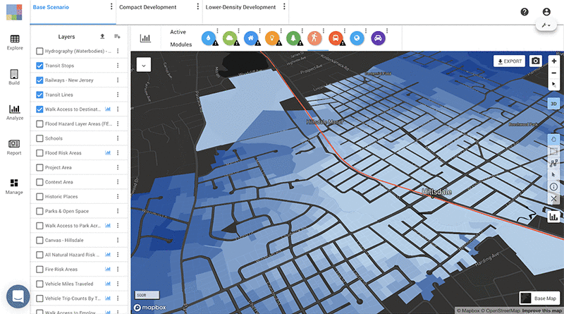
Create a map and examine existing conditions in a matter of minutes. Simply search UrbanFootprint for any U.S. location to create a current land use map. In our example below, we search “Hillsdale, New Jersey” and create what we call the “base canvas” in just a few minutes.
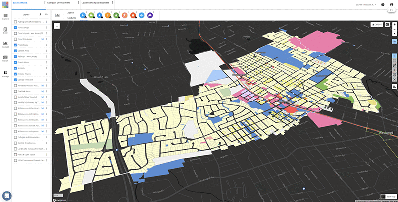
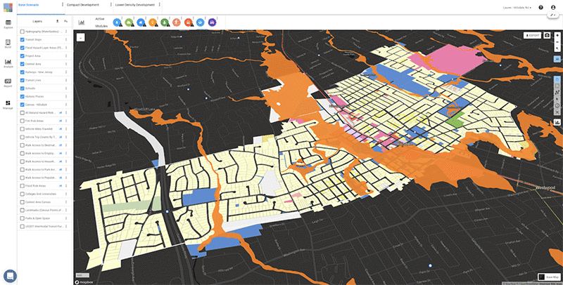
We can then add any of the hundreds of built-in datasets available to answer key planning questions. In the example below, with just a few clicks of a button, we’re able to quickly identify FEMA flood hazard areas.
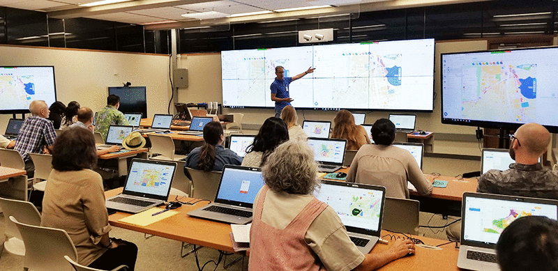
The easy user-interface allows educators to reclaim classroom time typically spent teaching complex planning tools. Further students’ understanding of key academic and practical urban planning concepts without the prerequisite of extensive GIS training.
Boost Student Engagement with Interactive Planning Exercises
Pique student interest with the ability to quickly visualize iterative future scenarios. UrbanFootprint’s library of over 150 Building and Place Types makes it easy to explore unlimited future plan scenarios.
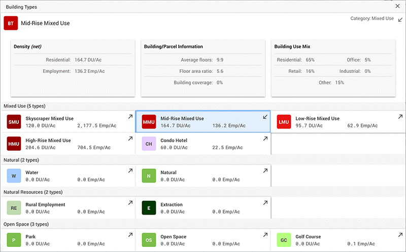
Each Building or Place Type comes preset with assumed density, land use, residential, and employment mix for each parcel or block. This streamlines the process of measuring basic planning metrics as the class make changes to the land use in real-time.
As Amir Hajrasouliha, Assistant Professor at California Polytechnic State University, finds, “Using UrbanFootprint challenged students to think critically and creatively about the topics we covered in class. The ease of use really contributed to increased interest in urban planning and student engagement.”
Inspire Deeper Discussions with Real-Time Analytics
Next, take class discussion a step further with UrbanFootprint’s suite of built-in analytic modules. Each module is built to help students gain a holistic understanding of each scenario’s potential impacts in terms of emissions, risk and resilience, transportation, accessibility, energy use, conservation, and more.
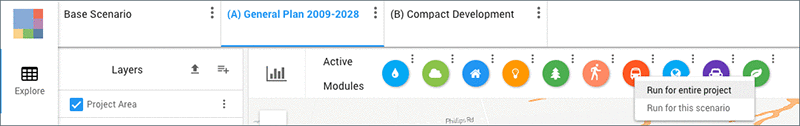
By simply clicking “run” for each of the ten modules, the class can easily visualize the potential outputs of each scenario and compare the projected costs and benefits.
In this example, after running the Walk Accessibility Module in UrbanFootprint, we can explore an analysis of Hillsdale’s current walk access to transit stops.
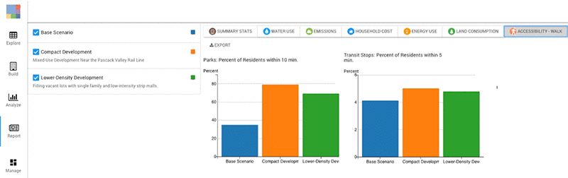
Plus, we can compare how walk accessibility to transit stops might change in two example scenarios when we switch to report mode.
This feature allows educators to facilitate data-driven discussions and helps students grasp a better understanding of the relationship between urban planning and supporting sustainable, resilient, and equitable places.
Ready to Learn More About UrbanFootprint Academic?
Sign up for a demo with our team and learn how the program is already being used by leading academic institutions across the country, including the University of Michigan, the University of Chicago, the Rochester Institute of Technology, the University of Redlands, UC San Diego, and more.
Have questions about UrbanFootprint? Tweet or email us to let us know. We’d love to hear from you.
